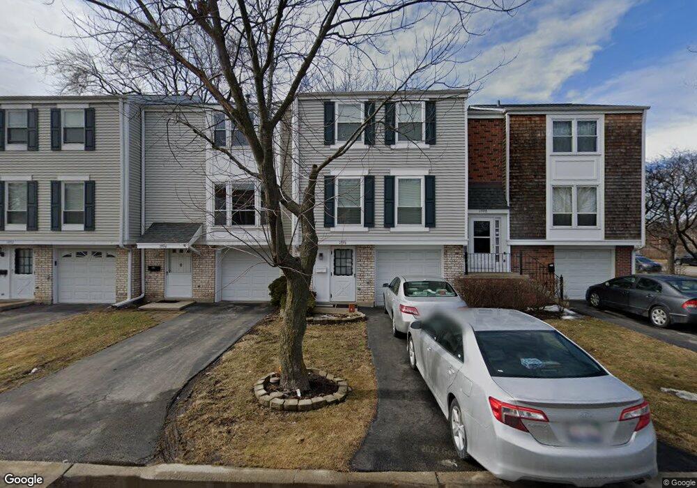
1996 Oxford Ln Unit 2 Hoffman Estates, IL 60169
South Hoffman Estates NeighborhoodEstimated Value: $292,000 - $303,000
3
Beds
2
Baths
1,252
Sq Ft
$237/Sq Ft
Est. Value
About This Home
This home is located at 1996 Oxford Ln Unit 2, Hoffman Estates, IL 60169 and is currently estimated at $296,642, approximately $236 per square foot. 1996 Oxford Ln Unit 2 is a home located in Cook County with nearby schools including John Muir Literacy Academy, Dwight D Eisenhower Junior High School, and Hoffman Estates High School.
Ownership History
Date
Name
Owned For
Owner Type
Purchase Details
Closed on
Mar 16, 2006
Sold by
Oskoui Baris
Bought by
Christensen Gardner C and Christensen Sue Yean
Current Estimated Value
Home Financials for this Owner
Home Financials are based on the most recent Mortgage that was taken out on this home.
Original Mortgage
$159,920
Outstanding Balance
$91,444
Interest Rate
6.37%
Mortgage Type
Fannie Mae Freddie Mac
Estimated Equity
$205,198
Create a Home Valuation Report for This Property
The Home Valuation Report is an in-depth analysis detailing your home's value as well as a comparison with similar homes in the area
Home Values in the Area
Average Home Value in this Area
Purchase History
| Date | Buyer | Sale Price | Title Company |
|---|---|---|---|
| Christensen Gardner C | $200,000 | Git |
Source: Public Records
Mortgage History
| Date | Status | Borrower | Loan Amount |
|---|---|---|---|
| Open | Christensen Gardner C | $159,920 |
Source: Public Records
Tax History Compared to Growth
Tax History
| Year | Tax Paid | Tax Assessment Tax Assessment Total Assessment is a certain percentage of the fair market value that is determined by local assessors to be the total taxable value of land and additions on the property. | Land | Improvement |
|---|---|---|---|---|
| 2024 | $4,506 | $18,000 | $3,000 | $15,000 |
| 2023 | $4,330 | $18,000 | $3,000 | $15,000 |
| 2022 | $4,330 | $18,000 | $3,000 | $15,000 |
| 2021 | $3,184 | $12,833 | $1,764 | $11,069 |
| 2020 | $3,184 | $12,833 | $1,764 | $11,069 |
| 2019 | $3,171 | $14,259 | $1,764 | $12,495 |
| 2018 | $3,669 | $14,688 | $1,540 | $13,148 |
| 2017 | $3,623 | $14,688 | $1,540 | $13,148 |
| 2016 | $3,632 | $14,688 | $1,540 | $13,148 |
| 2015 | $3,391 | $13,182 | $1,344 | $11,838 |
| 2014 | $3,349 | $13,182 | $1,344 | $11,838 |
| 2013 | $3,244 | $13,182 | $1,344 | $11,838 |
Source: Public Records
Map
Nearby Homes
- 1956 Georgetown Ln Unit 4
- 1925 Georgetown Ln Unit 4
- 1996 Blackberry Ln Unit 14
- 1886 Stockton Dr Unit 3253
- 1862 Stockton Dr Unit 3283
- 2230 Stratham Place
- 1854 Huntington Blvd Unit C
- 1840 Huntington Blvd Unit 415
- 1840 Huntington Blvd Unit 412
- 1738 Ardwick Dr
- 1977 Kenilworth Cir Unit D
- 1940 Kenilworth Cir Unit D
- 1808 Fayette Walk Unit H
- 1685 Cornell Dr
- 1800 Huntington Blvd Unit AE615
- 1672 Cornell Dr
- 2004 E Parkview Cir
- 1704 Fayette Walk Unit B
- 1763 Bristol Walk Unit 1763
- 2079 E Parkview Cir
- 1994 Oxford Ln
- 1998 Oxford Ln
- 1992 Oxford Ln
- 1990 Oxford Ln Unit 2
- 1997 Brighton Ln Unit 2
- 1995 Brighton Ln Unit 2
- 1999 Brighton Ln
- 1993 Brighton Ln Unit 2
- 1991 Brighton Ln
- 1986 Oxford Ln Unit 2
- 1989 Brighton Ln Unit 2
- 1997 Oxford Ln Unit 2
- 1984 Oxford Ln
- 1999 Oxford Ln Unit 2
- 1995 Oxford Ln Unit 2
- 1987 Brighton Ln Unit 2
- 1993 Oxford Ln Unit 2
- 1991 Oxford Ln Unit 2
- 1985 Brighton Ln Unit 2
- 1989 Oxford Ln Unit 2