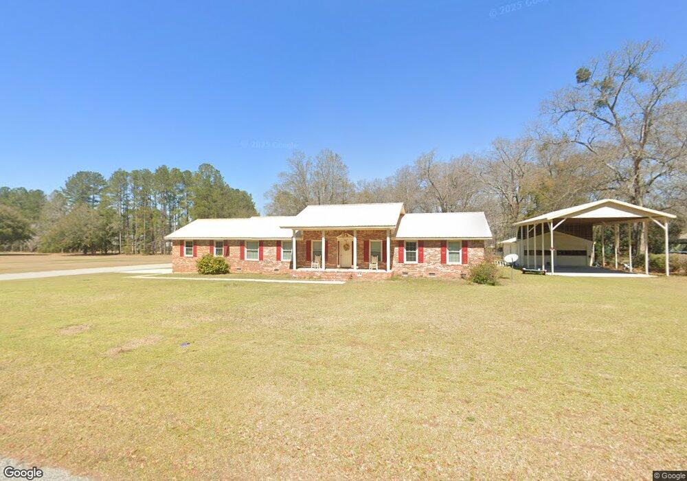
1996 Taylor Blvd Orangeburg, SC 29118
Estimated Value: $273,021 - $303,000
3
Beds
3
Baths
1,980
Sq Ft
$144/Sq Ft
Est. Value
About This Home
This home is located at 1996 Taylor Blvd, Orangeburg, SC 29118 and is currently estimated at $285,005, approximately $143 per square foot. 1996 Taylor Blvd is a home located in Orangeburg County with nearby schools including Marshall Elementary School, Marshall Elementary, and William J. Clark Middle School.
Ownership History
Date
Name
Owned For
Owner Type
Purchase Details
Closed on
Apr 16, 2025
Sold by
Gainey Charles Timothy
Bought by
Gainey Charles Timothy and Gainey Kevin Hale
Current Estimated Value
Home Financials for this Owner
Home Financials are based on the most recent Mortgage that was taken out on this home.
Original Mortgage
$128,968
Outstanding Balance
$126,708
Interest Rate
5.89%
Mortgage Type
FHA
Estimated Equity
$158,297
Purchase Details
Closed on
Sep 26, 2014
Sold by
Gainey Belva M
Bought by
Gainey Belva M and Gainey Charles Timothy
Create a Home Valuation Report for This Property
The Home Valuation Report is an in-depth analysis detailing your home's value as well as a comparison with similar homes in the area
Home Values in the Area
Average Home Value in this Area
Purchase History
| Date | Buyer | Sale Price | Title Company |
|---|---|---|---|
| Gainey Charles Timothy | -- | 20 20 Title Llc | |
| Gainey Charles Timothy | -- | 20 20 Title Llc | |
| Gainey Belva M | -- | -- |
Source: Public Records
Mortgage History
| Date | Status | Borrower | Loan Amount |
|---|---|---|---|
| Open | Gainey Charles Timothy | $128,968 | |
| Closed | Gainey Charles Timothy | $128,968 |
Source: Public Records
Tax History Compared to Growth
Tax History
| Year | Tax Paid | Tax Assessment Tax Assessment Total Assessment is a certain percentage of the fair market value that is determined by local assessors to be the total taxable value of land and additions on the property. | Land | Improvement |
|---|---|---|---|---|
| 2024 | $954 | $7,892 | $748 | $7,144 |
| 2023 | $724 | $5,924 | $708 | $5,216 |
| 2022 | $713 | $5,924 | $708 | $5,216 |
| 2021 | $705 | $5,924 | $708 | $5,216 |
| 2020 | $689 | $5,924 | $708 | $5,216 |
| 2019 | $693 | $5,924 | $708 | $5,216 |
| 2018 | $614 | $5,680 | $708 | $4,972 |
| 2017 | $603 | $5,680 | $0 | $0 |
| 2016 | $603 | $5,680 | $0 | $0 |
| 2015 | $551 | $5,680 | $0 | $0 |
| 2014 | $551 | $5,681 | $709 | $4,972 |
| 2013 | -- | $5,548 | $708 | $4,840 |
Source: Public Records
Map
Nearby Homes
- 4098 Slaughter Dr
- 113 Ginger Unit Subdivision
- 4057 Creekmoor Dr
- 2042 Clifton Cir
- 104 Knollwood Ct
- 408 Grasshopper Ct
- 1501 Harris Dr
- 4265 Columbia Rd
- 4405 Cricket Dr
- 1357 Macon Dr
- 3236 Hart St
- 3265 Hunter Dr
- 4480 Deerfield Dr
- 3210 Hunter Dr
- 783 Patriots Way
- 1438 Lartique Dr
- 1039 Berkeley Dr
- 0 Ramsgate Dr Unit 24022640
- 4414 Ramsgate Dr
- 2220 Hillside St NE
- 1964 Taylor Blvd
- 4026 Slaughter Dr
- 1953 Taylor Blvd
- 1946 Taylor Blvd
- 1946 Taylor Blvd
- 4038 Slaughter Dr
- 4099 Cedric St
- 0 Slaughter Dr NE Unit 900569
- 0 Slaughter Dr NE Unit 38383
- 0 Slaughter Dr NE
- 4073 Cedric St
- 4131 Cedric St
- 0 Lots 2 3 Block D Unit Lot 2/3, Block D
- 0 Lots 2 3 Block D Unit 43584
- 120 120
- 1928 Taylor Blvd
- 1976 Benjamin Blvd
- 3910 Slaughter Dr
- 4153 Cedric St
- 1921 Taylor Blvd