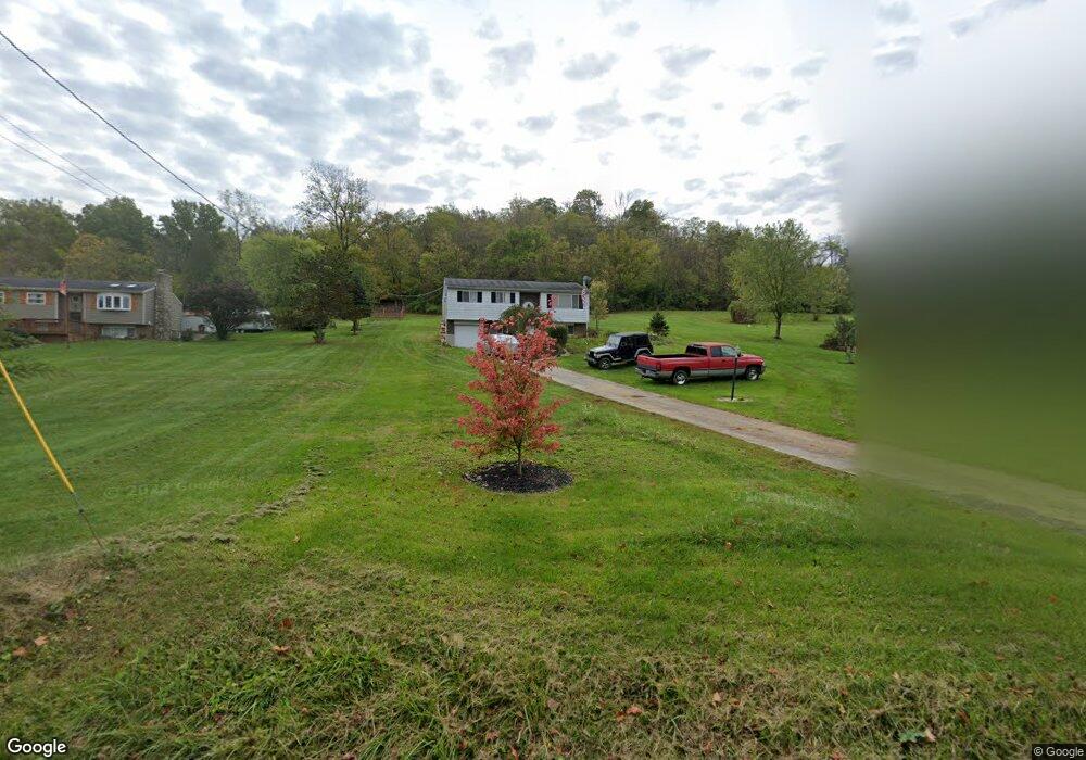
19962 Salt Fork Rd Lawrenceburg, IN 47025
Estimated Value: $251,000 - $360,000
3
Beds
2
Baths
2,148
Sq Ft
$136/Sq Ft
Est. Value
About This Home
This home is located at 19962 Salt Fork Rd, Lawrenceburg, IN 47025 and is currently estimated at $292,248, approximately $136 per square foot. 19962 Salt Fork Rd is a home located in Dearborn County with nearby schools including East Central High School.
Ownership History
Date
Name
Owned For
Owner Type
Purchase Details
Closed on
Dec 22, 2008
Sold by
King Michael S
Bought by
King Michael S and King Rhonda
Current Estimated Value
Home Financials for this Owner
Home Financials are based on the most recent Mortgage that was taken out on this home.
Original Mortgage
$30,000
Outstanding Balance
$236
Interest Rate
6.06%
Mortgage Type
Credit Line Revolving
Estimated Equity
$292,012
Create a Home Valuation Report for This Property
The Home Valuation Report is an in-depth analysis detailing your home's value as well as a comparison with similar homes in the area
Home Values in the Area
Average Home Value in this Area
Purchase History
| Date | Buyer | Sale Price | Title Company |
|---|---|---|---|
| King Michael S | -- | -- |
Source: Public Records
Mortgage History
| Date | Status | Borrower | Loan Amount |
|---|---|---|---|
| Open | King Michael S | $30,000 |
Source: Public Records
Tax History Compared to Growth
Tax History
| Year | Tax Paid | Tax Assessment Tax Assessment Total Assessment is a certain percentage of the fair market value that is determined by local assessors to be the total taxable value of land and additions on the property. | Land | Improvement |
|---|---|---|---|---|
| 2024 | $1,036 | $137,400 | $32,000 | $105,400 |
| 2023 | $1,020 | $138,600 | $32,000 | $106,600 |
| 2022 | $1,025 | $137,700 | $32,000 | $105,700 |
| 2021 | $963 | $129,200 | $32,000 | $97,200 |
| 2020 | $942 | $129,200 | $32,000 | $97,200 |
| 2019 | $946 | $129,300 | $32,000 | $97,300 |
| 2018 | $795 | $117,000 | $32,000 | $85,000 |
| 2017 | $808 | $116,100 | $32,000 | $84,100 |
| 2016 | $786 | $116,100 | $32,000 | $84,100 |
| 2014 | $811 | $117,700 | $32,000 | $85,700 |
| 2013 | $811 | $124,500 | $32,000 | $92,500 |
Source: Public Records
Map
Nearby Homes
- 0 Inghams Mill Ln Unit 205574
- 0 Timberline Trail Unit 198823
- 2504 Cove Cir W
- 2458 Cedar Cliff Dr
- 1753 Cove Cir E
- Sanibel Plan at The Crossing At Tanners Creek
- Longwood Plan at The Crossing At Tanners Creek
- Avalon Plan at The Crossing At Tanners Creek
- Dallas Plan at The Crossing At Tanners Creek
- Drexel Plan at The Crossing At Tanners Creek
- Somerset Plan at The Crossing At Tanners Creek
- Rockford Plan at The Crossing At Tanners Creek
- 2082 Morningside Dr
- 20551 Heather Ct
- 20072 Cravenhurst Dr
- 18815 Rileys Ridge
- 20912 Bellemeade Dr
- 0 Ridgewood Cir Unit 202961
- 18820 Casey's Trail
- 18826 Casey's Trail
- 19934 Salt Fork Rd
- 19988 Salt Fork Rd
- 19925 Salt Fork Rd
- 19872 Salt Fork Rd
- 19852 Salt Fork Rd
- 19824 Salt Fork Rd
- 19786 Salt Fork Rd
- 19909 Salt Fork Rd
- 19748 Salt Fork Rd
- 20148 Salt Fork Rd
- 19724 Salt Fork Rd
- 20168 Salt Fork Rd
- 19672 Salt Fork Rd
- 19658 Salt Fork Rd
- 19642 Salt Fork Rd
- 19570 Salt Fork Rd
- 19550 Salt Fork Rd
- 20234 Salt Fork Rd
- 19440 State Route 1
- 20332 Salt Fork Rd