Estimated Value: $513,000 - $1,085,000
3
Beds
2
Baths
1,875
Sq Ft
$383/Sq Ft
Est. Value
About This Home
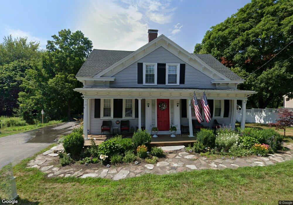
This home is located at 1996C Post Rd, Wells, ME 04090 and is currently estimated at $718,930, approximately $383 per square foot. 1996C Post Rd is a home located in York County with nearby schools including Wells Junior High School, Wells Elementary School, and Wells High School.
Ownership History
Date
Name
Owned For
Owner Type
Purchase Details
Closed on
Sep 18, 2018
Sold by
Aureli Patricia A and Brennan Mary J
Bought by
Diane A Roberts 2009 Ret
Current Estimated Value
Home Financials for this Owner
Home Financials are based on the most recent Mortgage that was taken out on this home.
Original Mortgage
$200,000
Outstanding Balance
$172,631
Interest Rate
4.6%
Mortgage Type
New Conventional
Estimated Equity
$546,299
Purchase Details
Closed on
Jan 19, 2010
Sold by
Fecteau Lori and Maxon Todd
Bought by
Aureli Patricia A and Brennan Mary J
Home Financials for this Owner
Home Financials are based on the most recent Mortgage that was taken out on this home.
Original Mortgage
$232,240
Interest Rate
4.71%
Mortgage Type
Purchase Money Mortgage
Purchase Details
Closed on
Jan 19, 2007
Sold by
Everett Theresa A Est
Bought by
Fecteau Lori and Maxon Todd
Home Financials for this Owner
Home Financials are based on the most recent Mortgage that was taken out on this home.
Original Mortgage
$160,000
Interest Rate
6.14%
Mortgage Type
Unknown
Create a Home Valuation Report for This Property
The Home Valuation Report is an in-depth analysis detailing your home's value as well as a comparison with similar homes in the area
Home Values in the Area
Average Home Value in this Area
Purchase History
| Date | Buyer | Sale Price | Title Company |
|---|---|---|---|
| Diane A Roberts 2009 Ret | -- | -- | |
| Aureli Patricia A | -- | -- | |
| Fecteau Lori | -- | -- |
Source: Public Records
Mortgage History
| Date | Status | Borrower | Loan Amount |
|---|---|---|---|
| Open | Diane A Roberts 2009 Ret | $200,000 | |
| Previous Owner | Aureli Patricia A | $232,240 | |
| Previous Owner | Fecteau Lori | $75,000 | |
| Previous Owner | Fecteau Lori | $160,000 |
Source: Public Records
Tax History
| Year | Tax Paid | Tax Assessment Tax Assessment Total Assessment is a certain percentage of the fair market value that is determined by local assessors to be the total taxable value of land and additions on the property. | Land | Improvement |
|---|---|---|---|---|
| 2025 | $3,070 | $475,170 | $247,680 | $227,490 |
| 2024 | $2,889 | $475,170 | $247,680 | $227,490 |
| 2023 | $2,832 | $475,170 | $247,680 | $227,490 |
| 2022 | $3,434 | $328,330 | $157,420 | $170,910 |
| 2021 | $3,454 | $328,330 | $157,250 | $171,080 |
| 2020 | $3,309 | $315,740 | $157,420 | $158,320 |
| 2019 | $3,290 | $315,740 | $157,420 | $158,320 |
| 2018 | $3,097 | $315,740 | $157,420 | $158,320 |
| 2017 | $3,208 | $315,740 | $157,420 | $158,320 |
| 2016 | $3,176 | $315,740 | $157,420 | $158,320 |
| 2015 | $3,142 | $315,740 | $157,420 | $158,320 |
| 2013 | $2,880 | $315,740 | $157,420 | $158,320 |
Source: Public Records
Map
Nearby Homes
- 66 Nicholas Dr
- 50 Coles Hill Rd
- 1762 Post Rd Unit 206
- 1733 Post Rd
- Lots 1-6 Pike Rd
- TBD Eagle Crest Dr
- 99 Harbor Rd Unit Lot 52
- 99 Harbor Rd Unit Lot 54
- 500 Atlantic Ave Unit 2
- 47 Whistle Stop Cir
- 89 Skyline Cir
- 1413 Post Rd Unit 58
- 1373 Post Rd Unit 8E
- 1373 Post Rd Unit 4E
- 1373 Post Rd Unit 10A
- 1373 Post Rd Unit 2C
- 1373 Post Rd Unit 6B
- 1373 Post Rd Unit 1F
- 160 Millbrooke Farm Dr Unit 160
- 162 Millbrooke Farm Dr Unit 162
- 1996 Post Rd
- 1980 Post Rd
- 2004 Post Rd
- 8 Blacksmith Rd
- 2033 Post Rd
- 2010 Post Rd
- 21 Black Smith Rd Unit 3
- 21 Black Smith Rd Unit 2
- 21 Black Smith Rd Unit 1
- 21 Blacksmith Rd Unit 3A
- 21 Blacksmith Rd Unit 2
- 1999 Post Rd
- 2016 Post Rd
- 1983 Post Rd
- 27 Black Smith Rd Unit 6
- 27 Black Smith Rd Unit 5
- 27 Black Smith Rd Unit 4
- 27 Blacksmith Rd Unit 5B
- 27 Blacksmith Rd Unit 6B
- 27 Blacksmith Brook Rd Unit 6B
Your Personal Tour Guide
Ask me questions while you tour the home.