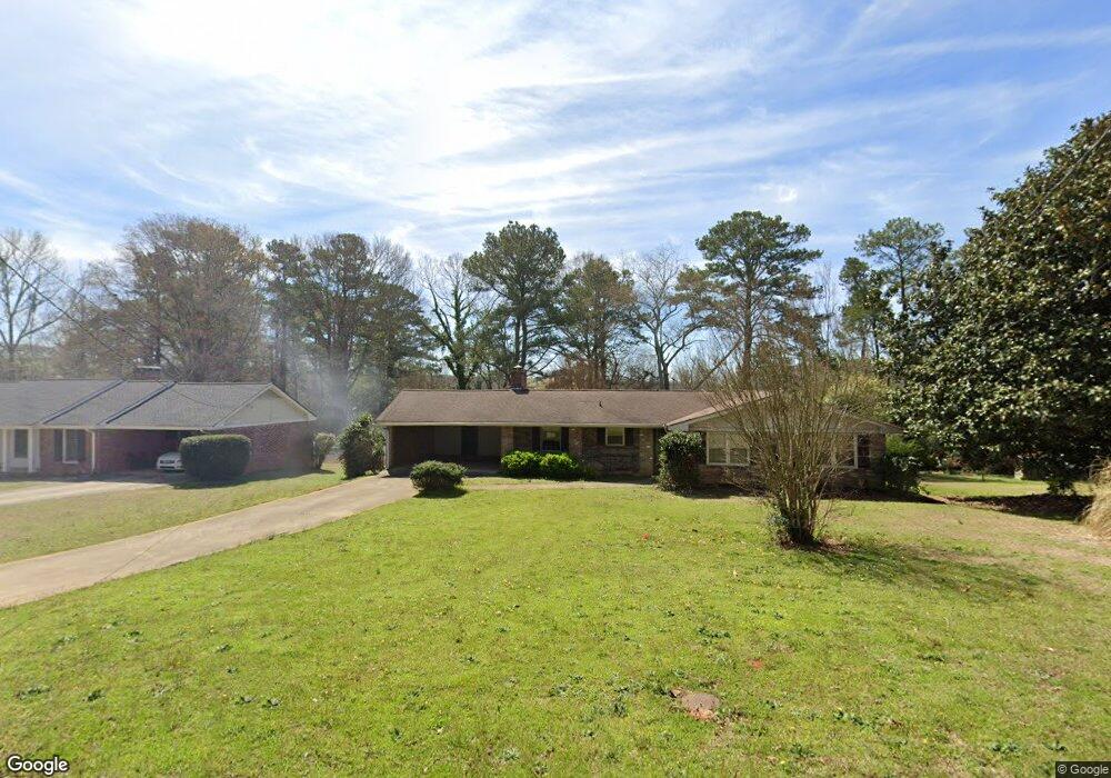
1997 Brannon Dr Unit 1 Austell, GA 30106
Estimated Value: $258,000 - $306,000
3
Beds
2
Baths
1,415
Sq Ft
$195/Sq Ft
Est. Value
About This Home
This home is located at 1997 Brannon Dr Unit 1, Austell, GA 30106 and is currently estimated at $276,508, approximately $195 per square foot. 1997 Brannon Dr Unit 1 is a home located in Cobb County with nearby schools including Deerwood Elementary School, Austell Elementary School, and Garrett Middle School.
Ownership History
Date
Name
Owned For
Owner Type
Purchase Details
Closed on
Jun 19, 2003
Sold by
Twyman Amanda M
Bought by
Twyman Amanda M and Twyman William
Current Estimated Value
Home Financials for this Owner
Home Financials are based on the most recent Mortgage that was taken out on this home.
Original Mortgage
$217,500
Outstanding Balance
$92,047
Interest Rate
5.43%
Mortgage Type
New Conventional
Estimated Equity
$184,461
Purchase Details
Closed on
Nov 7, 1996
Sold by
Thomas Iris S
Bought by
Twyman Amanda M William H
Create a Home Valuation Report for This Property
The Home Valuation Report is an in-depth analysis detailing your home's value as well as a comparison with similar homes in the area
Home Values in the Area
Average Home Value in this Area
Purchase History
| Date | Buyer | Sale Price | Title Company |
|---|---|---|---|
| Twyman Amanda M | -- | -- | |
| Twyman Amanda M William H | $85,000 | -- |
Source: Public Records
Mortgage History
| Date | Status | Borrower | Loan Amount |
|---|---|---|---|
| Open | Twyman Amanda M | $217,500 | |
| Closed | Twyman Amanda M William H | $0 |
Source: Public Records
Tax History Compared to Growth
Tax History
| Year | Tax Paid | Tax Assessment Tax Assessment Total Assessment is a certain percentage of the fair market value that is determined by local assessors to be the total taxable value of land and additions on the property. | Land | Improvement |
|---|---|---|---|---|
| 2025 | $3,093 | $102,664 | $30,000 | $72,664 |
| 2024 | $3,095 | $102,664 | $30,000 | $72,664 |
| 2023 | $3,094 | $102,616 | $20,000 | $82,616 |
| 2022 | $2,618 | $86,248 | $10,000 | $76,248 |
| 2021 | $1,660 | $54,700 | $10,000 | $44,700 |
| 2020 | $1,660 | $54,700 | $10,000 | $44,700 |
| 2019 | $1,327 | $43,716 | $6,000 | $37,716 |
| 2018 | $277 | $43,716 | $6,000 | $37,716 |
| 2017 | $249 | $43,716 | $6,000 | $37,716 |
| 2016 | $166 | $24,952 | $6,000 | $18,952 |
| 2015 | $177 | $24,952 | $6,000 | $18,952 |
| 2014 | $72 | $14,860 | $0 | $0 |
Source: Public Records
Map
Nearby Homes
- 1803 Gherry Dr
- 1971 Annette Ln
- 1943 Arnold Dr
- 1 Perkerson Mill Rd SW
- 1841 Mobley St
- 0 Harris St Unit 7661273
- 5466 Davis Dr
- 2136 Perkerson Mill Rd SW
- 5164 Medford Ln
- 5154 Medford Ln
- 5025 Bishops Row SW
- 5410 Beth Dr
- 5320 Beth Dr
- 5425 Davis Dr
- Laurel Plan at Avenbrook
- Rosedale Plan at Avenbrook
- Fulmont at Avenbrook Plan at Avenbrook
- Addison Plan at Avenbrook
- Conley Plan at Avenbrook
- Bayberry Plan at Sawmill Creek - Bungalow Series
- 1987 Brannon Dr
- 2019 Brannon Dr
- 1988 Brannon Dr
- 1977 Brannon Dr
- 1996 Gherry Dr
- 1984 Gherry Dr
- 1998 Brannon Dr
- 2008 Gherry Dr
- 1972 Gherry Dr
- 2030 Brannon Dr
- 1978 Brannon Dr
- 1967 Brannon Dr
- 2020 Gherry Dr
- 1968 Brannon Dr
- 1942 Gherry Dr
- 1987 Annette Ln
- 5338 Birdsong Ln Unit 2
- 2033 Brannon Dr
- 1997 Annette Ln
- 1977 Annette Ln