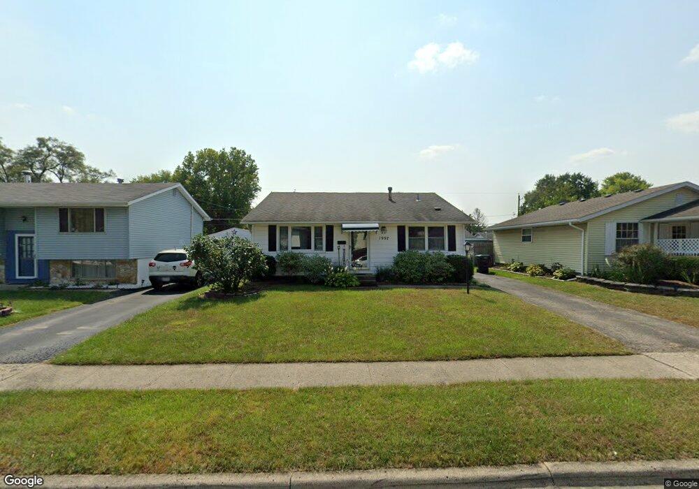
1997 Tupsfield Rd Columbus, OH 43229
Forest Park East NeighborhoodEstimated Value: $196,000 - $253,000
3
Beds
2
Baths
896
Sq Ft
$246/Sq Ft
Est. Value
About This Home
This home is located at 1997 Tupsfield Rd, Columbus, OH 43229 and is currently estimated at $220,459, approximately $246 per square foot. 1997 Tupsfield Rd is a home located in Franklin County with nearby schools including Forest Park Elementary School, Woodward Park Middle School, and Northland High School.
Ownership History
Date
Name
Owned For
Owner Type
Purchase Details
Closed on
Jun 13, 2017
Sold by
Lindner Michele Lisa and Nash Scott M
Bought by
Lindner Nash Michele Lisa and Nash Scott Michael
Current Estimated Value
Purchase Details
Closed on
Jul 8, 1992
Bought by
Nash Scott M
Purchase Details
Closed on
Nov 10, 1987
Create a Home Valuation Report for This Property
The Home Valuation Report is an in-depth analysis detailing your home's value as well as a comparison with similar homes in the area
Home Values in the Area
Average Home Value in this Area
Purchase History
| Date | Buyer | Sale Price | Title Company |
|---|---|---|---|
| Lindner Nash Michele Lisa | -- | None Available | |
| Nash Scott M | $69,500 | -- | |
| -- | $63,500 | -- |
Source: Public Records
Tax History
| Year | Tax Paid | Tax Assessment Tax Assessment Total Assessment is a certain percentage of the fair market value that is determined by local assessors to be the total taxable value of land and additions on the property. | Land | Improvement |
|---|---|---|---|---|
| 2025 | $2,873 | $64,020 | $15,930 | $48,090 |
| 2024 | $2,873 | $64,020 | $15,930 | $48,090 |
| 2023 | $2,836 | $64,015 | $15,925 | $48,090 |
| 2022 | $2,238 | $43,160 | $9,450 | $33,710 |
| 2021 | $2,242 | $43,160 | $9,450 | $33,710 |
| 2020 | $2,245 | $43,160 | $9,450 | $33,710 |
| 2019 | $1,960 | $32,310 | $7,000 | $25,310 |
| 2018 | $978 | $32,310 | $7,000 | $25,310 |
| 2017 | $1,911 | $32,310 | $7,000 | $25,310 |
| 2016 | $1,864 | $28,140 | $6,580 | $21,560 |
| 2015 | $846 | $28,140 | $6,580 | $21,560 |
| 2014 | $1,696 | $28,140 | $6,580 | $21,560 |
| 2013 | $880 | $29,610 | $6,930 | $22,680 |
Source: Public Records
Map
Nearby Homes
- 5720 Beechcroft Rd Unit B
- 5732 Beechcroft Rd Unit B
- 5458 Sumac Loop S
- 5705 Tamarack Blvd Unit F
- 5885 Beechcroft Rd Unit 306
- 5885 Beechcroft Rd Unit 313
- 5491 Parkshire Dr Unit 5491
- 5556 Parkshire Dr Unit 5556
- 1687 Brookfield Square S
- 5486 Pine Bluff Rd
- 6019 Beechcroft Rd
- 2294 Teakwood Dr
- 6148 Sharon Woods Blvd
- 1638 Arrowood Loop N
- 2470 Carolina Ave Unit 66
- 6048 Pinemoor St
- 6166 Harrington Ct
- 6035 Karl Rd
- 5524 Driftwood Rd
- 1452 Ironwood Dr
- 1991 Tupsfield Rd
- 2003 Tupsfield Rd
- 1985 Tupsfield Rd
- 2011 Tupsfield Rd
- 1992 Brimfield Ct
- 1998 Brimfield Ct
- 1977 Tupsfield Rd
- 1984 Brimfield Ct
- 1996 Tupsfield Rd
- 2002 Tupsfield Rd
- 1988 Tupsfield Rd
- 1978 Brimfield Ct
- 2010 Tupsfield Rd
- 1982 Tupsfield Rd
- 2002 Brimfield Ct
- 1971 Tupsfield Rd
- 2018 Tupsfield Rd
- 1972 Brimfield Ct
- 1976 Tupsfield Rd
- 2028 Shawbury Ct W
Your Personal Tour Guide
Ask me questions while you tour the home.