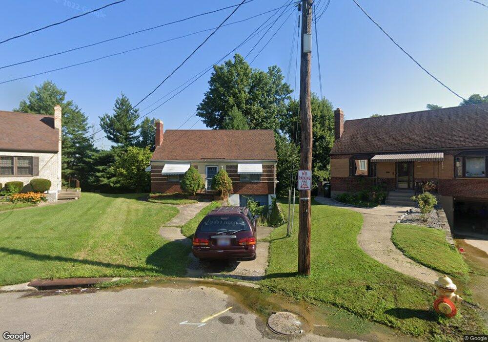
1998 Alphonse Ln Cincinnati, OH 45238
Estimated Value: $194,000 - $223,000
3
Beds
1
Bath
1,258
Sq Ft
$165/Sq Ft
Est. Value
About This Home
This home is located at 1998 Alphonse Ln, Cincinnati, OH 45238 and is currently estimated at $207,536, approximately $164 per square foot. 1998 Alphonse Ln is a home located in Hamilton County with nearby schools including Covedale School, Gilbert A. Dater High School, and Western Hills High School.
Ownership History
Date
Name
Owned For
Owner Type
Purchase Details
Closed on
Apr 22, 2004
Sold by
Schneider Thomas J
Bought by
Converse James E
Current Estimated Value
Home Financials for this Owner
Home Financials are based on the most recent Mortgage that was taken out on this home.
Original Mortgage
$81,225
Interest Rate
5.5%
Mortgage Type
Unknown
Purchase Details
Closed on
Jul 21, 1994
Sold by
Schneider Theresa M
Bought by
Schneider Thomas J
Create a Home Valuation Report for This Property
The Home Valuation Report is an in-depth analysis detailing your home's value as well as a comparison with similar homes in the area
Home Values in the Area
Average Home Value in this Area
Purchase History
| Date | Buyer | Sale Price | Title Company |
|---|---|---|---|
| Converse James E | $85,500 | -- | |
| Schneider Thomas J | -- | -- |
Source: Public Records
Mortgage History
| Date | Status | Borrower | Loan Amount |
|---|---|---|---|
| Closed | Converse James E | $81,225 |
Source: Public Records
Tax History
| Year | Tax Paid | Tax Assessment Tax Assessment Total Assessment is a certain percentage of the fair market value that is determined by local assessors to be the total taxable value of land and additions on the property. | Land | Improvement |
|---|---|---|---|---|
| 2025 | $3,314 | $54,369 | $14,175 | $40,194 |
| 2023 | $3,283 | $54,369 | $14,175 | $40,194 |
| 2022 | $2,419 | $33,366 | $11,330 | $22,036 |
| 2021 | $2,194 | $33,366 | $11,330 | $22,036 |
| 2020 | $2,225 | $33,366 | $11,330 | $22,036 |
| 2019 | $2,208 | $29,789 | $10,115 | $19,674 |
| 2018 | $2,212 | $29,789 | $10,115 | $19,674 |
| 2017 | $2,113 | $29,789 | $10,115 | $19,674 |
| 2016 | $2,282 | $31,595 | $10,395 | $21,200 |
| 2015 | $2,057 | $31,595 | $10,395 | $21,200 |
| 2014 | $2,072 | $31,595 | $10,395 | $21,200 |
| 2013 | $2,027 | $31,913 | $10,500 | $21,413 |
Source: Public Records
Map
Nearby Homes
- 5301 Leon Ct
- 1650 Colonial Dr
- 3141 W Tower Ave
- 3124 Veazey Ave
- 5020 Sidney Rd
- 5132 Ralph Ave
- 4925 Shirley Place
- 3061 Veazey Ave
- 2195 Woodmere Ct
- 4915 Heuwerth Ave
- 5114 Cleves Warsaw Pike
- 5183 Cleves Warsaw Pike
- 5461 Bellfield Ln
- 5140 Willnet Dr
- 4849 Prosperity Place
- 3004 Glenmore Ave
- 5524 Sidney Rd
- 2925 Boudinot Ave
- 4965 Glenway Ave
- 5487 Belcross Ct
- 1995 Alphonse Ln
- 1994 Alphonse Ln
- 5191 Crookshank Rd
- 1990 Alphonse Ln
- 1991 Alphonse Ln
- 1986 Alphonse Ln
- 1987 Alphonse Ln
- 5198 Leona Dr
- 5200 Leona Dr
- 5204 Leona Dr
- 5155 Crookshank Rd
- 5194 Leona Dr
- 5208 Leona Dr
- 5212 Leona Dr
- 5216 Leona Dr
- 5190 Leona Dr
- 5220 Leona Dr
- 5186 Leona Dr
- 5281 Ponce Ln
- 5191 Leona Dr
Your Personal Tour Guide
Ask me questions while you tour the home.