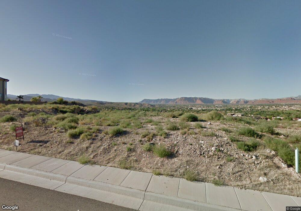
1998 W 450 S Saint George, UT 84770
Estimated Value: $897,000 - $1,163,000
4
Beds
3
Baths
2,589
Sq Ft
$384/Sq Ft
Est. Value
About This Home
This home is located at 1998 W 450 S, Saint George, UT 84770 and is currently estimated at $993,238, approximately $383 per square foot. 1998 W 450 S is a home located in Washington County with nearby schools including Arrowhead School, Dixie Intermediate School, and Dixie Middle School.
Ownership History
Date
Name
Owned For
Owner Type
Purchase Details
Closed on
Oct 28, 2020
Sold by
Lesprix Family Limited Partnership
Bought by
Vincent Properties Llc
Current Estimated Value
Purchase Details
Closed on
Dec 16, 2010
Sold by
Zions First National Bank
Bought by
Vincent Properties Llc and Lesprix Family Limited Partnership
Purchase Details
Closed on
Nov 2, 2010
Sold by
Dos Pollos Llc
Bought by
Zions First National Bank
Purchase Details
Closed on
Feb 7, 2008
Sold by
Quality Development Llc
Bought by
Dos Pollos Llc
Purchase Details
Closed on
Oct 27, 2006
Sold by
Qrs Develoment Inc
Bought by
Quality Development Llc
Create a Home Valuation Report for This Property
The Home Valuation Report is an in-depth analysis detailing your home's value as well as a comparison with similar homes in the area
Home Values in the Area
Average Home Value in this Area
Purchase History
| Date | Buyer | Sale Price | Title Company |
|---|---|---|---|
| Vincent Properties Llc | -- | None Available | |
| Vincent Properties Llc | -- | Southern Utah Title | |
| Zions First National Bank | -- | Guardian Title Company Of Ut | |
| Dos Pollos Llc | -- | None Available | |
| Quality Development Llc | -- | None Available |
Source: Public Records
Tax History Compared to Growth
Tax History
| Year | Tax Paid | Tax Assessment Tax Assessment Total Assessment is a certain percentage of the fair market value that is determined by local assessors to be the total taxable value of land and additions on the property. | Land | Improvement |
|---|---|---|---|---|
| 2025 | $5,882 | $905,500 | $238,000 | $667,500 |
| 2023 | $5,822 | $869,800 | $212,500 | $657,300 |
| 2022 | $6,465 | $908,400 | $225,000 | $683,400 |
| 2021 | $5,614 | $647,000 | $187,000 | $460,000 |
| 2020 | $5,292 | $574,400 | $178,500 | $395,900 |
| 2019 | $5,272 | $559,000 | $178,500 | $380,500 |
| 2018 | $5,232 | $520,800 | $0 | $0 |
| 2017 | $5,103 | $493,200 | $0 | $0 |
| 2016 | $5,324 | $475,900 | $0 | $0 |
| 2015 | $1,772 | $152,000 | $0 | $0 |
| 2014 | $1,622 | $140,000 | $0 | $0 |
Source: Public Records
Map
Nearby Homes
- 2024 W 450 Cir S
- 335 S Luce Del Sol Unit 1
- 280 S Luce Del Sol Unit 615
- 280 S Luce Del Sol Unit 119
- 280 S Luce Del Sol Unit 518
- 280 S Luce Del Sol Unit 511
- 280 S Luce Del Sol Unit 316
- 691 Rainier Dr
- 1825 W Mathis Park Place
- 1825 W Mathis Park Place Unit 40
- 145 S Crystal Lakes Dr Unit 72
- 24 N Emeraud Dr N
- 2243 W Sunbrook Dr
- 584 S Dixie Dr Unit Lot 20
- 584 S Dixie Dr Unit Lot 19
- 584 S Dixie Dr
- 584 S Dixie Dr Unit Lot 18
- 584 S Dixie Dr Unit 26
- 1998 W 450 S Unit 119
- 1982 W 450 S
- 0 W 450 Cir S
- 0 450 Cir S
- 450 W 450 Cir S
- 2005 W 450 Cir S
- Lot 126 450 Cir S
- Lot 125 450 Cir S
- 1987 W 450 Cir S
- 1969 W 450 Cir S
- 2024 W 450 S
- 2017 W 450 S
- Lot 124 450 Cir S
- 1956 W 450 Cir S
- 2036 W 450 Cir S
- 2031 W 450 Cir S
- 2039 W 450 Cir S
- Lot 111 450 Cir S
- 1948 W 450 Cir S
- 2048 W 450 S
