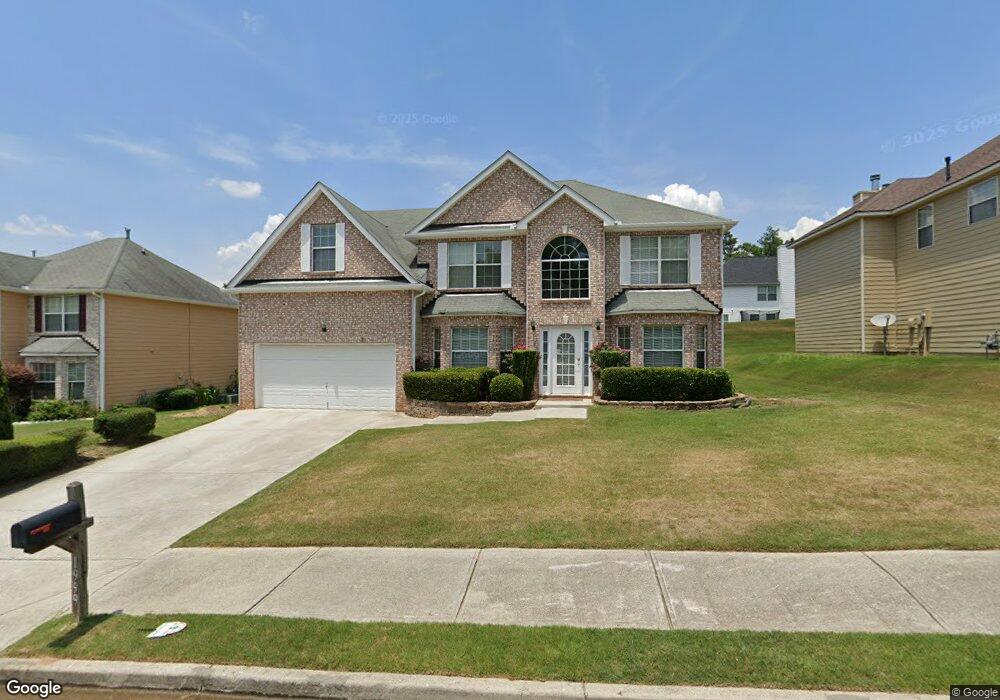
1999 Bridgestone Cir Unit 130 Conyers, GA 30012
Estimated Value: $341,832 - $373,000
5
Beds
3
Baths
3,190
Sq Ft
$111/Sq Ft
Est. Value
About This Home
This home is located at 1999 Bridgestone Cir Unit 130, Conyers, GA 30012 and is currently estimated at $354,708, approximately $111 per square foot. 1999 Bridgestone Cir Unit 130 is a home located in Rockdale County with nearby schools including Hicks Elementary School, Conyers Middle School, and Rockdale County High School.
Ownership History
Date
Name
Owned For
Owner Type
Purchase Details
Closed on
Jun 25, 2013
Sold by
Grant Devon
Bought by
Dossantos Frankie and Dossantos Colleen
Current Estimated Value
Purchase Details
Closed on
Oct 6, 2008
Sold by
Grant Devon
Bought by
Grant Devon and Grant Doris M
Home Financials for this Owner
Home Financials are based on the most recent Mortgage that was taken out on this home.
Original Mortgage
$197,184
Interest Rate
5.22%
Mortgage Type
FHA
Create a Home Valuation Report for This Property
The Home Valuation Report is an in-depth analysis detailing your home's value as well as a comparison with similar homes in the area
Home Values in the Area
Average Home Value in this Area
Purchase History
| Date | Buyer | Sale Price | Title Company |
|---|---|---|---|
| Dossantos Frankie | $109,500 | -- | |
| Grant Devon | -- | -- |
Source: Public Records
Mortgage History
| Date | Status | Borrower | Loan Amount |
|---|---|---|---|
| Previous Owner | Grant Devon | $197,184 |
Source: Public Records
Tax History Compared to Growth
Tax History
| Year | Tax Paid | Tax Assessment Tax Assessment Total Assessment is a certain percentage of the fair market value that is determined by local assessors to be the total taxable value of land and additions on the property. | Land | Improvement |
|---|---|---|---|---|
| 2024 | $5,355 | $138,280 | $27,720 | $110,560 |
| 2023 | $5,123 | $133,360 | $26,800 | $106,560 |
| 2022 | $2,503 | $112,480 | $20,960 | $91,520 |
| 2021 | $5,777 | $97,960 | $18,800 | $79,160 |
| 2020 | $5,596 | $88,480 | $16,000 | $72,480 |
| 2019 | $4,367 | $65,080 | $8,800 | $56,280 |
| 2018 | $2,934 | $65,080 | $8,800 | $56,280 |
| 2017 | $3,435 | $51,640 | $10,400 | $41,240 |
| 2016 | $3,365 | $50,160 | $7,200 | $42,960 |
| 2015 | $2,285 | $50,160 | $7,200 | $42,960 |
| 2014 | $2,017 | $43,800 | $6,261 | $37,539 |
| 2013 | -- | $53,920 | $8,800 | $45,120 |
Source: Public Records
Map
Nearby Homes
- 1962 Bridgestone Cir
- 1954 Bridgestone Cir
- 1666 E Brook Dr
- 1669 E Brook Dr
- 2131 Bridgestone Business Pkwy
- 1915 Cornerstone Pass
- 1903 Cobblestone Ct
- 1469 Cliff View Terrace
- 1526 Battle Brook Dr
- 1260 Brookstone Cir
- 1262 Brookstone Cir
- 1640 Andalusian Way
- 1217 Brookstone Cir
- 1735 Hill St NE
- 1270 Pine Knoll Ln NE
- 1794 Spring St NE
- 2173 Tanglewood Trail NE
- 1288 Lakewood Dr NE
- 2184 Pine Knoll Cir NE
- 1729 Spring St NE
- 1999 Bridgestone Cir
- 1997 Bridgestone Cir
- 2001 Bridgestone Cir
- 1965 Bridgestone Cir
- 1963 Bridgestone Cir
- 1967 Bridgestone Cir
- 1995 Bridgestone Cir
- 2003 Bridgestone Cir
- 1998 Bridgestone Cir
- 2000 Bridgestone Cir
- 1996 Bridgestone Cir
- 1969 Bridgestone Cir
- 1961 Bridgestone Cir
- 2002 Bridgestone Cir
- 2005 Bridgestone Cir
- 1993 Bridgestone Cir
- 1915 Keystone Way
- 1971 Bridgestone Cir
- 1953 Bridgestone Cir
- 1964 Bridgestone Cir