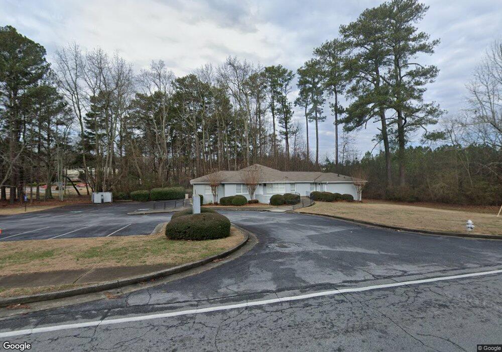
1999 North Rd Snellville, GA 30078
Estimated Value: $339,000 - $382,971
3
Beds
2
Baths
1,616
Sq Ft
$225/Sq Ft
Est. Value
About This Home
This home is located at 1999 North Rd, Snellville, GA 30078 and is currently estimated at $364,243, approximately $225 per square foot. 1999 North Rd is a home located in Gwinnett County with nearby schools including Pharr Elementary School, Couch Middle School, and Grayson High School.
Ownership History
Date
Name
Owned For
Owner Type
Purchase Details
Closed on
Aug 6, 2022
Sold by
Yadav Amol
Bought by
Yadav Amol and Mane Aparna
Current Estimated Value
Purchase Details
Closed on
Feb 13, 2017
Sold by
Bell Joseph E
Bought by
Yadav Amol
Home Financials for this Owner
Home Financials are based on the most recent Mortgage that was taken out on this home.
Original Mortgage
$148,000
Interest Rate
4.12%
Mortgage Type
New Conventional
Purchase Details
Closed on
Feb 22, 1999
Sold by
Bell Joseph E and Bell Mary Jo
Bought by
Bell Joseph E and Bell Mary Jo
Create a Home Valuation Report for This Property
The Home Valuation Report is an in-depth analysis detailing your home's value as well as a comparison with similar homes in the area
Home Values in the Area
Average Home Value in this Area
Purchase History
| Date | Buyer | Sale Price | Title Company |
|---|---|---|---|
| Yadav Amol | -- | -- | |
| Yadav Amol | $185,000 | -- | |
| Bell Joseph E | -- | -- |
Source: Public Records
Mortgage History
| Date | Status | Borrower | Loan Amount |
|---|---|---|---|
| Previous Owner | Yadav Amol | $148,000 |
Source: Public Records
Tax History Compared to Growth
Tax History
| Year | Tax Paid | Tax Assessment Tax Assessment Total Assessment is a certain percentage of the fair market value that is determined by local assessors to be the total taxable value of land and additions on the property. | Land | Improvement |
|---|---|---|---|---|
| 2024 | $4,856 | $151,760 | $33,880 | $117,880 |
| 2023 | $4,856 | $148,920 | $41,800 | $107,120 |
| 2022 | $4,143 | $129,080 | $37,400 | $91,680 |
| 2021 | $3,482 | $106,160 | $33,000 | $73,160 |
| 2020 | $3,653 | $95,520 | $30,200 | $65,320 |
| 2019 | $3,644 | $95,520 | $30,200 | $65,320 |
| 2018 | $2,847 | $74,000 | $25,560 | $48,440 |
| 2016 | $2,511 | $65,160 | $18,880 | $46,280 |
| 2015 | $2,365 | $61,080 | $25,480 | $35,600 |
| 2014 | $2,380 | $61,080 | $25,480 | $35,600 |
Source: Public Records
Map
Nearby Homes
- 1883 Bennett Ridge SW
- 2153 Timber Ln
- 2324 Blackberry Ct
- 2194 Meadow Dr
- 2173 Timber Ln
- 2180 Stockton Walk Ln
- 2207 Windsor Dr Unit 2
- 2240 Stockton Walk Ln
- 1825 North Rd
- 2183 Chaparral Dr
- 1847 Englewood Way
- 1900 Pennistone Way
- 2260 Burlington Ln Unit 1
- 2256 Windsor Dr SW
- 2272 Kimberley Way Unit 1
- 1952 Colony Oaks Dr
- 1801 Driftwood Place
- 2240 Pinehurst Rd
- 1998 North Rd
- 1996 N Rd
- 2000 North Rd
- 1991 North Rd
- 1996 North Rd
- 2005 North Rd
- 2250 Pinehurst Rd
- 1989 North Rd
- 2221 Pinehurst Rd
- 1994 North Rd
- 2015 North Rd
- 2013 Chancellor Ct
- 2138 Dogwood Cir
- 2023 Chancellor Ct
- 1984 North Rd
- 2260 Pinehurst Rd
- 2211 Pinehurst Rd
- 2004 North Rd
- 2025 North Rd