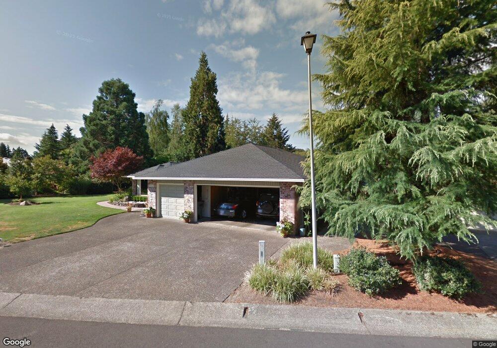
1999 NW Doral St McMinnville, OR 97128
Estimated Value: $710,000 - $746,000
3
Beds
2
Baths
2,090
Sq Ft
$350/Sq Ft
Est. Value
About This Home
This home is located at 1999 NW Doral St, McMinnville, OR 97128 and is currently estimated at $730,700, approximately $349 per square foot. 1999 NW Doral St is a home located in Yamhill County with nearby schools including Memorial Elementary School, Patton Middle School, and McMinnville High School.
Ownership History
Date
Name
Owned For
Owner Type
Purchase Details
Closed on
Sep 18, 2013
Sold by
Patterson William E and Patterson Marjorie A
Bought by
Hall Darren G
Current Estimated Value
Home Financials for this Owner
Home Financials are based on the most recent Mortgage that was taken out on this home.
Original Mortgage
$225,000
Outstanding Balance
$167,636
Interest Rate
4.36%
Mortgage Type
New Conventional
Estimated Equity
$563,064
Create a Home Valuation Report for This Property
The Home Valuation Report is an in-depth analysis detailing your home's value as well as a comparison with similar homes in the area
Home Values in the Area
Average Home Value in this Area
Purchase History
| Date | Buyer | Sale Price | Title Company |
|---|---|---|---|
| Hall Darren G | $329,000 | First American Title |
Source: Public Records
Mortgage History
| Date | Status | Borrower | Loan Amount |
|---|---|---|---|
| Open | Hall Darren G | $225,000 |
Source: Public Records
Tax History Compared to Growth
Tax History
| Year | Tax Paid | Tax Assessment Tax Assessment Total Assessment is a certain percentage of the fair market value that is determined by local assessors to be the total taxable value of land and additions on the property. | Land | Improvement |
|---|---|---|---|---|
| 2024 | $7,734 | $444,957 | -- | -- |
| 2023 | $7,302 | $431,997 | $0 | $0 |
| 2022 | $6,917 | $419,415 | $0 | $0 |
| 2021 | $6,754 | $407,199 | $0 | $0 |
| 2020 | $6,700 | $395,339 | $0 | $0 |
| 2019 | $6,518 | $383,824 | $0 | $0 |
| 2018 | $6,389 | $372,645 | $0 | $0 |
| 2017 | $6,167 | $361,791 | $0 | $0 |
| 2016 | $5,946 | $351,253 | $0 | $0 |
| 2015 | $5,801 | $341,024 | $0 | $0 |
| 2014 | $5,488 | $331,093 | $0 | $0 |
Source: Public Records
Map
Nearby Homes
- 1875 NW Doral St
- 1120 NW Baker Creek Rd
- 1462 NW Chardonnay Dr
- 2735 NW Pinehurst Dr Unit 5
- 3192 NW Pinehurst Dr Unit 76
- 1564 NW Pinehurst Dr Unit 106
- 2799 NW Pinehurst Dr Unit 11
- 2787 NW Pinehurst Dr Unit 10
- 2897 NW Pinehurst Dr Unit 13
- 2719 NW Pinehurst Dr Unit 3
- 2743 NW Pinehurst Dr Unit 6
- 3106 NW Pinehurst Dr Unit 49
- 2805 NW Pinehurst Dr Unit 12
- 1536 NW Pinehurst Dr Unit 108
- 3200 NW Pinehurst Dr Unit 75
- 2769 NW Pinehurst Dr Unit 8
- 2925 NW Pinehurst Dr Unit 14
- 2713 NW Pinehurst Dr Unit 2
- 3164 NW Pinehurst Dr Unit 77
- 3046 NW Pinehurst Dr Unit 46
- 1959 NW Doral St
- 2019 NW Doral St
- 1931 NW Doral St
- 2037 NW Doral St
- 1889 NW Doral St
- 1472 NW Firestone Ct
- 1460 NW Firestone Ct
- 2045 NW Doral St
- 1880 NW Doral St
- 1200 NW Saint Andrews Point
- 2133 NW Saint Andrews Dr
- 2127 NW Saint Andrews Dr
- 1484 NW Firestone Ct
- 1267 NW Torres Pine Ct
- 1863 NW Doral St
- 1451 NW Firestone Ct
- 2048 NW Doral St
- 1279 NW Torres Pine Ct
- 2050 NW Doral St
- 1225 NW Saint Andrews Point