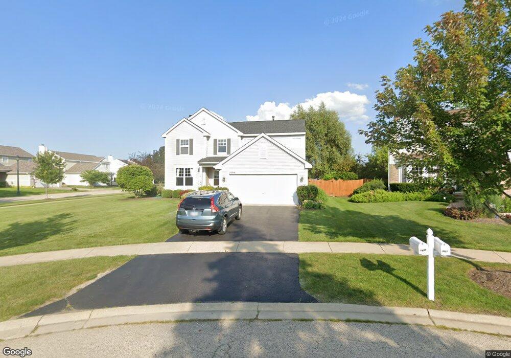
1999 Sparrow Cir Round Lake, IL 60073
Valley Lakes NeighborhoodEstimated Value: $389,846 - $434,000
--
Bed
3
Baths
2,310
Sq Ft
$179/Sq Ft
Est. Value
About This Home
This home is located at 1999 Sparrow Cir, Round Lake, IL 60073 and is currently estimated at $414,462, approximately $179 per square foot. 1999 Sparrow Cir is a home located in Lake County with nearby schools including Big Hollow Primary School, Big Hollow Elementary School, and Big Hollow Middle School.
Ownership History
Date
Name
Owned For
Owner Type
Purchase Details
Closed on
Dec 27, 2021
Sold by
Cernuska Tammy M
Bought by
Hoth Tammy
Current Estimated Value
Home Financials for this Owner
Home Financials are based on the most recent Mortgage that was taken out on this home.
Original Mortgage
$274,725
Interest Rate
3.5%
Mortgage Type
FHA
Purchase Details
Closed on
Feb 3, 2003
Sold by
Centex Homes
Bought by
Cernuska Joseph G and Cernuska Tammy
Home Financials for this Owner
Home Financials are based on the most recent Mortgage that was taken out on this home.
Original Mortgage
$243,250
Interest Rate
5.71%
Create a Home Valuation Report for This Property
The Home Valuation Report is an in-depth analysis detailing your home's value as well as a comparison with similar homes in the area
Home Values in the Area
Average Home Value in this Area
Purchase History
| Date | Buyer | Sale Price | Title Company |
|---|---|---|---|
| Hoth Tammy | -- | Fidelity National Title | |
| Cernuska Joseph G | $256,500 | -- |
Source: Public Records
Mortgage History
| Date | Status | Borrower | Loan Amount |
|---|---|---|---|
| Previous Owner | Hoth Tammy | $274,725 | |
| Previous Owner | Cernuska Joseph G | $243,250 |
Source: Public Records
Tax History Compared to Growth
Tax History
| Year | Tax Paid | Tax Assessment Tax Assessment Total Assessment is a certain percentage of the fair market value that is determined by local assessors to be the total taxable value of land and additions on the property. | Land | Improvement |
|---|---|---|---|---|
| 2024 | $9,028 | $118,766 | $20,831 | $97,935 |
| 2023 | $8,630 | $105,916 | $19,624 | $86,292 |
| 2022 | $8,630 | $89,177 | $12,512 | $76,665 |
| 2021 | $8,428 | $84,058 | $11,794 | $72,264 |
| 2020 | $8,391 | $82,856 | $11,625 | $71,231 |
| 2019 | $8,112 | $79,455 | $11,148 | $68,307 |
| 2018 | $8,674 | $84,527 | $13,872 | $70,655 |
| 2017 | $8,467 | $78,128 | $12,822 | $65,306 |
| 2016 | $8,482 | $71,454 | $11,727 | $59,727 |
| 2015 | $8,218 | $66,679 | $10,943 | $55,736 |
| 2014 | $7,762 | $64,047 | $16,382 | $47,665 |
| 2012 | $7,082 | $66,737 | $17,070 | $49,667 |
Source: Public Records
Map
Nearby Homes
- 26 N Berkshire Ln
- 389 Prairie Mist Dr
- 34156 N Redtop Rd
- 34113 N Primrose Ct
- 308 S Fieldstone Ct
- 338 S Litchfield Dr
- 330 S Fieldstone Ct
- 398 S Jade Ln
- 00 Gilmer Rd
- 0 Gilmer Rd Unit MRD12263293
- 33336 N Fish Lake Rd
- 25644 W Brooks Farm Rd
- 34346 N White Clover Ct Unit 34346
- 1543 W Remington Ln
- 1561 W Turtle Creek Ln
- 1688 W Turtle Creek Ln
- 649 N Fox Trail
- 34382 N Goldenrod Ct Unit 26139
- 1506 W Turtle Creek Ln
- 610 N Red Deer Rd
- 2001 Sparrow Cir
- 1995 Marigold Ln
- 2003 Sparrow Cir
- 1985 Marigold Ln
- 1960 Marigold Ln
- 1950 Marigold Ln
- 1970 Marigold Ln
- 1940 Marigold Ln
- 2005 Sparrow Cir
- 2009 Sparrow Cir
- 1980 Marigold Ln
- 1975 Marigold Ln
- 1930 Marigold Ln
- 2007 Sparrow Cir
- 1990 Marigold Ln
- 1953 Lily Ln
- 1965 Marigold Ln
- 1963 Lily Ln
- 1933 Lily Ln
- 1920 Marigold Ln