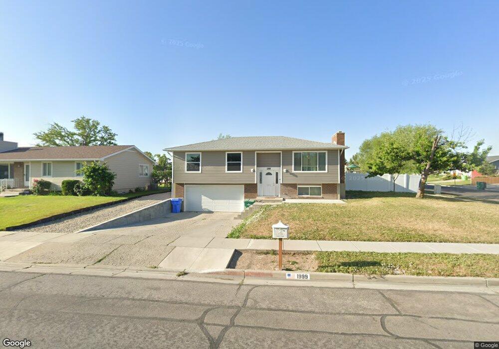
1999 W 12015 S Riverton, UT 84065
Estimated Value: $507,000 - $534,000
3
Beds
1
Bath
1,235
Sq Ft
$421/Sq Ft
Est. Value
About This Home
This home is located at 1999 W 12015 S, Riverton, UT 84065 and is currently estimated at $520,126, approximately $421 per square foot. 1999 W 12015 S is a home located in Salt Lake County with nearby schools including Rosamond Elementary School, Oquirrh Hills Middle School, and Riverton High School.
Ownership History
Date
Name
Owned For
Owner Type
Purchase Details
Closed on
Oct 22, 2025
Sold by
Kirk Spencer Alan and Ashley Ruth
Bought by
Spencer And Ashley Kirk Living Trust and Kirk
Current Estimated Value
Purchase Details
Closed on
Mar 1, 2016
Sold by
Danielson Gary S and Danielson Claudia S
Bought by
Kirk Spencer Alan and Kirk Ashley Ruth
Home Financials for this Owner
Home Financials are based on the most recent Mortgage that was taken out on this home.
Original Mortgage
$206,513
Interest Rate
3.81%
Mortgage Type
New Conventional
Purchase Details
Closed on
Aug 3, 1995
Sold by
Okeefe William
Bought by
Danielson Gary S and Danielson Claudia S
Create a Home Valuation Report for This Property
The Home Valuation Report is an in-depth analysis detailing your home's value as well as a comparison with similar homes in the area
Home Values in the Area
Average Home Value in this Area
Purchase History
| Date | Buyer | Sale Price | Title Company |
|---|---|---|---|
| Spencer And Ashley Kirk Living Trust | -- | None Listed On Document | |
| Kirk Spencer Alan | -- | Magellan Title Insurance Age | |
| Danielson Gary S | -- | -- |
Source: Public Records
Mortgage History
| Date | Status | Borrower | Loan Amount |
|---|---|---|---|
| Previous Owner | Kirk Spencer Alan | $206,513 |
Source: Public Records
Tax History Compared to Growth
Tax History
| Year | Tax Paid | Tax Assessment Tax Assessment Total Assessment is a certain percentage of the fair market value that is determined by local assessors to be the total taxable value of land and additions on the property. | Land | Improvement |
|---|---|---|---|---|
| 2025 | $2,471 | $450,700 | $202,000 | $248,700 |
| 2024 | $2,471 | $427,600 | $198,300 | $229,300 |
| 2023 | $2,390 | $390,000 | $183,600 | $206,400 |
| 2022 | $2,501 | $400,300 | $180,000 | $220,300 |
| 2021 | $2,197 | $313,100 | $135,000 | $178,100 |
| 2020 | $1,973 | $262,200 | $121,000 | $141,200 |
| 2019 | $1,980 | $258,700 | $110,000 | $148,700 |
| 2018 | $1,852 | $238,200 | $110,000 | $128,200 |
| 2017 | $1,754 | $219,900 | $110,000 | $109,900 |
| 2016 | $1,677 | $201,700 | $102,000 | $99,700 |
| 2015 | $1,648 | $192,200 | $103,800 | $88,400 |
| 2014 | $1,583 | $181,000 | $98,900 | $82,100 |
Source: Public Records
Map
Nearby Homes
- 12034 S 1900 W
- 1721 W Hollow Cedar Ln Unit 1
- 2295 W Myers Ln
- 11666 S Gold Dust Dr
- 11788 S Myers Park Ln Unit 101
- 1767 W Lunford Ln
- 11707 S Myers Park Ln Unit 111
- 1661 W Madison View Dr
- 1611 W Laurel Chase Dr
- 12317 S Redwood Rd
- 12325 S Redwood Rd
- 12345 S Redwood Rd
- 2511 W 11730 S
- 1410 W 12115 S
- 1592 W Andover Rd
- 12294 S 1490 W
- 11694 Stone Crest Cir
- 11711 Stone Crest Cir
- 11716 S 2610 W
- 11784 Stone Ridge Ct
- 1985 W 12015 S
- 12045 S 1975 W
- 12030 S 2010 W
- 12030 S 1975 W
- 12030 S Doreen Dr
- 1969 W 12015 S
- 2000 W 12015 S
- 12044 S 1975 W
- 1964 W 12110 S
- 1986 W 12015 S
- 12061 S 1975 W
- 1972 W 12110 S
- 2047 W 12015 S
- 2022 W 12015 S
- 1970 W 12015 S
- 1951 W 12015 S
- 2046 W 12060 S
- 2048 W 12015 S
- 2005 W 11970 S
- 1984 W 12110 S