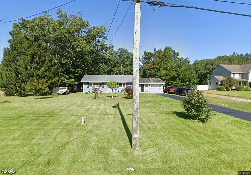
1999 Williamstown Rd Franklinville, NJ 08322
Franklin Township NeighborhoodEstimated Value: $252,000 - $366,000
3
Beds
1
Bath
1,092
Sq Ft
$281/Sq Ft
Est. Value
About This Home
This home is located at 1999 Williamstown Rd, Franklinville, NJ 08322 and is currently estimated at $306,684, approximately $280 per square foot. 1999 Williamstown Rd is a home located in Gloucester County with nearby schools including Delsea Regional Middle School and Delsea Regional High School.
Ownership History
Date
Name
Owned For
Owner Type
Purchase Details
Closed on
Dec 9, 2011
Sold by
Bellanger Shelley and Schwab Philip
Bought by
Roman Marissa
Current Estimated Value
Home Financials for this Owner
Home Financials are based on the most recent Mortgage that was taken out on this home.
Original Mortgage
$137,755
Outstanding Balance
$94,234
Interest Rate
4.01%
Mortgage Type
New Conventional
Estimated Equity
$212,450
Create a Home Valuation Report for This Property
The Home Valuation Report is an in-depth analysis detailing your home's value as well as a comparison with similar homes in the area
Home Values in the Area
Average Home Value in this Area
Purchase History
| Date | Buyer | Sale Price | Title Company |
|---|---|---|---|
| Roman Marissa | $135,000 | Foundation Title Llc |
Source: Public Records
Mortgage History
| Date | Status | Borrower | Loan Amount |
|---|---|---|---|
| Open | Roman Marissa | $137,755 |
Source: Public Records
Tax History Compared to Growth
Tax History
| Year | Tax Paid | Tax Assessment Tax Assessment Total Assessment is a certain percentage of the fair market value that is determined by local assessors to be the total taxable value of land and additions on the property. | Land | Improvement |
|---|---|---|---|---|
| 2025 | $4,731 | $125,000 | $23,400 | $101,600 |
| 2024 | $4,608 | $125,000 | $23,400 | $101,600 |
| 2023 | $4,608 | $125,000 | $23,400 | $101,600 |
| 2022 | $4,488 | $125,000 | $23,400 | $101,600 |
| 2021 | $4,425 | $125,000 | $23,400 | $101,600 |
| 2020 | $4,378 | $125,000 | $23,400 | $101,600 |
| 2019 | $4,320 | $125,000 | $23,400 | $101,600 |
| 2018 | $4,263 | $125,000 | $23,400 | $101,600 |
| 2017 | $4,183 | $125,000 | $23,400 | $101,600 |
| 2016 | $4,164 | $125,000 | $23,400 | $101,600 |
| 2015 | $3,996 | $125,000 | $23,400 | $101,600 |
| 2014 | $3,848 | $125,000 | $23,400 | $101,600 |
Source: Public Records
Map
Nearby Homes
- 18 Crysta Ct
- 893 Fries Mill Rd
- 295 Blackwood Ave
- 0 Fries Mill Rd
- 1780 Coles Mill Rd
- 1800 Coles Mill Rd
- 51 Elmer St
- Lot 89 Delsea Dr
- 900 Delsea Dr
- 2165 Delsea Dr
- 3198 Delsea Dr
- 3071 Delsea Dr
- 141 Fries Mill Rd
- 3328 Delsea Dr
- 2323 Sheridan Ave
- 664 Scotland Run Ave
- 338 Sugar Hill Dr
- 3060 Williamstown Rd
- 919 Little Mill Rd
- 1756 Delsea Dr
- L:39.03 Williamstown Rd
- 2019 Williamstown Rd
- 1981 Williamstown Rd
- 2006 Williamstown Rd
- 2020 Williamstown Rd
- 2029 Williamstown Rd
- 1986 Williamstown Rd
- 1965 Williamstown Rd
- 2038 Williamstown Rd
- 1971 Williamstown Rd
- 2041 Williamstown Rd
- 1972 Williamstown Rd
- 2005 Williamstown Rd
- 2063 Williamstown Rd
- 1931 Williamstown Rd
- 2062 Williamstown Rd
- 1990 Williamstown Rd
- 1956 Williamstown Rd
- 2044 Williamstown Rd
- 2002 Williamstown Rd