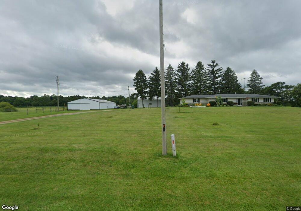
19991 State Route 47 Raymond, OH 43067
Estimated Value: $357,000 - $438,000
3
Beds
3
Baths
1,796
Sq Ft
$219/Sq Ft
Est. Value
About This Home
This home is located at 19991 State Route 47, Raymond, OH 43067 and is currently estimated at $393,775, approximately $219 per square foot. 19991 State Route 47 is a home located in Union County with nearby schools including North Union Elementary School, North Union Middle School, and North Union High School.
Ownership History
Date
Name
Owned For
Owner Type
Purchase Details
Closed on
Apr 2, 2021
Sold by
Pyers Anthony L
Bought by
Dempsey Racheal M and Bartle Connor P
Current Estimated Value
Home Financials for this Owner
Home Financials are based on the most recent Mortgage that was taken out on this home.
Original Mortgage
$355,000
Interest Rate
2.9%
Mortgage Type
New Conventional
Create a Home Valuation Report for This Property
The Home Valuation Report is an in-depth analysis detailing your home's value as well as a comparison with similar homes in the area
Home Values in the Area
Average Home Value in this Area
Purchase History
| Date | Buyer | Sale Price | Title Company |
|---|---|---|---|
| Dempsey Racheal M | $375,000 | First Ohio Title Insurance |
Source: Public Records
Mortgage History
| Date | Status | Borrower | Loan Amount |
|---|---|---|---|
| Closed | Dempsey Racheal M | $355,000 |
Source: Public Records
Tax History Compared to Growth
Tax History
| Year | Tax Paid | Tax Assessment Tax Assessment Total Assessment is a certain percentage of the fair market value that is determined by local assessors to be the total taxable value of land and additions on the property. | Land | Improvement |
|---|---|---|---|---|
| 2024 | $3,647 | $84,050 | $17,340 | $66,710 |
| 2023 | $3,647 | $84,050 | $17,340 | $66,710 |
| 2022 | $3,594 | $84,050 | $17,340 | $66,710 |
| 2021 | $3,129 | $106,730 | $58,370 | $48,360 |
| 2020 | $2,502 | $106,730 | $58,370 | $48,360 |
| 2019 | $2,518 | $106,730 | $58,370 | $48,360 |
| 2018 | $2,571 | $95,080 | $53,890 | $41,190 |
| 2017 | $2,557 | $95,080 | $53,890 | $41,190 |
| 2016 | $2,588 | $95,080 | $53,890 | $41,190 |
| 2015 | $2,222 | $81,350 | $48,780 | $32,570 |
| 2014 | $2,137 | $81,350 | $48,780 | $32,570 |
| 2013 | $2,171 | $81,350 | $48,780 | $32,570 |
Source: Public Records
Map
Nearby Homes
- 28370 State Route 739
- 25875 Ohio 31
- 19250 Powder Lick Rd
- 21800 State Route 47
- 18055 Miller Rd
- 30650 State Route 739
- 31434 State Route 31
- 25400 Storms Rd
- 31535 State Route 31
- 0 Ohio 31
- 0 Powder Lick Rd Unit 1016484
- 23863 Drake Skidmore Rd
- 23750 Drake-Skidmore Rd
- 32220 State Route 31
- 25883 Lunda Rd
- 21630 Main St
- 27900 Zook Rd
- 184 E Mann St
- 27770 Zook Rd
- 23156 State Route 739
- 19991 Ohio 47
- 0 State Route 47 Unit 213025303
- 0 State Route 47 Unit 213025305
- 0 State Route 47 Unit 1021655
- 0 State Route 47 Unit 222037567
- 20220 State Route 47
- 20221 State Route 47
- 20282 State Route 47
- 19639 State Route 47
- 20291 State Route 47
- 20314 State Route 47
- 20340 Ohio 47
- 20340 State Route 47
- 20385 State Route 47
- 20421 Ohio 47
- 000 State Route 31
- 28654 Storms Rd
- 20155 Predmore Rd
- 20421 State Route 47
- 19462 State Route 47