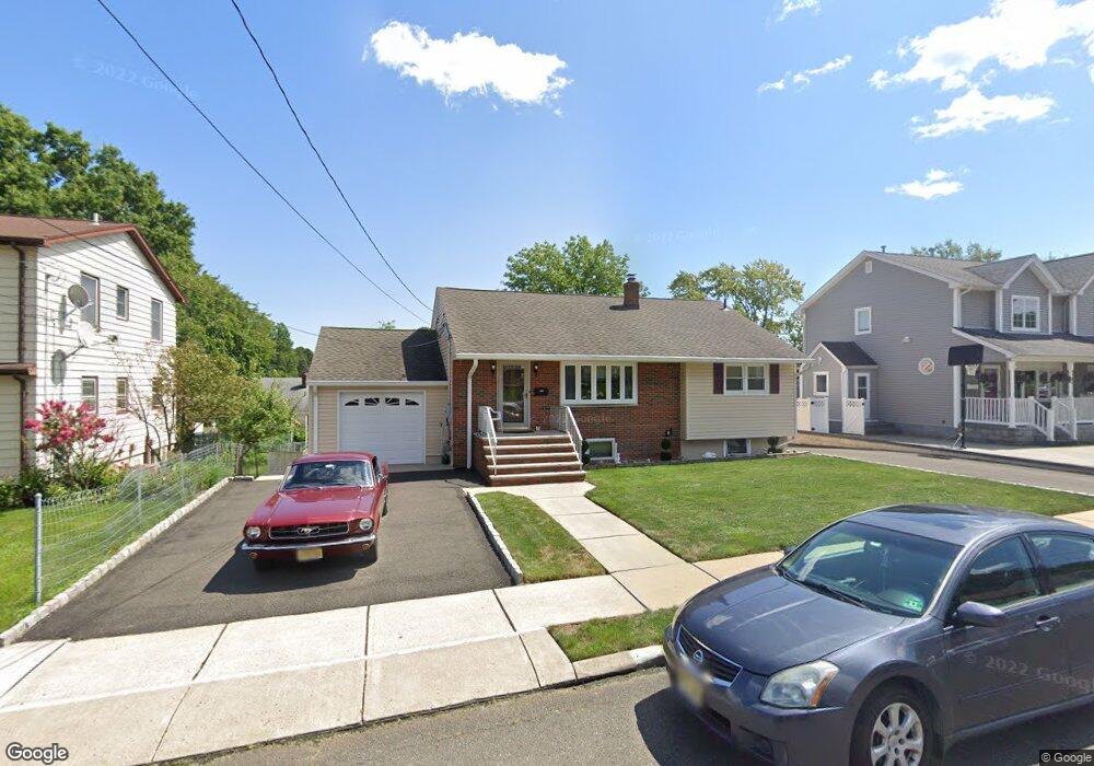
1A Highview Ave Totowa, NJ 07512
Estimated Value: $565,000 - $636,000
3
Beds
2
Baths
1,078
Sq Ft
$559/Sq Ft
Est. Value
About This Home
This home is located at 1A Highview Ave, Totowa, NJ 07512 and is currently estimated at $602,370, approximately $558 per square foot. 1A Highview Ave is a home located in Passaic County with nearby schools including Washington Park Elementary School, Passaic Valley High School, and John P Holland Charter School.
Ownership History
Date
Name
Owned For
Owner Type
Purchase Details
Closed on
May 24, 2021
Sold by
Pezzolla Vito and Ryan Denise Dagostino
Bought by
Velazquez Phillip and Velazquez Ann Marie
Current Estimated Value
Home Financials for this Owner
Home Financials are based on the most recent Mortgage that was taken out on this home.
Original Mortgage
$479,250
Outstanding Balance
$433,641
Interest Rate
3%
Mortgage Type
New Conventional
Estimated Equity
$168,729
Purchase Details
Closed on
Mar 8, 2013
Sold by
Pezzolla Anna and Pezzolla Joseph
Bought by
Pezzolla Joseph
Create a Home Valuation Report for This Property
The Home Valuation Report is an in-depth analysis detailing your home's value as well as a comparison with similar homes in the area
Home Values in the Area
Average Home Value in this Area
Purchase History
| Date | Buyer | Sale Price | Title Company |
|---|---|---|---|
| Velazquez Phillip | $505,000 | Evident Title Agency Inc | |
| Velazquez Phillip | $505,000 | Evident Title Agency | |
| Pezzolla Joseph | -- | None Available |
Source: Public Records
Mortgage History
| Date | Status | Borrower | Loan Amount |
|---|---|---|---|
| Open | Velazquez Phillip | $479,250 | |
| Closed | Velazquez Phillip | $479,250 |
Source: Public Records
Tax History Compared to Growth
Tax History
| Year | Tax Paid | Tax Assessment Tax Assessment Total Assessment is a certain percentage of the fair market value that is determined by local assessors to be the total taxable value of land and additions on the property. | Land | Improvement |
|---|---|---|---|---|
| 2025 | $10,277 | $379,100 | $175,700 | $203,400 |
| 2024 | $9,830 | $379,100 | $175,700 | $203,400 |
| 2022 | $9,242 | $379,100 | $175,700 | $203,400 |
| 2021 | $9,019 | $379,100 | $175,700 | $203,400 |
| 2020 | $9,182 | $379,100 | $175,700 | $203,400 |
| 2019 | $9,053 | $379,100 | $175,700 | $203,400 |
| 2018 | $9,034 | $379,100 | $175,700 | $203,400 |
| 2017 | $8,943 | $379,100 | $175,700 | $203,400 |
| 2016 | $8,905 | $379,100 | $175,700 | $203,400 |
| 2015 | $8,659 | $379,100 | $175,700 | $203,400 |
| 2014 | $8,045 | $379,100 | $175,700 | $203,400 |
Source: Public Records
Map
Nearby Homes