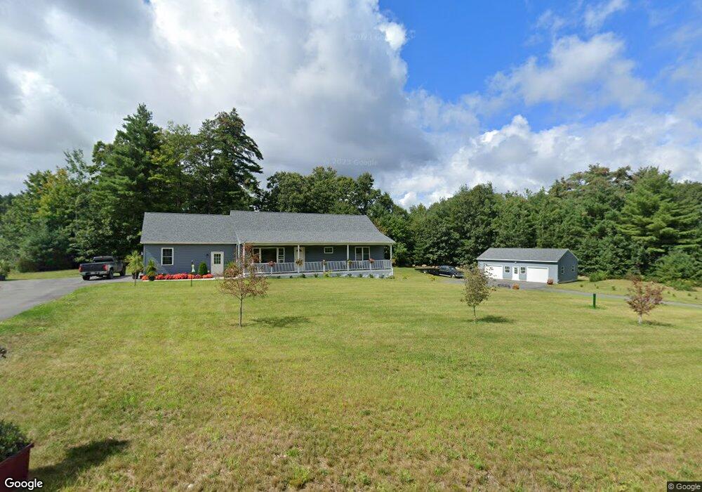
1A Katie Ln Palmer, MA 01069
Estimated Value: $366,000 - $500,000
2
Beds
2
Baths
1,392
Sq Ft
$306/Sq Ft
Est. Value
About This Home
This home is located at 1A Katie Ln, Palmer, MA 01069 and is currently estimated at $425,933, approximately $305 per square foot. 1A Katie Ln is a home with nearby schools including Old Mill Pond Elementary School, Converse Middle School, and Palmer High School.
Create a Home Valuation Report for This Property
The Home Valuation Report is an in-depth analysis detailing your home's value as well as a comparison with similar homes in the area
Home Values in the Area
Average Home Value in this Area
Tax History
| Year | Tax Paid | Tax Assessment Tax Assessment Total Assessment is a certain percentage of the fair market value that is determined by local assessors to be the total taxable value of land and additions on the property. | Land | Improvement |
|---|---|---|---|---|
| 2025 | $8,253 | $451,500 | $48,500 | $403,000 |
| 2024 | $7,692 | $412,000 | $44,200 | $367,800 |
| 2023 | $7,541 | $387,900 | $44,200 | $343,700 |
| 2022 | $830 | $38,800 | $38,800 | $0 |
| 2021 | $975 | $43,100 | $43,100 | $0 |
| 2020 | $983 | $43,100 | $43,100 | $0 |
| 2019 | $954 | $43,100 | $43,100 | $0 |
| 2018 | $923 | $41,800 | $41,800 | $0 |
| 2017 | $902 | $41,800 | $41,800 | $0 |
| 2016 | $864 | $40,600 | $40,600 | $0 |
| 2015 | $838 | $40,600 | $40,600 | $0 |
Source: Public Records
Map
Nearby Homes
- Lot 34 Old Warren Rd
- 593 Old Warren Rd
- 599-607 Old Warren Rd
- 123 Peterson Rd
- 50 Stimson St
- 61 Beech St
- 0 Old Warren Rd
- 101 Ware St
- Lot 14 Center St
- 4498 High St
- 213 River St
- 4415 High St
- 1711-1723 Ware St
- Lot 8 Breckenridge St
- 141 Thompson St
- 70 Summer St
- 7,37,38 Thorndike and Lawrence St
- 0 St Unit 73414881
- 44-50 Lawrence St
- 62-91 Lawrence St
Your Personal Tour Guide
Ask me questions while you tour the home.