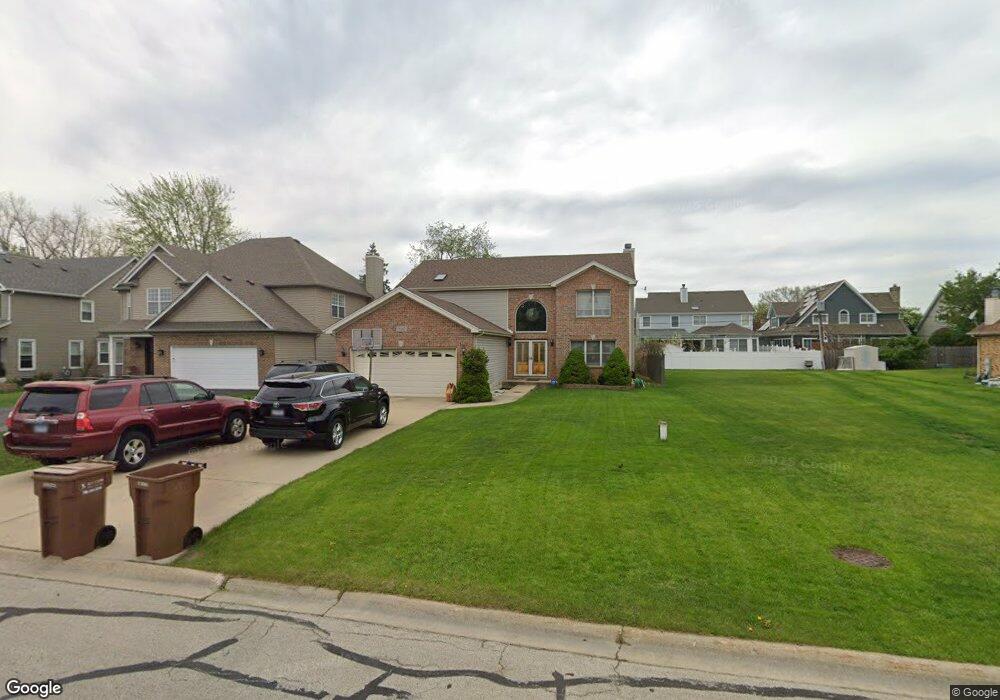
1N162 West St Carol Stream, IL 60188
South Carol Stream NeighborhoodEstimated Value: $484,000 - $573,000
3
Beds
3
Baths
2,394
Sq Ft
$221/Sq Ft
Est. Value
About This Home
This home is located at 1N162 West St, Carol Stream, IL 60188 and is currently estimated at $528,503, approximately $220 per square foot. 1N162 West St is a home located in DuPage County with nearby schools including Washington Elementary School, Franklin Middle School, and Monroe Middle School.
Ownership History
Date
Name
Owned For
Owner Type
Purchase Details
Closed on
Oct 11, 2001
Sold by
Khoury Daniel M
Bought by
Mendoza Roderick and Mendoza Rosalie R
Current Estimated Value
Home Financials for this Owner
Home Financials are based on the most recent Mortgage that was taken out on this home.
Original Mortgage
$209,900
Outstanding Balance
$81,622
Interest Rate
6.8%
Estimated Equity
$446,881
Create a Home Valuation Report for This Property
The Home Valuation Report is an in-depth analysis detailing your home's value as well as a comparison with similar homes in the area
Home Values in the Area
Average Home Value in this Area
Purchase History
| Date | Buyer | Sale Price | Title Company |
|---|---|---|---|
| Mendoza Roderick | $310,000 | First American Title Ins |
Source: Public Records
Mortgage History
| Date | Status | Borrower | Loan Amount |
|---|---|---|---|
| Open | Mendoza Roderick | $209,900 |
Source: Public Records
Tax History Compared to Growth
Tax History
| Year | Tax Paid | Tax Assessment Tax Assessment Total Assessment is a certain percentage of the fair market value that is determined by local assessors to be the total taxable value of land and additions on the property. | Land | Improvement |
|---|---|---|---|---|
| 2024 | $9,131 | $147,881 | $15,970 | $131,911 |
| 2023 | $8,739 | $136,120 | $14,700 | $121,420 |
| 2022 | $8,570 | $128,640 | $13,890 | $114,750 |
| 2021 | $8,311 | $125,590 | $13,560 | $112,030 |
| 2020 | $8,188 | $124,420 | $13,430 | $110,990 |
| 2019 | $7,984 | $121,140 | $13,080 | $108,060 |
| 2018 | $8,686 | $129,660 | $12,330 | $117,330 |
| 2017 | $8,526 | $124,870 | $11,870 | $113,000 |
| 2016 | $8,400 | $119,890 | $11,400 | $108,490 |
| 2015 | $8,324 | $114,380 | $10,880 | $103,500 |
| 2014 | $8,362 | $112,870 | $10,950 | $101,920 |
| 2013 | $8,075 | $113,210 | $10,980 | $102,230 |
Source: Public Records
Map
Nearby Homes
- Lot 11 Ellis Ave
- 0 Ellis Ave
- 1N344 Darling St
- 1N321 Morse St
- 2018 N West St
- 25W275 Doris Ave
- 25W277 Doris Ave
- 25W361 Doris Ave
- 1919 Kingsbrook Ct
- 628 Belmont Ln
- 640 Belmont Ln
- 100 W Park Circle Dr Unit 1C
- 0N632 Gables Blvd
- 0N741 Woodlawn St
- 0N649 Knollwood Dr
- 1N153 Mission Ct
- 0N 634 Knollwood Dr
- 0N510 Gary Ave
- 325 W Prairie Ave
- 1N599 Golf View Ln
- 1N154 West St
- 1N180 West St
- 1N144 West St
- 1N302 West St
- 1N171 Darling St
- 1N171 Darling St
- 1N155 Darling St
- 1N171 Darling St
- 1N184 West St
- 1N177 Darling St
- 1N140 West St
- 1N145 Darling St
- 1N201 Darling St
- 1N210 West St
- 1N205 Darling St
- 1N124 West St
- 1N216 West St
- 1N213 Darling St
- 1N140 Darling St
- 1N222 West St