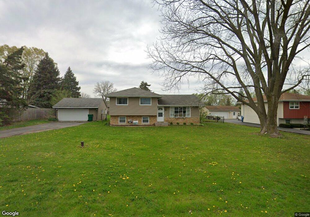
1N344 West St Carol Stream, IL 60188
South Carol Stream NeighborhoodEstimated Value: $237,000 - $403,000
3
Beds
1
Bath
1,040
Sq Ft
$307/Sq Ft
Est. Value
About This Home
This home is located at 1N344 West St, Carol Stream, IL 60188 and is currently estimated at $318,890, approximately $306 per square foot. 1N344 West St is a home located in DuPage County with nearby schools including Washington Elementary School, Franklin Middle School, and Monroe Middle School.
Ownership History
Date
Name
Owned For
Owner Type
Purchase Details
Closed on
Sep 29, 2025
Sold by
Kurz Waldemar and Kurz Renate
Bought by
Kurz Family Revocable Trust and Kurz
Current Estimated Value
Purchase Details
Closed on
Jun 12, 2003
Sold by
Deutsche Bank National Trust Co
Bought by
Kurz Waldemar and Kurz Renate
Home Financials for this Owner
Home Financials are based on the most recent Mortgage that was taken out on this home.
Original Mortgage
$104,000
Interest Rate
6.01%
Mortgage Type
Purchase Money Mortgage
Purchase Details
Closed on
Oct 28, 1999
Sold by
Va
Bought by
Bankers Trust Company Of California Na and Vendee Mtg Trust 1999-3
Purchase Details
Closed on
Mar 7, 1998
Sold by
Odle Karen
Bought by
Odle Steven
Create a Home Valuation Report for This Property
The Home Valuation Report is an in-depth analysis detailing your home's value as well as a comparison with similar homes in the area
Home Values in the Area
Average Home Value in this Area
Purchase History
| Date | Buyer | Sale Price | Title Company |
|---|---|---|---|
| Kurz Family Revocable Trust | -- | None Listed On Document | |
| Kurz Waldemar | $120,000 | Counselors Title Llc | |
| Bankers Trust Company Of California Na | -- | Stewart Title Company | |
| Odle Steven | -- | -- |
Source: Public Records
Mortgage History
| Date | Status | Borrower | Loan Amount |
|---|---|---|---|
| Previous Owner | Kurz Waldemar | $104,000 |
Source: Public Records
Tax History Compared to Growth
Tax History
| Year | Tax Paid | Tax Assessment Tax Assessment Total Assessment is a certain percentage of the fair market value that is determined by local assessors to be the total taxable value of land and additions on the property. | Land | Improvement |
|---|---|---|---|---|
| 2024 | $6,045 | $100,601 | $31,658 | $68,943 |
| 2023 | $5,770 | $92,600 | $29,140 | $63,460 |
| 2022 | $5,696 | $87,510 | $27,540 | $59,970 |
| 2021 | $5,521 | $85,440 | $26,890 | $58,550 |
| 2020 | $5,437 | $84,640 | $26,640 | $58,000 |
| 2019 | $5,299 | $82,410 | $25,940 | $56,470 |
| 2018 | $4,580 | $71,200 | $24,440 | $46,760 |
| 2017 | $4,488 | $68,570 | $23,540 | $45,030 |
| 2016 | $4,413 | $65,830 | $22,600 | $43,230 |
| 2015 | $4,362 | $62,800 | $21,560 | $41,240 |
| 2014 | $5,192 | $72,350 | $24,310 | $48,040 |
| 2013 | $5,013 | $72,560 | $24,380 | $48,180 |
Source: Public Records
Map
Nearby Homes
- Lot 11 Ellis Ave
- 1N321 Morse St
- 25W275 Doris Ave
- 25W277 Doris Ave
- 25W361 Doris Ave
- 0 Ellis Ave
- 628 Belmont Ln
- 314 Brookside Cir
- 1919 Kingsbrook Ct
- 0N741 Woodlawn St
- 0N649 Knollwood Dr
- 0N 634 Knollwood Dr
- N675 Herrick Dr
- 26W080 Wood Lark Dr
- 325 E Hawthorne Blvd
- 462 S President St Unit 202
- 462 S President St Unit 304
- 291 Blackhawk Dr
- 181 Sype Dr
- 808 Bridle Ln
- 1N362 West St
- 1N330 West St
- 1N351 Darling St
- 1N353 Darling St
- 1N341 Darling St
- 1N322 West St
- 1N370 West St
- 1N331 Darling St
- 1N321 Darling St
- 25W019 Doris Ave
- 1N316 West St
- 1N375 Darling St
- 1N375 Darling St
- 1N311 Darling St
- 1N302 West St
- 1N364 Darling St
- 1N354 Darling St
- 1N305 Darling St
- 1N336 Darling St
- 1N330 Darling St