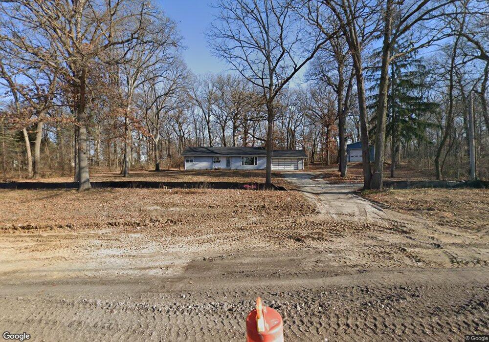
1S867 Il Route 47 Elburn, IL 60119
Nottingham Woods NeighborhoodEstimated Value: $287,000 - $537,000
3
Beds
1
Bath
1,404
Sq Ft
$288/Sq Ft
Est. Value
About This Home
This home is located at 1S867 Il Route 47, Elburn, IL 60119 and is currently estimated at $403,667, approximately $287 per square foot. 1S867 Il Route 47 is a home located in Kane County with nearby schools including Kaneland Blackberry Creek Elementary School, Harter Middle School, and Kaneland Senior High School.
Ownership History
Date
Name
Owned For
Owner Type
Purchase Details
Closed on
Sep 29, 2021
Sold by
Elsner Adrienne D
Bought by
Elburn Properties Llc
Current Estimated Value
Purchase Details
Closed on
Sep 22, 2021
Sold by
Chicago Title Land Trust Company
Bought by
Eisner Adrienne D
Purchase Details
Closed on
Aug 26, 2002
Sold by
Kuefler Peter M and Kuefler Peggy A
Bought by
Elsner Adrienne D
Home Financials for this Owner
Home Financials are based on the most recent Mortgage that was taken out on this home.
Original Mortgage
$283,500
Interest Rate
6.34%
Create a Home Valuation Report for This Property
The Home Valuation Report is an in-depth analysis detailing your home's value as well as a comparison with similar homes in the area
Home Values in the Area
Average Home Value in this Area
Purchase History
| Date | Buyer | Sale Price | Title Company |
|---|---|---|---|
| Elburn Properties Llc | $625,000 | Chicago Title Insurance Co | |
| Eisner Adrienne D | $340,000 | Chicago Title | |
| Elsner Adrienne D | $315,000 | -- |
Source: Public Records
Mortgage History
| Date | Status | Borrower | Loan Amount |
|---|---|---|---|
| Previous Owner | Elsner Adrienne D | $283,500 |
Source: Public Records
Tax History Compared to Growth
Tax History
| Year | Tax Paid | Tax Assessment Tax Assessment Total Assessment is a certain percentage of the fair market value that is determined by local assessors to be the total taxable value of land and additions on the property. | Land | Improvement |
|---|---|---|---|---|
| 2024 | $1,670 | $20,816 | $20,816 | -- |
| 2023 | $1,622 | $18,787 | $18,787 | -- |
| 2022 | $5,083 | $57,052 | $17,242 | $39,810 |
| 2021 | $6,076 | $67,260 | $16,503 | $50,757 |
| 2020 | $5,983 | $65,683 | $16,116 | $49,567 |
| 2019 | $6,000 | $64,718 | $15,879 | $48,839 |
| 2018 | $5,459 | $57,676 | $15,879 | $41,797 |
| 2017 | $5,471 | $57,020 | $15,698 | $41,322 |
| 2016 | $6,011 | $60,807 | $22,405 | $38,402 |
| 2015 | -- | $67,781 | $21,531 | $46,250 |
| 2014 | -- | $89,115 | $17,023 | $72,092 |
| 2013 | -- | $89,115 | $17,023 | $72,092 |
Source: Public Records
Map
Nearby Homes
- 43W714 Willow Creek Ct Unit 4
- Lot #7 Derek Dr
- 42W773 Clover Hill Ln
- 16 Derek Dr
- 12 Derek Dr
- 6 Derek Dr
- 5 Derek Dr
- 4 Derek Dr
- 11 Derek Dr
- LOT 7 Rowe Rd
- 44W700 Rowe Rd
- Lot 9 Rowe Rd
- 3S520 Marian Ln
- 43W556 Kenmar Ct
- 43W690 Marian Cir
- 000 Finley Rd
- 00 Rt 38 Rd
- 1382 Independence Ave
- 44W099 Finley Rd
- 1473 Anderson Rd
- 43W664 Tall Oaks Trail
- 43W613 Main Street Rd
- 43W638 Tall Oaks Trail
- 1S864 Il Route 47
- 43W705 Main Street Rd
- 43W705 Main Street Rd
- 1S960 Highway 47
- 43W612 Tall Oaks Trail
- 43W641 Main Street Rd
- 43W659 Main Street Rd
- 0 Illinois 47
- 43W593 Main Street Rd
- 43W593 Main Street Rd
- 1 Illinois 47
- 43W584 Tall Oaks Trail
- 43W591 Main Street Rd
- 1S960 State Route 47
- 43W643 Tall Oaks Trail
- 43W564 Tall Oaks Trail
- Lot 1 Route 47