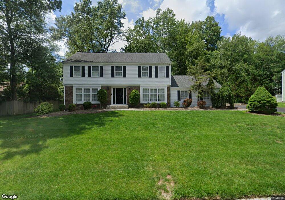
2 1/2 Trowbridge Rd Morris Plains, NJ 07950
Estimated Value: $847,552 - $982,000
--
Bed
--
Bath
2,359
Sq Ft
$391/Sq Ft
Est. Value
About This Home
This home is located at 2 1/2 Trowbridge Rd, Morris Plains, NJ 07950 and is currently estimated at $923,388, approximately $391 per square foot. 2 1/2 Trowbridge Rd is a home located in Morris County with nearby schools including Mountain Way Elementary School, Borough School, and The Red Oaks School.
Ownership History
Date
Name
Owned For
Owner Type
Purchase Details
Closed on
Jun 24, 2004
Sold by
Dempsey Elizabeth
Bought by
Cardarelli Peter and Asmonga Juli
Current Estimated Value
Home Financials for this Owner
Home Financials are based on the most recent Mortgage that was taken out on this home.
Original Mortgage
$333,700
Outstanding Balance
$166,615
Interest Rate
6.32%
Estimated Equity
$756,773
Create a Home Valuation Report for This Property
The Home Valuation Report is an in-depth analysis detailing your home's value as well as a comparison with similar homes in the area
Home Values in the Area
Average Home Value in this Area
Purchase History
| Date | Buyer | Sale Price | Title Company |
|---|---|---|---|
| Cardarelli Peter | $590,000 | -- |
Source: Public Records
Mortgage History
| Date | Status | Borrower | Loan Amount |
|---|---|---|---|
| Open | Cardarelli Peter | $333,700 |
Source: Public Records
Tax History Compared to Growth
Tax History
| Year | Tax Paid | Tax Assessment Tax Assessment Total Assessment is a certain percentage of the fair market value that is determined by local assessors to be the total taxable value of land and additions on the property. | Land | Improvement |
|---|---|---|---|---|
| 2025 | $12,003 | $483,600 | $240,400 | $243,200 |
| 2024 | $12,085 | $483,600 | $240,400 | $243,200 |
| 2023 | $12,085 | $483,600 | $240,400 | $243,200 |
| 2022 | $11,843 | $483,600 | $240,400 | $243,200 |
| 2021 | $11,843 | $483,600 | $240,400 | $243,200 |
| 2020 | $11,548 | $483,600 | $240,400 | $243,200 |
| 2019 | $11,326 | $483,600 | $240,400 | $243,200 |
| 2018 | $10,958 | $483,600 | $240,400 | $243,200 |
| 2017 | $10,741 | $483,600 | $240,400 | $243,200 |
| 2016 | $10,364 | $483,600 | $240,400 | $243,200 |
| 2015 | $10,412 | $483,600 | $240,400 | $243,200 |
| 2014 | $10,291 | $483,600 | $240,400 | $243,200 |
Source: Public Records
Map
Nearby Homes
- 2 Trowbridge Rd
- 1 Cleveland Ave
- 44 Averell Dr
- 12 Sunrise Dr
- 44 Glenbrook Rd
- 422 Mountain Way
- 22 Glenbrook Rd
- 23 Northview Dr
- 69 W Hanover Ave
- 11 Laurel St
- 4 Elder Dr
- 10 Veterans Way Unit 233
- 11 Veterans Way Unit 132
- 17 Veterans Way
- 10 Veterans Way Unit 241
- 16 Sherman Ave
- 15 Beech Dr
- 17 Meslar Rd
- 22 Walt Whitman Trail
- 22 A Foxwood Dr Unit A
- 6 Rudden Ln
- 1 Trowbridge Rd
- 4 Trowbridge Rd
- 145 Grannis Ave
- 145 Granniss Ave
- 16 Wyckoff Way
- 14 Wyckoff Way
- 4 Rudden Ln
- 140 Grannis Ave
- 5 Trowbridge Rd
- 129 Grannis Ave
- 4 1/2 Trowbridge Rd
- 146 Grannis Ave
- 146 Granniss Ave
- 151 Grannis Ave
- 12 Wyckoff Way
- 5 Rudden Ln
- 95 Watnong Dr
- 128 Grannis Ave
- 127 Granniss Ave