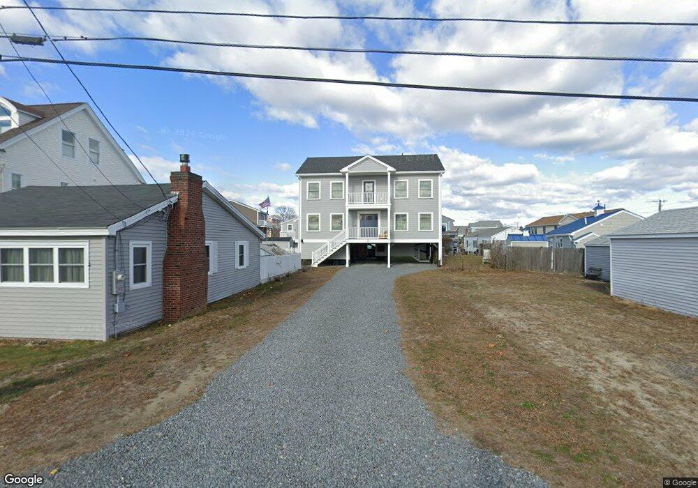
2 11th St W Salisbury, MA 01952
Estimated Value: $919,000 - $1,179,000
3
Beds
3
Baths
2,240
Sq Ft
$487/Sq Ft
Est. Value
About This Home
This home is located at 2 11th St W, Salisbury, MA 01952 and is currently estimated at $1,090,177, approximately $486 per square foot. 2 11th St W is a home located in Essex County with nearby schools including Triton Regional High School.
Ownership History
Date
Name
Owned For
Owner Type
Purchase Details
Closed on
Nov 19, 2021
Sold by
Luchini Mark P and Luchini Gail A
Bought by
Gail A Luchini 2020 T
Current Estimated Value
Purchase Details
Closed on
Sep 9, 2009
Sold by
Donovan Sharon M and Casey Richard M
Bought by
Luchini Mark P and Luchini Gail A
Home Financials for this Owner
Home Financials are based on the most recent Mortgage that was taken out on this home.
Original Mortgage
$284,000
Interest Rate
5.36%
Mortgage Type
Purchase Money Mortgage
Create a Home Valuation Report for This Property
The Home Valuation Report is an in-depth analysis detailing your home's value as well as a comparison with similar homes in the area
Home Values in the Area
Average Home Value in this Area
Purchase History
| Date | Buyer | Sale Price | Title Company |
|---|---|---|---|
| Gail A Luchini 2020 T | -- | None Available | |
| Luchini Mark P | $355,000 | -- |
Source: Public Records
Mortgage History
| Date | Status | Borrower | Loan Amount |
|---|---|---|---|
| Previous Owner | Luchini Mark P | $284,000 |
Source: Public Records
Tax History
| Year | Tax Paid | Tax Assessment Tax Assessment Total Assessment is a certain percentage of the fair market value that is determined by local assessors to be the total taxable value of land and additions on the property. | Land | Improvement |
|---|---|---|---|---|
| 2025 | $9,636 | $956,000 | $276,500 | $679,500 |
| 2024 | $9,701 | $928,300 | $276,500 | $651,800 |
| 2023 | $9,370 | $867,600 | $276,500 | $591,100 |
| 2022 | $4,957 | $445,000 | $227,100 | $217,900 |
| 2021 | $4,894 | $434,600 | $227,100 | $207,500 |
| 2020 | $4,562 | $398,100 | $227,100 | $171,000 |
| 2019 | $4,405 | $371,400 | $216,300 | $155,100 |
| 2018 | $4,296 | $364,700 | $216,300 | $148,400 |
| 2017 | $4,251 | $356,600 | $216,300 | $140,300 |
| 2016 | $4,199 | $359,800 | $216,300 | $143,500 |
| 2015 | $3,962 | $337,200 | $216,300 | $120,900 |
Source: Public Records
Map
Nearby Homes
- 432 N End Blvd
- 492 N End Blvd
- 42 Commonwealth Ave
- 308 State Route 286 Unit Lot 73
- 308 State Route 286 Unit Lot 108
- 308 State Route 286 Unit Lot 23
- 308 State Route 286 Unit Lot 87
- 308 Route 286 Unit Lot 58
- 98 Central Ave
- 78 N End Blvd Unit 1
- 100 Forest Rd
- 16 N End Blvd Unit 8
- 16 N End Blvd Unit 3
- 16 N End Blvd Unit 7
- 16 N End Blvd Unit 12
- 16 N End Blvd Unit 5
- 16 N End Blvd Unit 9
- 27 Cross Beach Rd
- 3 Tyngsboro St
- 9 Tyngsboro St
- 447 North End Blvd
- 4 11th St W Unit 2
- 4 11th St W Unit 1
- 4 11th St W
- 7 10th St W
- 443 North End Blvd
- 5 10th St W
- 3 10th St W
- 445 North End Blvd
- 449 N End Blvd
- 449 North End Blvd
- 1 10th St W
- 18 Carter Ave
- 451 North End Blvd
- 437 N End Blvd Unit 1
- 6 11th St W
- 20 Carter Ave
- 1 11th St W
- 9 10th St W
- 9 10th St W Unit A
Your Personal Tour Guide
Ask me questions while you tour the home.