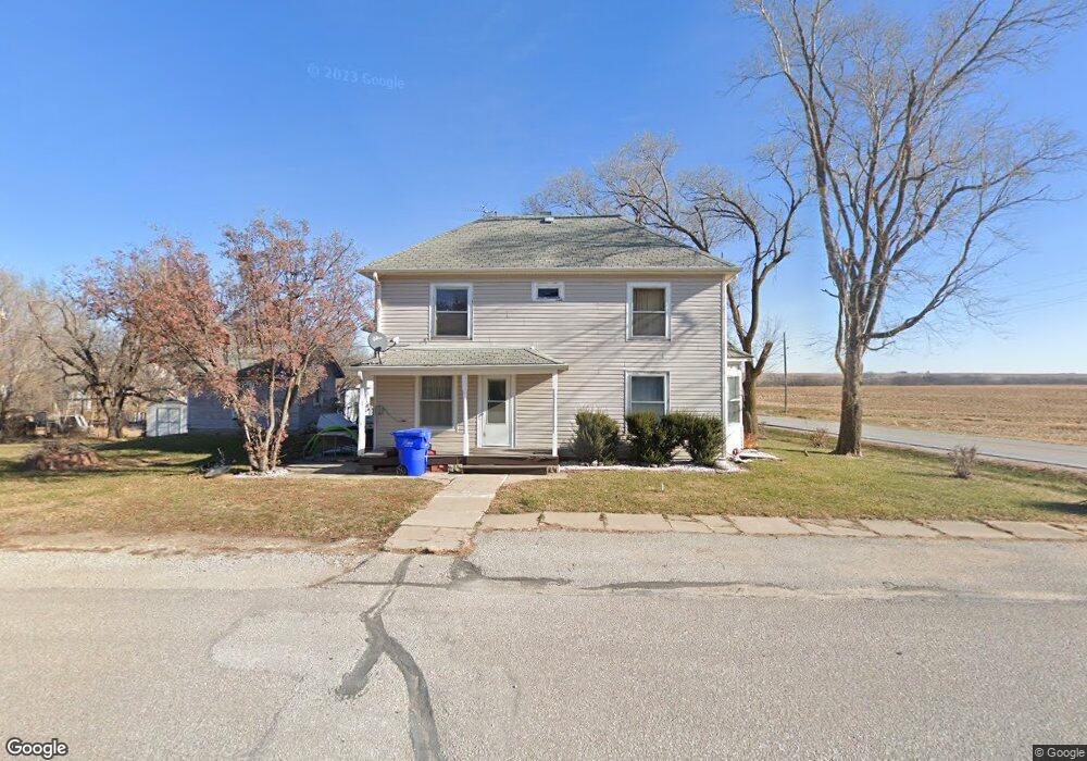
2 1st St Lorton, NE 68382
Estimated Value: $125,000 - $179,000
4
Beds
2
Baths
2,676
Sq Ft
$54/Sq Ft
Est. Value
About This Home
This home is located at 2 1st St, Lorton, NE 68382 and is currently estimated at $145,516, approximately $54 per square foot. 2 1st St is a home located in Otoe County with nearby schools including Johnson County Central Elementary School - Cook, Johnson County Central Elementary School - Tecumseh, and Johnson County Central Middle School.
Ownership History
Date
Name
Owned For
Owner Type
Purchase Details
Closed on
Nov 15, 2006
Sold by
Swanson Daniel E and Swanson Kathryn A
Bought by
Otterness Dana and Otterness Renee
Current Estimated Value
Home Financials for this Owner
Home Financials are based on the most recent Mortgage that was taken out on this home.
Original Mortgage
$61,900
Outstanding Balance
$36,717
Interest Rate
6.26%
Mortgage Type
New Conventional
Estimated Equity
$108,799
Create a Home Valuation Report for This Property
The Home Valuation Report is an in-depth analysis detailing your home's value as well as a comparison with similar homes in the area
Home Values in the Area
Average Home Value in this Area
Purchase History
| Date | Buyer | Sale Price | Title Company |
|---|---|---|---|
| Otterness Dana | $62,000 | None Available |
Source: Public Records
Mortgage History
| Date | Status | Borrower | Loan Amount |
|---|---|---|---|
| Open | Otterness Dana | $61,900 |
Source: Public Records
Tax History Compared to Growth
Tax History
| Year | Tax Paid | Tax Assessment Tax Assessment Total Assessment is a certain percentage of the fair market value that is determined by local assessors to be the total taxable value of land and additions on the property. | Land | Improvement |
|---|---|---|---|---|
| 2024 | $773 | $58,642 | $1,090 | $57,552 |
| 2023 | $868 | $58,642 | $1,090 | $57,552 |
| 2022 | $720 | $49,050 | $1,090 | $47,960 |
| 2021 | $679 | $49,050 | $1,090 | $47,960 |
| 2020 | $682 | $49,050 | $1,090 | $47,960 |
| 2019 | $668 | $49,050 | $1,090 | $47,960 |
| 2018 | $641 | $49,050 | $1,090 | $47,960 |
| 2017 | $619 | $49,050 | $1,090 | $47,960 |
| 2016 | $652 | $49,050 | $1,090 | $47,960 |
| 2015 | $646 | $49,050 | $1,090 | $47,960 |
| 2014 | $898 | $61,480 | $1,090 | $60,390 |
| 2012 | $978 | $61,480 | $1,090 | $60,390 |
Source: Public Records
Map
Nearby Homes