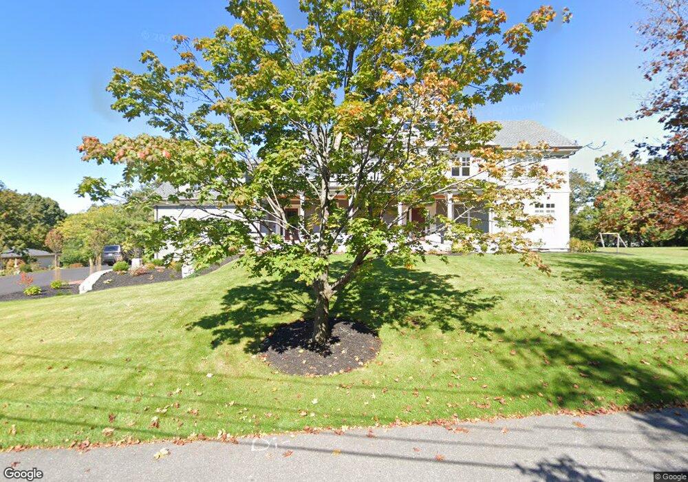
2 Abernathy Rd Lexington, MA 02420
Pheasant Brook Estates NeighborhoodEstimated Value: $2,515,000 - $3,226,000
5
Beds
6
Baths
5,158
Sq Ft
$580/Sq Ft
Est. Value
About This Home
This home is located at 2 Abernathy Rd, Lexington, MA 02420 and is currently estimated at $2,989,388, approximately $579 per square foot. 2 Abernathy Rd is a home located in Middlesex County with nearby schools including Harrington Elementary School, Jonas Clarke Middle School, and Lexington High School.
Ownership History
Date
Name
Owned For
Owner Type
Purchase Details
Closed on
Oct 28, 2024
Sold by
Rullo Roberto and Rullo Kelley
Bought by
Rullo Ft and Rullo
Current Estimated Value
Purchase Details
Closed on
Aug 17, 2020
Sold by
Jenkinson Barbara D Est
Bought by
Rullo Roberto and Rullo Kelley
Home Financials for this Owner
Home Financials are based on the most recent Mortgage that was taken out on this home.
Original Mortgage
$672,000
Interest Rate
3%
Mortgage Type
New Conventional
Purchase Details
Closed on
Nov 9, 2012
Sold by
Jenkinson John V and Jenkinson Barbara D
Bought by
Jenkinson John V and Jenkinson Barbara D
Create a Home Valuation Report for This Property
The Home Valuation Report is an in-depth analysis detailing your home's value as well as a comparison with similar homes in the area
Home Values in the Area
Average Home Value in this Area
Purchase History
| Date | Buyer | Sale Price | Title Company |
|---|---|---|---|
| Rullo Ft | -- | None Available | |
| Rullo Ft | -- | None Available | |
| Rullo Ft | -- | None Available | |
| Rullo Roberto | $840,000 | None Available | |
| Jenkinson John V | -- | -- | |
| Jenkinson John V | -- | -- |
Source: Public Records
Mortgage History
| Date | Status | Borrower | Loan Amount |
|---|---|---|---|
| Previous Owner | Rullo Roberto | $672,000 |
Source: Public Records
Tax History
| Year | Tax Paid | Tax Assessment Tax Assessment Total Assessment is a certain percentage of the fair market value that is determined by local assessors to be the total taxable value of land and additions on the property. | Land | Improvement |
|---|---|---|---|---|
| 2025 | $36,164 | $2,957,000 | $960,000 | $1,997,000 |
| 2024 | $35,905 | $2,931,000 | $914,000 | $2,017,000 |
| 2023 | $22,360 | $1,720,000 | $693,000 | $1,027,000 |
| 2022 | $14,076 | $1,020,000 | $630,000 | $390,000 |
| 2021 | $14,016 | $974,000 | $600,000 | $374,000 |
| 2020 | $13,994 | $996,000 | $600,000 | $396,000 |
| 2019 | $14,995 | $951,000 | $571,000 | $380,000 |
| 2018 | $13,070 | $914,000 | $544,000 | $370,000 |
| 2017 | $13,055 | $901,000 | $518,000 | $383,000 |
| 2016 | $12,527 | $858,000 | $494,000 | $364,000 |
| 2015 | $11,992 | $807,000 | $449,000 | $358,000 |
| 2014 | $10,810 | $697,000 | $408,000 | $289,000 |
Source: Public Records
Map
Nearby Homes
- 25 Maple St
- 20 Marrett Rd
- 10 Eliot Rd
- 1 Tricorne Rd
- 143 Emerson Gardens Rd
- 16 Lily Pond Ln Unit 16
- 197 Woburn St
- 1437 Massachusetts Ave
- 1475 Massachusetts Ave Unit 467
- 218 Lowell St
- 12 Brandon St
- 71 Webb St
- 10 Luongo Farm Ln
- 42 Winthrop Rd
- 8 Blueberry Ln
- 15 Peachtree Rd
- 67 Lowell St
- 6 Linc Cole Ln
- 22 Tyler Rd
- 30 Whipple Rd
- 11 Ingleside Rd
- 11 Ingleside Rd Unit 1
- 4 Abernathy Rd
- 5 Ingleside Rd
- 8 Ingleside Rd
- 10 Ingleside Rd
- 3 Abernathy Rd
- 15 Ingleside Rd
- 6 Clyde Place
- 6 Abernathy Rd
- 12 Ingleside Rd
- 5 Abernathy Rd
- 3 Ingleside Rd
- 6 Ingleside Rd
- 5 Clyde Place
- 17 Ingleside Rd
- 23 Byron Ave
- 28 Maple St
- 16 Ingleside Rd
- 7 Abernathy Rd