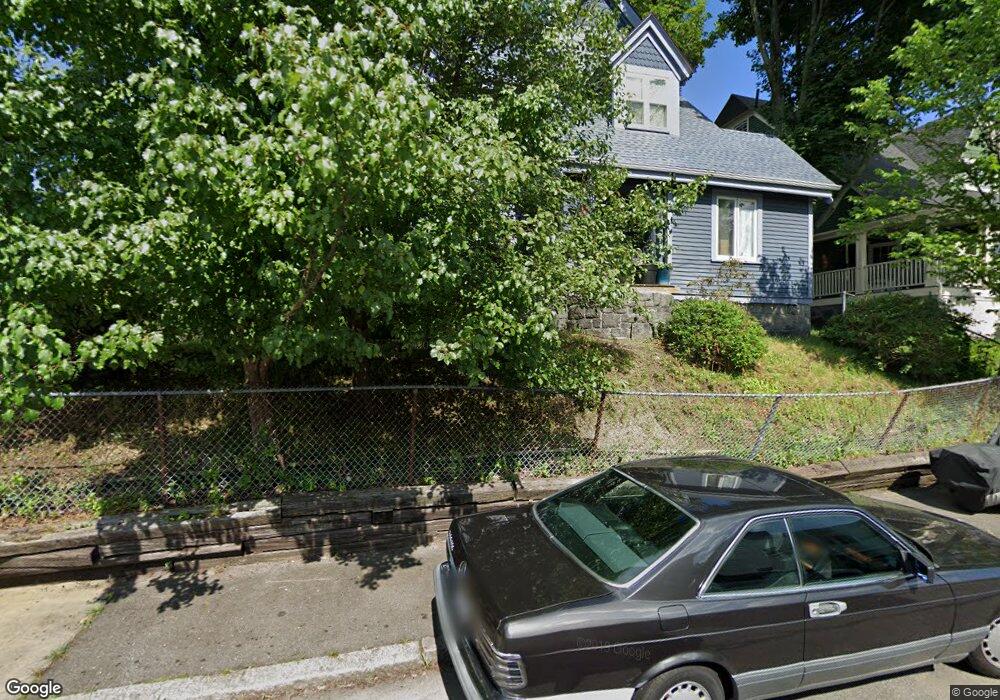
2 Ainsley St Dorchester, MA 02122
Neponset-Port Norfolk NeighborhoodEstimated Value: $733,000 - $1,066,535
4
Beds
2
Baths
2,799
Sq Ft
$336/Sq Ft
Est. Value
About This Home
This home is located at 2 Ainsley St, Dorchester, MA 02122 and is currently estimated at $940,134, approximately $335 per square foot. 2 Ainsley St is a home located in Suffolk County with nearby schools including Neighborhood House Charter School and Helen Y. Davis Leadership Academy Charter Public School.
Ownership History
Date
Name
Owned For
Owner Type
Purchase Details
Closed on
Mar 1, 2001
Sold by
Gauthier William A
Bought by
Richter Scott and Richter Minter
Current Estimated Value
Home Financials for this Owner
Home Financials are based on the most recent Mortgage that was taken out on this home.
Original Mortgage
$223,000
Interest Rate
7%
Mortgage Type
Purchase Money Mortgage
Create a Home Valuation Report for This Property
The Home Valuation Report is an in-depth analysis detailing your home's value as well as a comparison with similar homes in the area
Home Values in the Area
Average Home Value in this Area
Purchase History
| Date | Buyer | Sale Price | Title Company |
|---|---|---|---|
| Richter Scott | $229,900 | -- |
Source: Public Records
Mortgage History
| Date | Status | Borrower | Loan Amount |
|---|---|---|---|
| Open | Richter Scott | $50,000 | |
| Open | Richter Scott | $297,000 | |
| Closed | Richter Scott | $290,000 | |
| Closed | Richter Scott | $223,000 |
Source: Public Records
Tax History Compared to Growth
Tax History
| Year | Tax Paid | Tax Assessment Tax Assessment Total Assessment is a certain percentage of the fair market value that is determined by local assessors to be the total taxable value of land and additions on the property. | Land | Improvement |
|---|---|---|---|---|
| 2025 | $10,359 | $894,600 | $276,700 | $617,900 |
| 2024 | $9,276 | $851,000 | $248,600 | $602,400 |
| 2023 | $8,540 | $795,200 | $232,300 | $562,900 |
| 2022 | $8,235 | $756,900 | $221,100 | $535,800 |
| 2021 | $7,841 | $734,900 | $214,700 | $520,200 |
| 2020 | $7,516 | $711,700 | $212,100 | $499,600 |
| 2019 | $6,948 | $659,200 | $163,300 | $495,900 |
| 2018 | $6,455 | $615,900 | $163,300 | $452,600 |
| 2017 | $6,209 | $586,300 | $163,300 | $423,000 |
| 2016 | $5,376 | $488,700 | $163,300 | $325,400 |
| 2015 | $4,478 | $369,800 | $125,400 | $244,400 |
| 2014 | $4,387 | $348,700 | $125,400 | $223,300 |
Source: Public Records
Map
Nearby Homes
- 41 Rosemont St Unit 3
- 41 King St Unit 1
- 96 King St Unit 1
- 45 S Munroe Terrace Unit 2
- 104 King St Unit 2
- 334 Centre St Unit 101
- 1 Claymont Terrace
- 17 Lafield St Unit 2
- 15 Lafield St Unit 1
- 77 Dix St Unit 6
- 80-84 Shepton St Unit 80-3
- 51 Florida St Unit 3
- 381 Adams St Unit 3
- 381 Adams St Unit 2
- 27 Dix St Unit 1
- 96 Dix St Unit 6
- 22 Saint Marks Rd Unit 1
- 382 Adams St Unit 384-1
- 61 Shepton St
- 114 Wrentham St Unit 1
- 6 Ainsley St
- 27 Rosemont St
- 10 Ainsley St
- 35 Daly St
- 35 Daly St Unit 2
- 35 Daly St Unit 3
- 35 Daly St Unit 1
- 22 Rosemont St
- 24 Rosemont St
- 1 Ainsley St
- 18 Rosemont St
- 26 Rosemont St
- 5 Ainsley St
- 12 Ainsley St
- 37 Daly St
- 37 Daly St Unit 1
- 37 Daly St Unit 3
- 37 Daly St Unit 2
- 29 Rosemont St
- 29 Rosemont St Unit 1