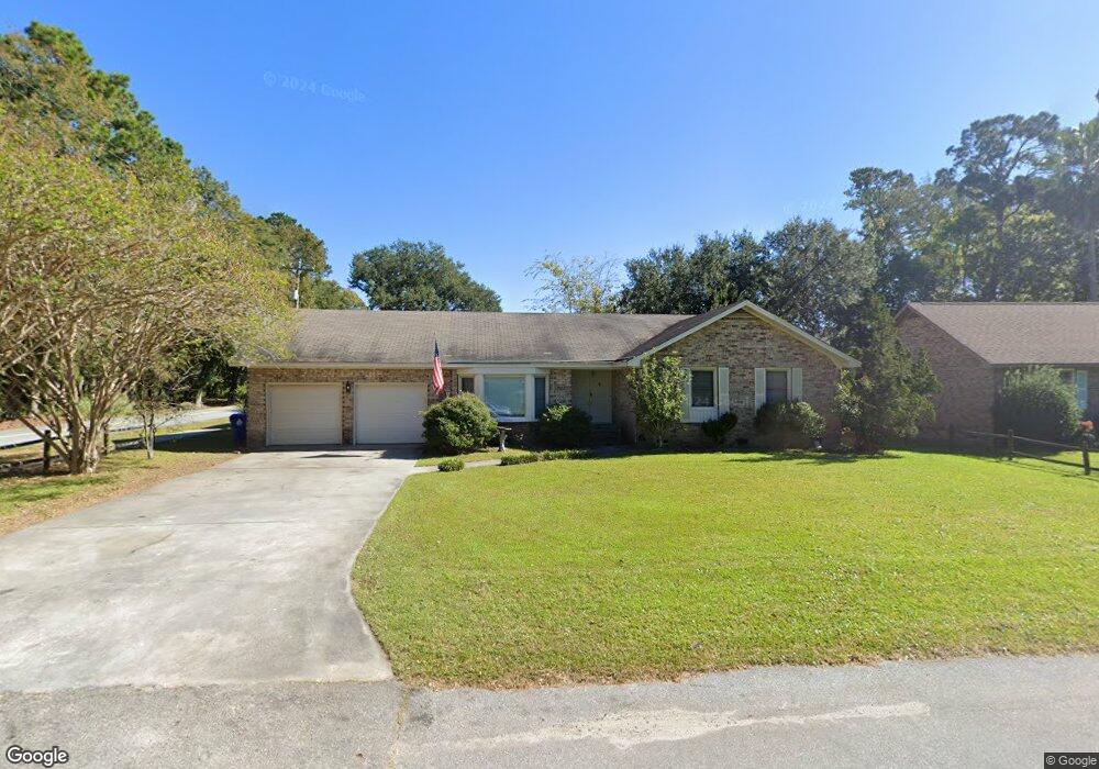
2 Allison Ct Charleston, SC 29407
Dupont Station NeighborhoodEstimated Value: $531,112 - $721,000
3
Beds
2
Baths
1,884
Sq Ft
$329/Sq Ft
Est. Value
About This Home
This home is located at 2 Allison Ct, Charleston, SC 29407 and is currently estimated at $620,528, approximately $329 per square foot. 2 Allison Ct is a home located in Charleston County with nearby schools including Stono Park Elementary School, West Ashley High School, and Carolina Voyager Charter.
Ownership History
Date
Name
Owned For
Owner Type
Purchase Details
Closed on
Nov 10, 2014
Sold by
Higdon George P and Higdon Millie Sue
Bought by
Higdon George P and Higdon Millie S
Current Estimated Value
Home Financials for this Owner
Home Financials are based on the most recent Mortgage that was taken out on this home.
Original Mortgage
$183,750
Interest Rate
4.16%
Mortgage Type
Future Advance Clause Open End Mortgage
Purchase Details
Closed on
Jun 12, 2002
Sold by
Higdon Margaret F
Bought by
Higdon Margaret F and Higdon George P
Create a Home Valuation Report for This Property
The Home Valuation Report is an in-depth analysis detailing your home's value as well as a comparison with similar homes in the area
Home Values in the Area
Average Home Value in this Area
Purchase History
| Date | Buyer | Sale Price | Title Company |
|---|---|---|---|
| Higdon George P | -- | -- | |
| Higdon Margaret F | -- | -- |
Source: Public Records
Mortgage History
| Date | Status | Borrower | Loan Amount |
|---|---|---|---|
| Closed | Higdon George P | $183,750 |
Source: Public Records
Tax History Compared to Growth
Tax History
| Year | Tax Paid | Tax Assessment Tax Assessment Total Assessment is a certain percentage of the fair market value that is determined by local assessors to be the total taxable value of land and additions on the property. | Land | Improvement |
|---|---|---|---|---|
| 2024 | $4,163 | $14,150 | $0 | $0 |
| 2023 | $4,163 | $14,150 | $0 | $0 |
| 2022 | $3,836 | $14,150 | $0 | $0 |
| 2021 | $3,789 | $14,150 | $0 | $0 |
| 2020 | $3,762 | $14,150 | $0 | $0 |
| 2019 | $3,440 | $12,300 | $0 | $0 |
| 2017 | $3,288 | $12,300 | $0 | $0 |
| 2016 | $3,183 | $12,300 | $0 | $0 |
| 2015 | $3,040 | $12,300 | $0 | $0 |
| 2014 | $2,843 | $0 | $0 | $0 |
| 2011 | -- | $0 | $0 | $0 |
Source: Public Records
Map
Nearby Homes
- 9 Sallys Alley
- 375 Hoff Ave
- 1866 Capri Dr
- 413 Hoff Ave
- 363 Timothy St
- 185 Wappoo Rd
- 344 Lantana Dr
- 244 Marsh Oaks Dr
- 323 Millcreek Dr
- 439 Geddes Ave
- 447 Geddes Ave
- 339 Cabell St
- 511 Mansfield St
- 2007 Boeing Ave
- 132 River Breeze Dr Unit M132
- 715 Yew St
- 198 River Breeze Dr Unit 75
- 1618 Evergreen St
- 1612 Evergreen St
- 301 Culver Ave