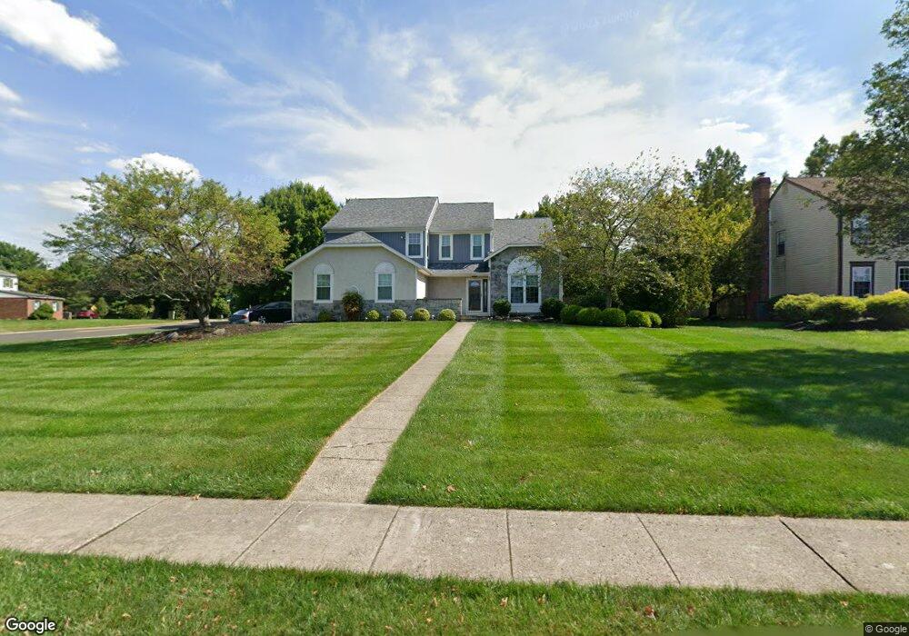
2 Andrew Ln Lansdale, PA 19446
Estimated Value: $640,759 - $777,000
4
Beds
3
Baths
2,198
Sq Ft
$314/Sq Ft
Est. Value
About This Home
This home is located at 2 Andrew Ln, Lansdale, PA 19446 and is currently estimated at $691,190, approximately $314 per square foot. 2 Andrew Ln is a home located in Montgomery County with nearby schools including Bridle Path Elementary School, Penndale Middle School, and North Penn Senior High School.
Ownership History
Date
Name
Owned For
Owner Type
Purchase Details
Closed on
Aug 27, 2004
Sold by
Mcmanus William E and Mcmanus Ginette M
Bought by
Blunt Robert and Rodgers Blunt Susan
Current Estimated Value
Home Financials for this Owner
Home Financials are based on the most recent Mortgage that was taken out on this home.
Original Mortgage
$0
Interest Rate
6.02%
Create a Home Valuation Report for This Property
The Home Valuation Report is an in-depth analysis detailing your home's value as well as a comparison with similar homes in the area
Home Values in the Area
Average Home Value in this Area
Purchase History
| Date | Buyer | Sale Price | Title Company |
|---|---|---|---|
| Blunt Robert | $395,000 | -- |
Source: Public Records
Mortgage History
| Date | Status | Borrower | Loan Amount |
|---|---|---|---|
| Closed | Blunt Robert | $0 | |
| Closed | Blunt Robert | $0 |
Source: Public Records
Tax History Compared to Growth
Tax History
| Year | Tax Paid | Tax Assessment Tax Assessment Total Assessment is a certain percentage of the fair market value that is determined by local assessors to be the total taxable value of land and additions on the property. | Land | Improvement |
|---|---|---|---|---|
| 2025 | $6,311 | $169,170 | $51,010 | $118,160 |
| 2024 | $6,311 | $169,170 | $51,010 | $118,160 |
| 2023 | $6,020 | $169,170 | $51,010 | $118,160 |
| 2022 | $5,809 | $169,170 | $51,010 | $118,160 |
| 2021 | $5,462 | $169,170 | $51,010 | $118,160 |
| 2020 | $5,318 | $169,170 | $51,010 | $118,160 |
| 2019 | $5,219 | $169,170 | $51,010 | $118,160 |
| 2018 | $898 | $169,170 | $51,010 | $118,160 |
| 2017 | $4,995 | $169,170 | $51,010 | $118,160 |
| 2016 | $4,929 | $169,170 | $51,010 | $118,160 |
| 2015 | $4,707 | $169,170 | $51,010 | $118,160 |
| 2014 | $4,707 | $169,170 | $51,010 | $118,160 |
Source: Public Records
Map
Nearby Homes
- 21 Meadow Glen Rd
- 107 Brianna Ct
- 534 Airy Ave
- 105 Brianna Ct Unit 3
- 111 Brianna Ct
- 103 Brianna Ct
- 109 Brianna Ct
- 119 Brianna Ct
- 111 Brianna Ct Unit 6
- 109 Brianna Ct Unit 5
- 119 Brianna Ct Unit 10
- 103 Brianna Ct Unit 2
- Simmons Plan at Birch Run at New Britain
- Simmons Elite Plan at Birch Run at New Britain
- 122 Brianna Ct Unit 36
- 124 Brianna Ct Unit 35
- 110 Country Club Dr
- 206 Broad Acres Rd
- 210 Remington Ct Unit 210
- 301 Essex Ct