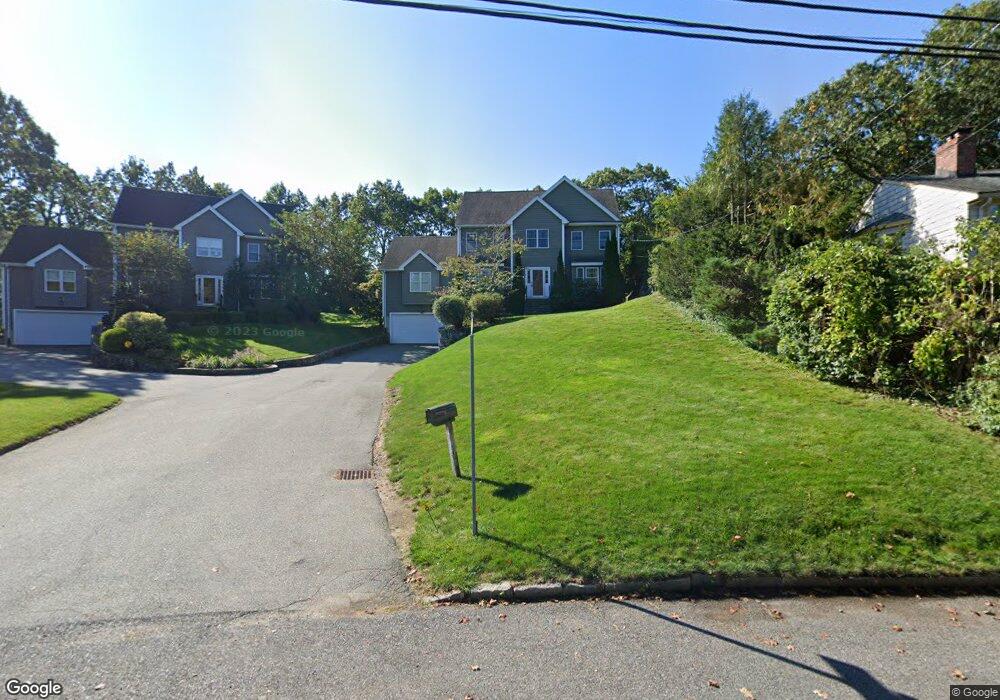
2 Andrews Way Arlington, MA 02474
Arlington Heights NeighborhoodEstimated Value: $1,686,000 - $1,913,143
3
Beds
3
Baths
2,955
Sq Ft
$625/Sq Ft
Est. Value
About This Home
This home is located at 2 Andrews Way, Arlington, MA 02474 and is currently estimated at $1,847,286, approximately $625 per square foot. 2 Andrews Way is a home located in Middlesex County with nearby schools including M. Norcross Stratton Elementary School, Ottoson Middle School, and Arlington High School.
Ownership History
Date
Name
Owned For
Owner Type
Purchase Details
Closed on
Dec 2, 2022
Sold by
Desouza Cynthia M and Karim Omar A
Bought by
Omar A Karim Ret and Karim
Current Estimated Value
Purchase Details
Closed on
Mar 22, 2007
Sold by
Debco Prop Dev Rt and Burns
Bought by
Desouza Cynthia M and Karim Omar A
Home Financials for this Owner
Home Financials are based on the most recent Mortgage that was taken out on this home.
Original Mortgage
$545,000
Interest Rate
6.33%
Mortgage Type
Purchase Money Mortgage
Create a Home Valuation Report for This Property
The Home Valuation Report is an in-depth analysis detailing your home's value as well as a comparison with similar homes in the area
Home Values in the Area
Average Home Value in this Area
Purchase History
| Date | Buyer | Sale Price | Title Company |
|---|---|---|---|
| Omar A Karim Ret | -- | None Available | |
| Omar A Karim Ret | -- | None Available | |
| Desouza Cynthia M | $815,000 | -- | |
| Desouza Cynthia M | $815,000 | -- | |
| Desouza Cynthia M | $815,000 | -- | |
| Desouza Cynthia M | $815,000 | -- | |
| Desouza Cynthia M | $815,000 | -- |
Source: Public Records
Mortgage History
| Date | Status | Borrower | Loan Amount |
|---|---|---|---|
| Previous Owner | Desouza Cynthia M | $412,000 | |
| Previous Owner | Desouza Cynthia M | $417,000 | |
| Previous Owner | Desouza Cynthia M | $545,000 |
Source: Public Records
Tax History Compared to Growth
Tax History
| Year | Tax Paid | Tax Assessment Tax Assessment Total Assessment is a certain percentage of the fair market value that is determined by local assessors to be the total taxable value of land and additions on the property. | Land | Improvement |
|---|---|---|---|---|
| 2025 | $19,024 | $1,766,400 | $672,200 | $1,094,200 |
| 2024 | $18,002 | $1,699,900 | $672,200 | $1,027,700 |
| 2023 | $16,991 | $1,515,700 | $578,400 | $937,300 |
| 2022 | $15,943 | $1,396,100 | $547,100 | $849,000 |
| 2021 | $15,537 | $1,370,100 | $547,100 | $823,000 |
| 2020 | $15,153 | $1,370,100 | $547,100 | $823,000 |
| 2019 | $13,296 | $1,180,800 | $547,100 | $633,700 |
| 2018 | $13,367 | $1,102,000 | $469,000 | $633,000 |
| 2017 | $13,448 | $1,070,700 | $437,700 | $633,000 |
| 2016 | $12,905 | $1,008,200 | $375,200 | $633,000 |
| 2015 | $12,944 | $955,300 | $336,100 | $619,200 |
Source: Public Records
Map
Nearby Homes
- 12 Longmeadow Rd
- 6 Pawnee Dr
- 37 Pine St
- 5A Wood Ln
- 281 Forest St
- 5 Wood Ln
- 16 Ridge St
- 10 Viking Rd
- 334 Mystic St
- 4 Beck Rd
- 335 Mystic St
- 52-56 Dudley St
- 18-20 Brattle St
- 1025 Massachusetts Ave Unit 204
- 204 Plan at Majestic Mill Brook
- 1025 Massachusetts Ave Unit 404
- 1025 Massachusetts Ave Unit 506
- 1025 Massachusetts Ave Unit 401
- 1025 Massachusetts Ave Unit 210
- 1025 Massachusetts Ave Unit 402
- 2 Andrew's Way(42 Old Colony Rd)
- 1 Andrews Way
- 44 Old Colony Rd
- 13 Andrews Way Unit 13
- 311 Ridge St
- 311 Ridge St
- 46 Old Colony Rd
- 315 Ridge St
- 41 Old Colony Rd
- 319 Ridge St
- 45 Old Colony Rd
- 37 Old Colony Rd
- 50 Old Colony Rd
- 34 Old Colony Rd
- 301 Ridge St
- 306 Ridge St
- 314 Ridge St
- 83 Morningside Dr
- 15 Cherokee Rd
- 318 Ridge St