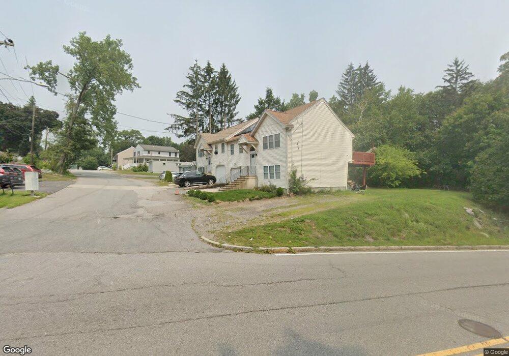
2 Atlas St Worcester, MA 01604
Grafton Hill NeighborhoodEstimated Value: $387,151 - $436,000
3
Beds
2
Baths
1,047
Sq Ft
$389/Sq Ft
Est. Value
About This Home
This home is located at 2 Atlas St, Worcester, MA 01604 and is currently estimated at $406,788, approximately $388 per square foot. 2 Atlas St is a home located in Worcester County with nearby schools including Roosevelt Elementary School, Jacob Hiatt Magnet School, and Chandler Magnet.
Ownership History
Date
Name
Owned For
Owner Type
Purchase Details
Closed on
Dec 4, 2003
Sold by
Bruinsma Kristel T
Bought by
Giraldo Shirley and Cornejo Wilfredo
Current Estimated Value
Home Financials for this Owner
Home Financials are based on the most recent Mortgage that was taken out on this home.
Original Mortgage
$194,000
Outstanding Balance
$90,837
Interest Rate
6.03%
Mortgage Type
Purchase Money Mortgage
Estimated Equity
$315,951
Purchase Details
Closed on
Oct 1, 2001
Sold by
Romeo Biagio
Bought by
Bruinsma Kristel T
Home Financials for this Owner
Home Financials are based on the most recent Mortgage that was taken out on this home.
Original Mortgage
$118,885
Interest Rate
6.91%
Mortgage Type
Purchase Money Mortgage
Create a Home Valuation Report for This Property
The Home Valuation Report is an in-depth analysis detailing your home's value as well as a comparison with similar homes in the area
Home Values in the Area
Average Home Value in this Area
Purchase History
| Date | Buyer | Sale Price | Title Company |
|---|---|---|---|
| Giraldo Shirley | $200,000 | -- | |
| Bruinsma Kristel T | $139,865 | -- |
Source: Public Records
Mortgage History
| Date | Status | Borrower | Loan Amount |
|---|---|---|---|
| Open | Giraldo Shirley | $194,000 | |
| Previous Owner | Bruinsma Kristel T | $118,885 |
Source: Public Records
Tax History
| Year | Tax Paid | Tax Assessment Tax Assessment Total Assessment is a certain percentage of the fair market value that is determined by local assessors to be the total taxable value of land and additions on the property. | Land | Improvement |
|---|---|---|---|---|
| 2025 | $4,565 | $346,125 | $84,525 | $261,600 |
| 2024 | $4,330 | $314,925 | $84,525 | $230,400 |
| 2023 | $4,116 | $287,003 | $73,503 | $213,500 |
| 2022 | $3,710 | $243,935 | $58,835 | $185,100 |
| 2021 | $3,550 | $218,044 | $47,044 | $171,000 |
| 2020 | $3,465 | $203,800 | $47,000 | $156,800 |
| 2019 | $3,337 | $185,400 | $42,400 | $143,000 |
| 2018 | $3,343 | $176,800 | $42,400 | $134,400 |
| 2017 | $3,167 | $164,800 | $42,400 | $122,400 |
| 2016 | $3,131 | $151,900 | $32,100 | $119,800 |
| 2015 | $3,049 | $151,900 | $32,100 | $119,800 |
| 2014 | $2,968 | $151,900 | $32,100 | $119,800 |
Source: Public Records
Map
Nearby Homes
- 1195 Grafton St Unit 29
- 1195 Grafton St Unit 39
- 7 Clarissa St
- 6 Nathaniel St
- 2 Salisbury St
- 9 Marissa Cir
- 182 Weatherstone Dr
- 1459 Grafton Rd
- 62 Edgemere Blvd
- 15 Lakeside Dr
- 7 Barbara St
- 11 Maplewood Rd
- 365 Lake Ave
- 143 Commonwealth Ave
- 25 Stoneham Rd
- 63 Progressive St
- 266 Massasoit Rd
- 259 Massasoit Rd
- 256 Massasoit Rd
- 12 Benham St
- 4 Atlas St
- 4 Atlas St Unit 1
- 485 Sunderland Rd
- 483 Sunderland Rd
- 483 & 485 Sunderland Rd
- 475 Sunderland Rd
- 480 Sunderland Rd
- 472 Sunderland Rd
- 8 Atlas St
- 488 Sunderland Rd
- 1 Atlas St
- 480B Sunderland Rd
- 468 Sunderland Rd
- 14 Atlas St
- 465 Sunderland Rd
- 3 Atlas St
- 33 Westdale St
- 18 Westdale St
- 22 Westdale St
- 16 Atlas St
Your Personal Tour Guide
Ask me questions while you tour the home.