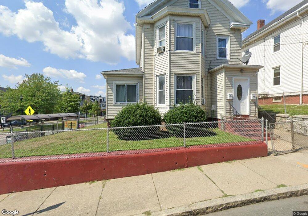
2 Austin St Somerville, MA 02145
East Somerville NeighborhoodEstimated Value: $1,125,000 - $1,284,000
6
Beds
3
Baths
2,820
Sq Ft
$436/Sq Ft
Est. Value
About This Home
This home is located at 2 Austin St, Somerville, MA 02145 and is currently estimated at $1,229,900, approximately $436 per square foot. 2 Austin St is a home located in Middlesex County with nearby schools including Somerville High School, Prospect Hill Academy Upper Elementary Campus, and Bright Future Educare Center.
Ownership History
Date
Name
Owned For
Owner Type
Purchase Details
Closed on
May 19, 1997
Sold by
Saraceno Shirley A
Bought by
Ochoa Melissa E and Ochoa Lesbia R
Current Estimated Value
Home Financials for this Owner
Home Financials are based on the most recent Mortgage that was taken out on this home.
Original Mortgage
$174,318
Outstanding Balance
$24,123
Interest Rate
8.12%
Mortgage Type
Purchase Money Mortgage
Estimated Equity
$1,205,777
Purchase Details
Closed on
Nov 18, 1993
Sold by
Passanisi Ottavio
Bought by
Somrock Corp
Create a Home Valuation Report for This Property
The Home Valuation Report is an in-depth analysis detailing your home's value as well as a comparison with similar homes in the area
Home Values in the Area
Average Home Value in this Area
Purchase History
| Date | Buyer | Sale Price | Title Company |
|---|---|---|---|
| Ochoa Melissa E | $179,000 | -- | |
| Somrock Corp | $127,500 | -- |
Source: Public Records
Mortgage History
| Date | Status | Borrower | Loan Amount |
|---|---|---|---|
| Open | Somrock Corp | $174,318 |
Source: Public Records
Tax History
| Year | Tax Paid | Tax Assessment Tax Assessment Total Assessment is a certain percentage of the fair market value that is determined by local assessors to be the total taxable value of land and additions on the property. | Land | Improvement |
|---|---|---|---|---|
| 2025 | $11,436 | $1,048,200 | $398,500 | $649,700 |
| 2024 | $10,905 | $1,036,600 | $398,500 | $638,100 |
| 2023 | $10,269 | $993,100 | $398,500 | $594,600 |
| 2022 | $9,680 | $950,900 | $379,500 | $571,400 |
| 2021 | $9,312 | $913,800 | $374,300 | $539,500 |
| 2020 | $8,753 | $867,500 | $359,900 | $507,600 |
| 2019 | $7,599 | $706,200 | $298,600 | $407,600 |
| 2018 | $6,542 | $578,400 | $238,700 | $339,700 |
| 2017 | $6,437 | $551,600 | $225,200 | $326,400 |
| 2016 | $5,706 | $455,400 | $158,200 | $297,200 |
| 2015 | $5,700 | $452,000 | $157,400 | $294,600 |
Source: Public Records
Map
Nearby Homes
- 4 George St Unit 1
- 3 Franklin St Unit C
- 31 Wisconsin Ave Unit 1
- 24 Glen St Unit 1
- 45 Pearl St Unit 1
- 5 Brook St
- 24 Rush St Unit E
- 7 Connecticut Ave Unit 1
- 78 Mount Vernon St
- 7 Washington St
- 43 Cross St
- 14 Bonair St Unit 14
- 34 Franklin Ave
- 17 Kensington Ave
- 84 Cross St
- 19 Everett Ave
- 76 Franklin St
- 11 Macarthur St Unit B
- 11 Macarthur St Unit A
- 129 Glen St Unit B
- 4 Austin St
- 4 Austin St Unit 1
- 4 Austin St Unit 2
- 6 Austin St
- 67 Broadway Unit 2&3
- 67 Broadway Unit 3
- 67 Broadway Unit 2
- 67 Broadway
- 8 Austin St
- 69 Broadway
- 59 Broadway
- 57 Broadway
- 57 Broadway Unit 1
- 5 Austin St Unit 3
- 5 Austin St Unit 2
- 5 Austin St Unit 1
- 5 Austin St Unit 2,1
- 5 Austin St Unit 3,1
- 5 Austin St Unit PH
- 1 Lincoln St
Your Personal Tour Guide
Ask me questions while you tour the home.