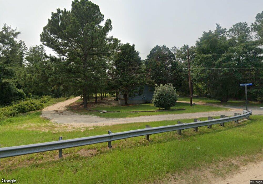
2 B and B Loop Butler, GA 31006
Estimated Value: $47,000 - $68,000
2
Beds
2
Baths
984
Sq Ft
$59/Sq Ft
Est. Value
About This Home
This home is located at 2 B and B Loop, Butler, GA 31006 and is currently estimated at $57,873, approximately $58 per square foot. 2 B and B Loop is a home located in Taylor County with nearby schools including Taylor County Upper Elementary School, Taylor County Primary School, and Taylor County Middle School.
Ownership History
Date
Name
Owned For
Owner Type
Purchase Details
Closed on
May 9, 2024
Sold by
King Janice
Bought by
Longleaf Properties Llc
Current Estimated Value
Purchase Details
Closed on
Oct 15, 2008
Sold by
Mathis Rodney O
Bought by
King Janice
Purchase Details
Closed on
Jan 15, 1999
Sold by
Jim Walter Homes
Bought by
Mathis Rodney O
Purchase Details
Closed on
Nov 18, 1998
Bought by
Wade William J Trust
Create a Home Valuation Report for This Property
The Home Valuation Report is an in-depth analysis detailing your home's value as well as a comparison with similar homes in the area
Purchase History
| Date | Buyer | Sale Price | Title Company |
|---|---|---|---|
| Longleaf Properties Llc | $40,000 | -- | |
| King Janice | $15,000 | -- | |
| Mathis Rodney O | $35,000 | -- | |
| Jim Walter Homes | -- | -- | |
| Wade William J Trust | $42,800 | -- |
Source: Public Records
Tax History
| Year | Tax Paid | Tax Assessment Tax Assessment Total Assessment is a certain percentage of the fair market value that is determined by local assessors to be the total taxable value of land and additions on the property. | Land | Improvement |
|---|---|---|---|---|
| 2025 | $407 | $19,360 | $2,480 | $16,880 |
| 2024 | $419 | $19,840 | $2,400 | $17,440 |
| 2023 | $358 | $16,000 | $2,400 | $13,600 |
| 2022 | $350 | $15,240 | $2,400 | $12,840 |
| 2021 | $335 | $14,240 | $2,400 | $11,840 |
| 2020 | $338 | $14,240 | $2,400 | $11,840 |
| 2019 | $343 | $14,240 | $2,400 | $11,840 |
| 2018 | $337 | $14,000 | $2,160 | $11,840 |
| 2017 | $438 | $18,426 | $2,400 | $16,026 |
| 2016 | $465 | $19,391 | $2,400 | $16,991 |
| 2015 | -- | $19,391 | $2,400 | $16,991 |
| 2014 | -- | $21,489 | $2,160 | $19,329 |
| 2013 | -- | $22,235 | $2,640 | $19,595 |
Source: Public Records
Map
Nearby Homes
- 2 Forest Ave
- 8 Laurel St
- 13 Marshall St
- 0 Oak Ridge Dr
- 27 Owens Rd
- 0 Georgia 127 Unit 25831251
- 0 Allmon Rd Unit 25510364
- 0 Allmon Rd Unit 25510570
- 0 Allmon Rd Unit 25510363
- 0 Allmon Rd Unit 25510361
- 0 Allmon Rd Unit 25510366
- 0 Georgia 137
- 160 Underwood Rd
- Parcel 2 Whipporwill Rd
- Parcel 3 Whipporwill Rd
- 010 Mallard Rd
- 29 Mallard Rd
- 0 Suggs Mill Pond Rd Unit 26113830
- 708 Tommy Purvis Junior Rd
- 0 Bickley Road Tract A
- 2 B & B Loop Rd
- 2 B&b Loop Rd
- 24 Maggie Wiggins Ave
- 36 Annie Lou Sanders Ave
- 26 Annie Lou Sanders Ave
- 35 Annie Lou Sanders Ave
- 16 Maggie Wiggins Ave
- 20 Annie Lou Sanders Ave
- 81 Green St
- 34 Lockhart Ave
- 16 Annie Lou Sanders Ave
- 42 Earlie Lockart Ave
- 32 Earlie Lockart Ave
- 19 Annie Lou Sanders Ave
- 32 Earlie Lockhart Ave
- 24 Lockhart Ave
- 270 E Main St
- 33 Lockhart Ave
- 43 Mcdowell St
- 25 Lockhart Ave
Your Personal Tour Guide
Ask me questions while you tour the home.