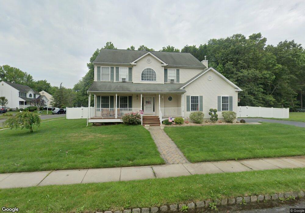
2 Bailey Ct Manalapan, NJ 07726
Estimated Value: $812,000 - $931,000
4
Beds
2
Baths
2,348
Sq Ft
$365/Sq Ft
Est. Value
About This Home
This home is located at 2 Bailey Ct, Manalapan, NJ 07726 and is currently estimated at $857,863, approximately $365 per square foot. 2 Bailey Ct is a home located in Monmouth County with nearby schools including Taylor Mills Elementary School, Manalapan-Englishtown Middle School, and Pine Brook Elementary School.
Ownership History
Date
Name
Owned For
Owner Type
Purchase Details
Closed on
May 22, 2001
Sold by
Country Woods
Bought by
Newman Lawrence and Newman Susan
Current Estimated Value
Home Financials for this Owner
Home Financials are based on the most recent Mortgage that was taken out on this home.
Original Mortgage
$160,000
Outstanding Balance
$60,274
Interest Rate
7.15%
Estimated Equity
$797,589
Create a Home Valuation Report for This Property
The Home Valuation Report is an in-depth analysis detailing your home's value as well as a comparison with similar homes in the area
Home Values in the Area
Average Home Value in this Area
Purchase History
| Date | Buyer | Sale Price | Title Company |
|---|---|---|---|
| Newman Lawrence | $286,000 | -- |
Source: Public Records
Mortgage History
| Date | Status | Borrower | Loan Amount |
|---|---|---|---|
| Open | Newman Lawrence | $160,000 |
Source: Public Records
Tax History
| Year | Tax Paid | Tax Assessment Tax Assessment Total Assessment is a certain percentage of the fair market value that is determined by local assessors to be the total taxable value of land and additions on the property. | Land | Improvement |
|---|---|---|---|---|
| 2025 | $16,059 | $863,600 | $333,700 | $529,900 |
| 2024 | $15,113 | $808,200 | $370,800 | $437,400 |
Source: Public Records
Map
Nearby Homes
- 0 Private St Unit 22508862
- 72 Carriage Ln
- 57 English Club Dr
- 37 Queens Way
- 43 Queens Way
- 14 Emily Rd
- 43 Main St
- 12 Emily Rd
- 12 Oxford Ct Unit 106
- 68 Main St
- 29 Wilson Ave
- 2 Dey St
- 8 Heritage Dr
- 33 Burke St
- 28 Whittier Dr
- 31 Atrium Way Unit 3-1
- 52 Crimson Dr
- 45 Lone Star Ln Unit C045
- 19 Weamaconk Dr
- 57 Chestnut Way
Your Personal Tour Guide
Ask me questions while you tour the home.