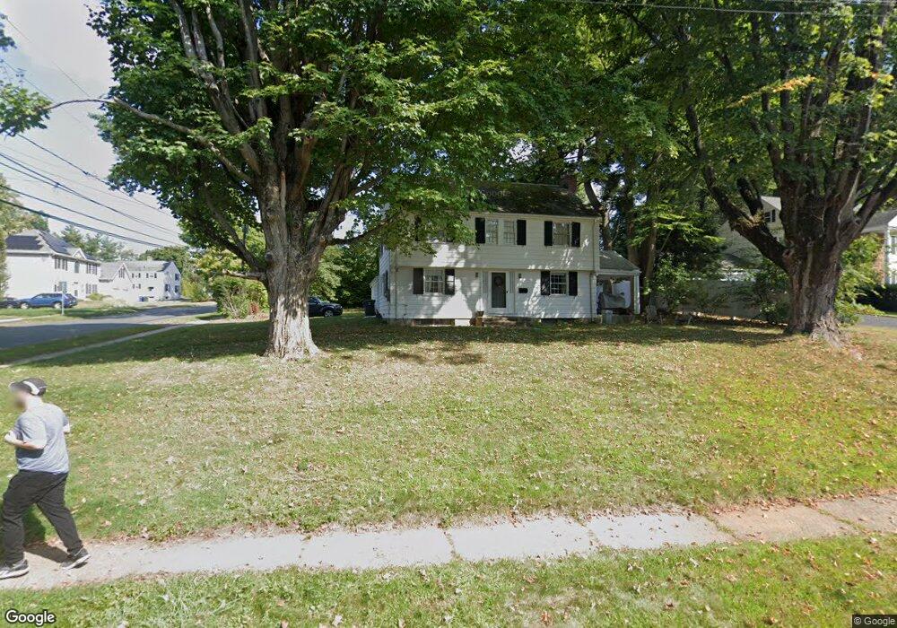
2 Brenway Dr West Hartford, CT 06117
Estimated Value: $498,164 - $660,000
3
Beds
3
Baths
1,764
Sq Ft
$326/Sq Ft
Est. Value
About This Home
This home is located at 2 Brenway Dr, West Hartford, CT 06117 and is currently estimated at $574,291, approximately $325 per square foot. 2 Brenway Dr is a home located in Hartford County with nearby schools including Bugbee School, King Philip Middle School, and Hall High School.
Create a Home Valuation Report for This Property
The Home Valuation Report is an in-depth analysis detailing your home's value as well as a comparison with similar homes in the area
Home Values in the Area
Average Home Value in this Area
Tax History Compared to Growth
Tax History
| Year | Tax Paid | Tax Assessment Tax Assessment Total Assessment is a certain percentage of the fair market value that is determined by local assessors to be the total taxable value of land and additions on the property. | Land | Improvement |
|---|---|---|---|---|
| 2025 | $10,742 | $239,890 | $122,710 | $117,180 |
| 2024 | $10,159 | $239,890 | $122,710 | $117,180 |
| 2023 | $9,816 | $239,890 | $122,710 | $117,180 |
| 2022 | $9,759 | $239,890 | $122,710 | $117,180 |
| 2021 | $9,484 | $223,580 | $122,710 | $100,870 |
| 2020 | $8,760 | $209,580 | $114,590 | $94,990 |
| 2019 | $8,760 | $209,580 | $114,590 | $94,990 |
| 2018 | $8,593 | $209,580 | $114,590 | $94,990 |
| 2017 | $8,601 | $209,580 | $114,590 | $94,990 |
| 2016 | $9,257 | $234,290 | $120,330 | $113,960 |
| 2015 | $8,898 | $232,260 | $120,330 | $111,930 |
| 2014 | $8,680 | $232,260 | $120,330 | $111,930 |
Source: Public Records
Map
Nearby Homes
- 62 Blue Ridge Ln
- 47 Flagg Rd
- 2581 Albany Ave
- 30 Farmstead Ln
- 50 Magnolia Hill
- 11 Rye Ridge Pkwy
- 129 Middlebrook Rd
- 1272 Trout Brook Dr
- 56 Fox Chase Ln
- 11 Lawler Rd
- 139 Mohawk Dr
- 132 N Main St
- 592 Mountain Rd Unit A
- 148 King Philip Dr
- 1196 Trout Brook Dr
- 3 Pilgrim Rd
- 26 Berwyn Rd
- 21 Barksdale Rd
- 1110 Trout Brook Dr
- 183 Loomis Dr Unit 109