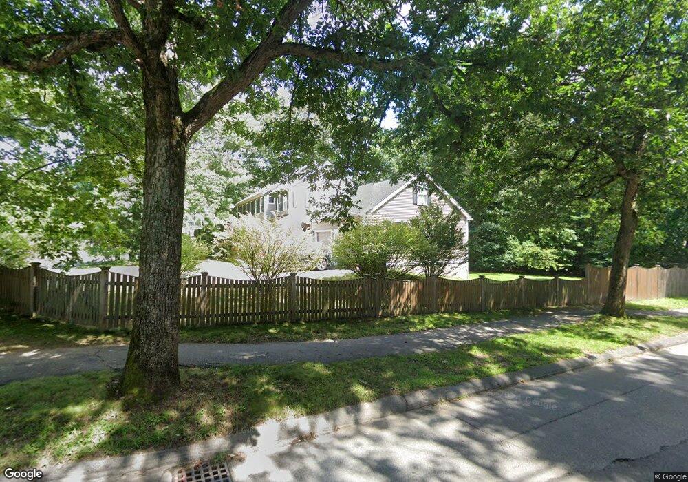
2 Briar Patch Ln Sudbury, MA 01776
Estimated Value: $1,194,324 - $1,247,000
3
Beds
4
Baths
2,978
Sq Ft
$412/Sq Ft
Est. Value
About This Home
This home is located at 2 Briar Patch Ln, Sudbury, MA 01776 and is currently estimated at $1,226,331, approximately $411 per square foot. 2 Briar Patch Ln is a home located in Middlesex County with nearby schools including Peter Noyes Elementary School, Ephraim Curtis Middle School, and Lincoln-Sudbury Regional High School.
Ownership History
Date
Name
Owned For
Owner Type
Purchase Details
Closed on
Aug 27, 1998
Sold by
Tremarche Claire P
Bought by
Crane David I and Crane Lisa A
Current Estimated Value
Home Financials for this Owner
Home Financials are based on the most recent Mortgage that was taken out on this home.
Original Mortgage
$173,600
Outstanding Balance
$37,083
Interest Rate
6.9%
Mortgage Type
Purchase Money Mortgage
Estimated Equity
$1,189,248
Purchase Details
Closed on
May 27, 1993
Sold by
Poole James F and Garden Carol
Bought by
Tremarche Claire P
Home Financials for this Owner
Home Financials are based on the most recent Mortgage that was taken out on this home.
Original Mortgage
$136,000
Interest Rate
7.41%
Mortgage Type
Purchase Money Mortgage
Purchase Details
Closed on
Aug 11, 1989
Sold by
Partridge Gordon R
Bought by
Poole James F
Home Financials for this Owner
Home Financials are based on the most recent Mortgage that was taken out on this home.
Original Mortgage
$132,000
Interest Rate
9.93%
Mortgage Type
Purchase Money Mortgage
Create a Home Valuation Report for This Property
The Home Valuation Report is an in-depth analysis detailing your home's value as well as a comparison with similar homes in the area
Home Values in the Area
Average Home Value in this Area
Purchase History
| Date | Buyer | Sale Price | Title Company |
|---|---|---|---|
| Crane David I | $217,000 | -- | |
| Tremarche Claire P | $170,000 | -- | |
| Poole James F | $165,000 | -- |
Source: Public Records
Mortgage History
| Date | Status | Borrower | Loan Amount |
|---|---|---|---|
| Open | Poole James F | $173,600 | |
| Previous Owner | Poole James F | $136,000 | |
| Previous Owner | Poole James F | $132,000 | |
| Closed | Poole James F | $21,700 |
Source: Public Records
Tax History
| Year | Tax Paid | Tax Assessment Tax Assessment Total Assessment is a certain percentage of the fair market value that is determined by local assessors to be the total taxable value of land and additions on the property. | Land | Improvement |
|---|---|---|---|---|
| 2025 | $16,205 | $1,106,900 | $388,900 | $718,000 |
| 2024 | $16,389 | $1,121,800 | $377,500 | $744,300 |
| 2023 | $15,229 | $965,700 | $343,100 | $622,600 |
| 2022 | $14,891 | $825,000 | $314,900 | $510,100 |
| 2021 | $13,978 | $742,300 | $314,900 | $427,400 |
| 2020 | $7,493 | $742,300 | $314,900 | $427,400 |
| 2019 | $13,295 | $742,300 | $314,900 | $427,400 |
| 2018 | $12,816 | $714,800 | $318,600 | $396,200 |
| 2017 | $5,952 | $700,000 | $307,600 | $392,400 |
| 2016 | $12,047 | $676,800 | $295,900 | $380,900 |
| 2015 | $11,533 | $655,300 | $282,000 | $373,300 |
| 2014 | $11,498 | $637,700 | $272,100 | $365,600 |
Source: Public Records
Map
Nearby Homes
- 25 Poplar St
- 30 Kendall Rd
- 557 Dutton Rd Unit 2
- 53 Pine St
- 62 Churchill St
- 11 October Rd
- 30 Harness Ln
- 30 Rolling Ln
- 11 Great Lake Dr
- 15 Huckleberry Ln
- 45 Webster Cir
- 8 Twillingate Rd
- 0 Robbins Rd
- 11 Farmstead Ln Unit 11
- 355 Maynard Rd
- 55 Widow Rites Ln
- 45 Widow Rites Ln
- 0 Boston Post Rd
- 111 Willis Rd
- 25 Plantation Cir
- 10 Briar Patch Ln
- 162 Pratts Mill Rd
- 153 Pratts Mill Rd
- 150 Pratts Mill Rd
- 161 Pratts Mill Rd
- 149 Pratts Mill Rd
- 7 Brentwood Rd
- 170 Pratts Mill Rd
- 126 Hemlock Rd
- 18 Briar Patch Ln
- 11 Brentwood Rd
- 143 Pratts Mill Rd
- 176 Pratts Mill Rd
- 138 Pratts Mill Rd
- 167 Pratts Mill Rd
- 175 Pratts Mill Rd
- 21 Briar Patch Ln
- 22 Briar Patch Ln
- 120 Hemlock Rd
- 10 Brentwood Rd
Your Personal Tour Guide
Ask me questions while you tour the home.