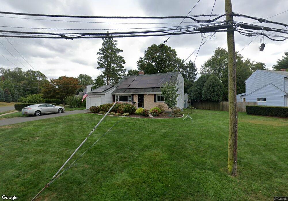
2 Burnham Dr West Hartford, CT 06110
Estimated Value: $415,000 - $459,000
4
Beds
2
Baths
1,701
Sq Ft
$256/Sq Ft
Est. Value
About This Home
This home is located at 2 Burnham Dr, West Hartford, CT 06110 and is currently estimated at $434,854, approximately $255 per square foot. 2 Burnham Dr is a home located in Hartford County with nearby schools including Wolcott School, Sedgwick Middle School, and Conard High School.
Ownership History
Date
Name
Owned For
Owner Type
Purchase Details
Closed on
Jun 24, 2014
Sold by
Hilborn Robert C and Hilborn Kristina J
Bought by
Kristina J Hilborn Ret
Current Estimated Value
Purchase Details
Closed on
Dec 30, 1994
Sold by
Roy Andre and Roy Lisa
Bought by
Hilborn Robert and Hilborn Kristina
Purchase Details
Closed on
Jun 15, 1989
Sold by
Cohen Stuart
Bought by
Roy Andre
Create a Home Valuation Report for This Property
The Home Valuation Report is an in-depth analysis detailing your home's value as well as a comparison with similar homes in the area
Home Values in the Area
Average Home Value in this Area
Purchase History
| Date | Buyer | Sale Price | Title Company |
|---|---|---|---|
| Kristina J Hilborn Ret | -- | -- | |
| Hilborn Robert | $145,000 | -- | |
| Roy Andre | $154,500 | -- |
Source: Public Records
Mortgage History
| Date | Status | Borrower | Loan Amount |
|---|---|---|---|
| Previous Owner | Roy Andre | $170,000 | |
| Previous Owner | Roy Andre | $143,000 |
Source: Public Records
Tax History Compared to Growth
Tax History
| Year | Tax Paid | Tax Assessment Tax Assessment Total Assessment is a certain percentage of the fair market value that is determined by local assessors to be the total taxable value of land and additions on the property. | Land | Improvement |
|---|---|---|---|---|
| 2025 | $9,241 | $206,360 | $60,200 | $146,160 |
| 2024 | $8,739 | $206,360 | $60,200 | $146,160 |
| 2023 | $8,444 | $206,360 | $60,200 | $146,160 |
| 2022 | $8,395 | $206,360 | $60,200 | $146,160 |
| 2021 | $7,637 | $180,040 | $60,200 | $119,840 |
| 2020 | $7,098 | $169,820 | $51,240 | $118,580 |
| 2019 | $7,098 | $169,820 | $51,240 | $118,580 |
| 2018 | $6,963 | $169,820 | $51,240 | $118,580 |
| 2017 | $6,969 | $169,820 | $51,240 | $118,580 |
| 2016 | $7,160 | $181,230 | $52,500 | $128,730 |
| 2015 | $6,943 | $181,230 | $52,500 | $128,730 |
| 2014 | $6,773 | $181,230 | $52,500 | $128,730 |
Source: Public Records
Map
Nearby Homes
- 25 Fowler Dr
- 43 Burnham Dr
- 1 Valley Crest Dr
- 24 Thorne Rd Unit 24
- 42 Avery Rd
- 479 S Main St
- 16 Thornton Dr
- 281 South Rd
- 32 Miles Standish Dr
- 228 Reservoir Rd
- 305 Hampton Ct
- 18 Federal St
- 422 S Main St
- 107 Westgate St
- 34 Sandhurst Dr
- 61 Colonial St
- 148 Colonial St
- 49 Somerset St
- 39 Cortland St
- 123 Grove St