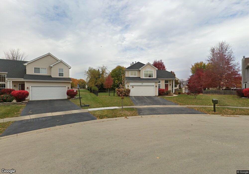
2 Carol Ct Bolingbrook, IL 60440
Balstrode Park NeighborhoodEstimated Value: $401,000 - $413,000
4
Beds
4
Baths
1,659
Sq Ft
$246/Sq Ft
Est. Value
About This Home
This home is located at 2 Carol Ct, Bolingbrook, IL 60440 and is currently estimated at $407,351, approximately $245 per square foot. 2 Carol Ct is a home located in Will County with nearby schools including Jamie Mcgee Elementary School, Jane Addams Middle School, and Bolingbrook High School.
Ownership History
Date
Name
Owned For
Owner Type
Purchase Details
Closed on
Aug 8, 2008
Sold by
Mohr Brian D and Mohr Tiffin P
Bought by
Dore Michael P and Sveinsson Ellen M
Current Estimated Value
Home Financials for this Owner
Home Financials are based on the most recent Mortgage that was taken out on this home.
Original Mortgage
$231,500
Interest Rate
5.96%
Mortgage Type
Purchase Money Mortgage
Create a Home Valuation Report for This Property
The Home Valuation Report is an in-depth analysis detailing your home's value as well as a comparison with similar homes in the area
Home Values in the Area
Average Home Value in this Area
Purchase History
| Date | Buyer | Sale Price | Title Company |
|---|---|---|---|
| Dore Michael P | $257,500 | Greater Illinois Title Co |
Source: Public Records
Mortgage History
| Date | Status | Borrower | Loan Amount |
|---|---|---|---|
| Previous Owner | Dore Michael P | $231,500 |
Source: Public Records
Tax History
| Year | Tax Paid | Tax Assessment Tax Assessment Total Assessment is a certain percentage of the fair market value that is determined by local assessors to be the total taxable value of land and additions on the property. | Land | Improvement |
|---|---|---|---|---|
| 2024 | $10,406 | $120,669 | $23,371 | $97,298 |
| 2023 | $10,406 | $108,573 | $21,028 | $87,545 |
| 2022 | $9,082 | $97,884 | $18,958 | $78,926 |
| 2021 | $8,610 | $91,523 | $17,726 | $73,797 |
| 2020 | $8,346 | $88,513 | $17,143 | $71,370 |
| 2019 | $8,078 | $84,298 | $16,327 | $67,971 |
| 2018 | $7,757 | $80,683 | $15,627 | $65,056 |
| 2017 | $7,387 | $76,476 | $14,812 | $61,664 |
| 2016 | $7,174 | $72,800 | $14,100 | $58,700 |
| 2015 | $7,022 | $69,800 | $13,500 | $56,300 |
| 2014 | $7,022 | $69,800 | $13,500 | $56,300 |
| 2013 | $7,022 | $71,200 | $13,800 | $57,400 |
Source: Public Records
Map
Nearby Homes
- 10 Lindsey Ct W
- 845 Barclay Dr
- 265 Commonwealth Dr Unit 1
- 1042 Churchill Dr Unit 12
- VACANT W Boughton Rd
- 4 Franklin Ct Unit 2
- 261 Bryant Way
- 345 Redwing Dr Unit 5
- 662 Sundance Dr
- 556 Pontiac Ln Unit 5
- 118 Springleaf Dr Unit 5
- 1086 Lily Field Ln
- 333 Claridge Cir
- 228 Elkhorn Ct Unit B
- 8 Lily Ct
- 234 Butternut Dr
- 217 S Orchard Dr
- 224 Kedvale Ct
- 867 Harris Dr Unit 5
- 250 Butternut Dr
- 1 Carol Ct Unit 2
- 3 Carol Ct
- 18 Lindsey Ct E
- 19 Lindsey Ct E
- 20 Lindsey Ct E
- 17 Lindsey Ct E
- 4 Carol Ct
- 5 Carol Ct
- 6 Carol Ct
- 16 Lindsey Ct E
- 240 Penny Ln
- 247 Berkeley Dr Unit 1
- 229 Carol Ln
- 251 Berkeley Dr Unit 1
- 237 Penny Ln
- 239 Berkeley Dr Unit 1
- 255 Berkeley Dr
- 235 Berkeley Dr Unit 1
- 236 Penny Ln Unit 1
- 12 Lindsey Ct E
Your Personal Tour Guide
Ask me questions while you tour the home.