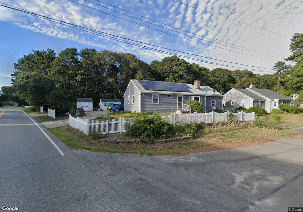
2 Carol Ln West Harwich, MA 02671
Northwest Harwich NeighborhoodEstimated Value: $586,000 - $720,000
3
Beds
2
Baths
1,201
Sq Ft
$554/Sq Ft
Est. Value
About This Home
This home is located at 2 Carol Ln, West Harwich, MA 02671 and is currently estimated at $665,628, approximately $554 per square foot. 2 Carol Ln is a home located in Barnstable County with nearby schools including Harwich Elementary School, Chatham Elementary School, and Monomoy Regional Middle School.
Ownership History
Date
Name
Owned For
Owner Type
Purchase Details
Closed on
Dec 10, 1999
Sold by
Ware Sharon
Bought by
Smith Susan Ann and Smith Michael T
Current Estimated Value
Home Financials for this Owner
Home Financials are based on the most recent Mortgage that was taken out on this home.
Original Mortgage
$120,000
Interest Rate
7.9%
Mortgage Type
Purchase Money Mortgage
Purchase Details
Closed on
Dec 31, 1998
Sold by
Mazgelis Christopher G and Murphy Christina M
Bought by
Ware Sharon K
Purchase Details
Closed on
Oct 11, 1988
Sold by
Lincoln Fred F
Bought by
Mazgelis Christopher G
Create a Home Valuation Report for This Property
The Home Valuation Report is an in-depth analysis detailing your home's value as well as a comparison with similar homes in the area
Home Values in the Area
Average Home Value in this Area
Purchase History
| Date | Buyer | Sale Price | Title Company |
|---|---|---|---|
| Smith Susan Ann | $133,500 | -- | |
| Ware Sharon K | $103,000 | -- | |
| Mazgelis Christopher G | $117,500 | -- |
Source: Public Records
Mortgage History
| Date | Status | Borrower | Loan Amount |
|---|---|---|---|
| Open | Mazgelis Christopher G | $188,000 | |
| Closed | Mazgelis Christopher G | $160,000 | |
| Closed | Mazgelis Christopher G | $120,000 |
Source: Public Records
Tax History Compared to Growth
Tax History
| Year | Tax Paid | Tax Assessment Tax Assessment Total Assessment is a certain percentage of the fair market value that is determined by local assessors to be the total taxable value of land and additions on the property. | Land | Improvement |
|---|---|---|---|---|
| 2025 | $3,183 | $538,500 | $179,700 | $358,800 |
| 2024 | $3,092 | $512,800 | $169,600 | $343,200 |
| 2023 | $2,960 | $445,800 | $154,100 | $291,700 |
| 2022 | $2,913 | $359,200 | $134,100 | $225,100 |
| 2021 | $2,747 | $319,400 | $121,900 | $197,500 |
| 2020 | $2,748 | $314,800 | $120,500 | $194,300 |
| 2019 | $2,563 | $295,600 | $114,400 | $181,200 |
| 2018 | $2,593 | $286,100 | $104,000 | $182,100 |
| 2017 | $2,357 | $262,800 | $90,100 | $172,700 |
| 2016 | $2,298 | $253,400 | $90,100 | $163,300 |
| 2015 | $2,215 | $246,900 | $88,300 | $158,600 |
| 2014 | $2,157 | $246,000 | $90,000 | $156,000 |
Source: Public Records
Map
Nearby Homes
- 141 Division St
- 141 Division St
- 47 Telegraph Rd Unit 1
- 45 Route 28
- 91 Depot Rd W
- 9 Country Ln
- 166 Upper County Rd Unit 1-4
- 10 South St Unit 2-1
- 11 Lane Rd
- 73 Division St
- 79 Massachusetts 28
- 5 Home Wood Ln
- 157 Depot St Unit 3
- 418 Depot St
- 159 Center St Unit 22
- 64 Smith St
- 6 Bayberry Ln
- 435 Main St Unit 1
- 12 Cross St
- 6 Carol Ln
- 15 Division St
- 197 Division St Unit 4
- 197 Division St Unit 13
- 197 Division St Unit 12
- 197 Division St Unit 10
- 197 Division St Unit 1
- 197 Division St Unit 5
- 197 Division St Unit 14
- 197 Division St Unit 8
- 197 Division St Unit 11
- 197 Division St Unit 6
- 197 Division St
- 197 Division St Unit 2
- 197 Division St Unit 3
- 197 Division St Unit 16
- 197 Division St Unit 9
- 197 Division St Unit 7
- 197 Division St Unit 15
- 153 Division St