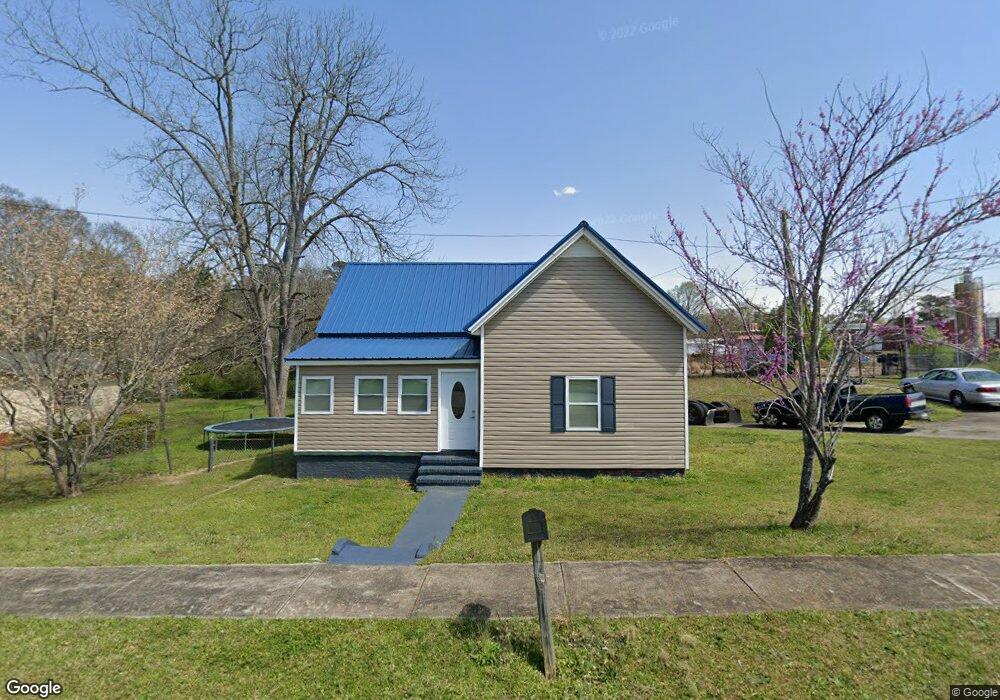
2 Cary St Lagrange, GA 30241
Estimated Value: $76,000 - $116,000
2
Beds
1
Bath
1,056
Sq Ft
$94/Sq Ft
Est. Value
About This Home
This home is located at 2 Cary St, Lagrange, GA 30241 and is currently estimated at $99,164, approximately $93 per square foot. 2 Cary St is a home located in Troup County with nearby schools including Franklin Forest Elementary School, Hollis Hand Elementary School, and Ethel W. Kight Elementary School.
Ownership History
Date
Name
Owned For
Owner Type
Purchase Details
Closed on
Jun 5, 2012
Sold by
Baker Cassandra Lepearl
Bought by
Hurston Travis
Current Estimated Value
Purchase Details
Closed on
Oct 15, 1996
Sold by
Baker Geo W
Bought by
Baker Cassandra Lepearl
Purchase Details
Closed on
Feb 15, 1979
Sold by
George Yates
Bought by
Baker Geo W
Purchase Details
Closed on
Apr 25, 1974
Sold by
Newton Anderson
Bought by
George Yates
Purchase Details
Closed on
Jan 1, 1974
Bought by
Newton Anderson
Purchase Details
Closed on
Oct 1, 1968
Sold by
Wilma David L and Wilma Costley
Create a Home Valuation Report for This Property
The Home Valuation Report is an in-depth analysis detailing your home's value as well as a comparison with similar homes in the area
Purchase History
| Date | Buyer | Sale Price | Title Company |
|---|---|---|---|
| Hurston Travis | -- | -- | |
| Baker Cassandra Lepearl | $11,300 | -- | |
| Baker Geo W | $19,500 | -- | |
| George Yates | $6,000 | -- | |
| Newton Anderson | $5,000 | -- | |
| -- | -- | -- |
Source: Public Records
Tax History
| Year | Tax Paid | Tax Assessment Tax Assessment Total Assessment is a certain percentage of the fair market value that is determined by local assessors to be the total taxable value of land and additions on the property. | Land | Improvement |
|---|---|---|---|---|
| 2025 | $747 | $27,400 | $2,920 | $24,480 |
| 2024 | $668 | $24,480 | $2,920 | $21,560 |
| 2023 | $581 | $21,320 | $2,920 | $18,400 |
| 2022 | $568 | $20,360 | $2,920 | $17,440 |
| 2021 | $423 | $14,040 | $2,000 | $12,040 |
| 2020 | $423 | $14,040 | $2,000 | $12,040 |
| 2019 | $384 | $12,720 | $2,000 | $10,720 |
| 2018 | $364 | $12,080 | $2,000 | $10,080 |
| 2017 | $364 | $12,079 | $1,999 | $10,080 |
| 2016 | $355 | $11,767 | $1,999 | $9,768 |
| 2015 | $369 | $12,210 | $1,996 | $10,214 |
| 2014 | $293 | $11,673 | $1,996 | $9,677 |
| 2013 | -- | $12,539 | $1,996 | $10,543 |
Source: Public Records
Map
Nearby Homes
- 15 Fulton St
- 4 1/2 Barnard Ave
- 5 Curran Ave
- 2 Louise St
- 3 Gulfstream Dr
- 5 Gulfstream Dr
- 204 Cleveland Dr
- 212 Cleveland Dr
- 147 Shenandoah Ln
- 143 Shenandoah Ln
- 141 Shenandoah Ln
- 146 Shenandoah Ln
- 139 Shenandoah Ln
- 142 Shenandoah Ln
- 136 Shenandoah Ln
- 87 Youngs Mill Rd
- 0 N Barnard Ave
- 115 Clara Jean Ct
- 0 E Render St
- 107 N Barnard Ave
Your Personal Tour Guide
Ask me questions while you tour the home.