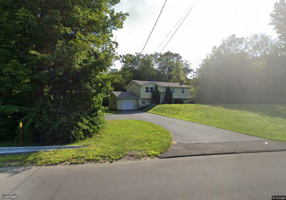
2 Cedar Ln New Hartford, CT 06057
Estimated Value: $339,000 - $422,000
3
Beds
2
Baths
1,132
Sq Ft
$336/Sq Ft
Est. Value
About This Home
This home is located at 2 Cedar Ln, New Hartford, CT 06057 and is currently estimated at $380,823, approximately $336 per square foot. 2 Cedar Ln is a home located in Litchfield County with nearby schools including Ann Antolini School, Northwestern Regional Middle School, and Northwestern Regional High School.
Ownership History
Date
Name
Owned For
Owner Type
Purchase Details
Closed on
Jun 24, 2010
Sold by
Tower Assoc Llc
Bought by
Muckle Stephen
Current Estimated Value
Home Financials for this Owner
Home Financials are based on the most recent Mortgage that was taken out on this home.
Original Mortgage
$233,159
Outstanding Balance
$154,567
Interest Rate
4.75%
Mortgage Type
FHA
Estimated Equity
$226,256
Purchase Details
Closed on
Aug 10, 2009
Sold by
Est Mcmahon John C and Mcmahon Richard R
Bought by
Tower Assoc Llc
Create a Home Valuation Report for This Property
The Home Valuation Report is an in-depth analysis detailing your home's value as well as a comparison with similar homes in the area
Home Values in the Area
Average Home Value in this Area
Purchase History
| Date | Buyer | Sale Price | Title Company |
|---|---|---|---|
| Muckle Stephen | $236,300 | -- | |
| Tower Assoc Llc | $70,000 | -- |
Source: Public Records
Mortgage History
| Date | Status | Borrower | Loan Amount |
|---|---|---|---|
| Open | Tower Assoc Llc | $233,159 |
Source: Public Records
Tax History Compared to Growth
Tax History
| Year | Tax Paid | Tax Assessment Tax Assessment Total Assessment is a certain percentage of the fair market value that is determined by local assessors to be the total taxable value of land and additions on the property. | Land | Improvement |
|---|---|---|---|---|
| 2025 | $5,478 | $197,960 | $49,840 | $148,120 |
| 2024 | $5,214 | $197,960 | $49,840 | $148,120 |
| 2023 | $4,892 | $152,530 | $49,840 | $102,690 |
| 2022 | $4,814 | $152,530 | $49,840 | $102,690 |
| 2021 | $4,832 | $152,530 | $49,840 | $102,690 |
| 2020 | $4,764 | $152,530 | $49,840 | $102,690 |
| 2019 | $4,706 | $152,530 | $49,840 | $102,690 |
| 2018 | $4,580 | $144,200 | $49,840 | $94,360 |
| 2017 | $4,580 | $144,200 | $49,840 | $94,360 |
| 2016 | $4,343 | $144,200 | $49,840 | $94,360 |
| 2015 | $4,346 | $144,200 | $49,840 | $94,360 |
| 2014 | $4,078 | $144,200 | $49,840 | $94,360 |
Source: Public Records
Map
Nearby Homes
- 37 E Cotton Hill Rd
- 71 Wickett St
- 19 Vickers Rd
- 37 Hidden Hill Rd
- 35 Hemlock Dr
- 290 Gillette Rd
- 302 Gillette Rd
- 1480 Litchfield Turnpike
- 16 Sabolcik Rd
- 208 South Rd
- 1526 Litchfield Turnpike
- 21 Kellogg Rd
- 595 Town Hill Rd
- 6 Windsor Ln
- 175 Ramstein Rd
- 92 Shafer Rd
- 85 Stedman Rd
- 555 Town Hill Rd
- 172 Hillandale Blvd
- 22B Hoppen Rd
- 18 Cedar Ln
- 7 Cedar Ln
- 19 Bluedoor Rd
- 1140 Litchfield Turnpike
- 5 Gillette Rd
- 1147 Litchfield Turnpike
- 1170 Litchfield Turnpike
- 1141 Litchfield Turnpike
- 1133 Litchfield Turnpike
- 25 Cedar Ln
- 1165 Litchfield Turnpike
- 1165 Litchfield Turnpike Unit East Unit
- 0 E Cotton Hill Rd Unit L144377
- 0 E Cotton Hill Rd Unit L148707
- 0 E Cotton Hill Rd Unit L10026371
- 0 E Cotton Hill Rd Unit 170618061
- 0 E Cotton Hill Rd Unit 170207523
- 39 Maple Hollow Rd
- 5 E Cotton Hill Rd
- 12 Cotton Hill Rd