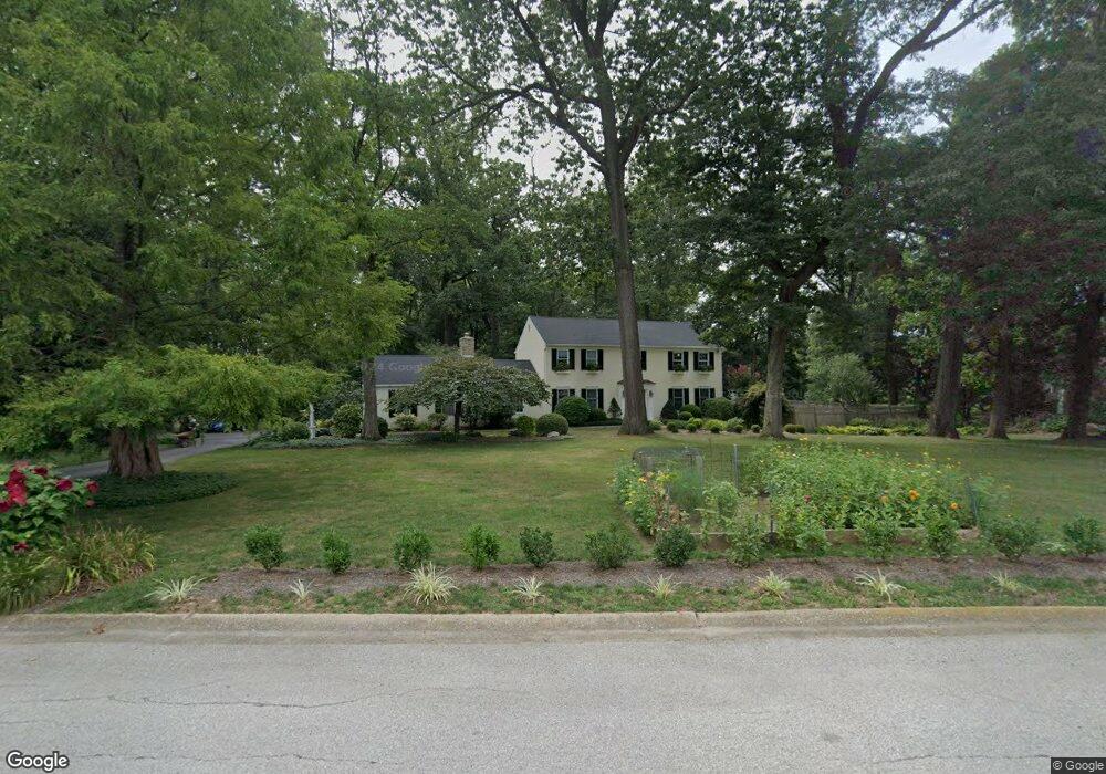
2 Collegeview Dr Malvern, PA 19355
Estimated Value: $906,000 - $1,030,988
4
Beds
3
Baths
2,918
Sq Ft
$325/Sq Ft
Est. Value
About This Home
This home is located at 2 Collegeview Dr, Malvern, PA 19355 and is currently estimated at $949,247, approximately $325 per square foot. 2 Collegeview Dr is a home located in Chester County with nearby schools including Sugartown Elementary School, Great Valley Middle School, and Great Valley High School.
Ownership History
Date
Name
Owned For
Owner Type
Purchase Details
Closed on
Jun 25, 1996
Sold by
Wright Charles J and Wright Carole L
Bought by
Bader Robert L and Bader Susan E
Current Estimated Value
Home Financials for this Owner
Home Financials are based on the most recent Mortgage that was taken out on this home.
Original Mortgage
$224,800
Outstanding Balance
$14,487
Interest Rate
7%
Estimated Equity
$934,760
Create a Home Valuation Report for This Property
The Home Valuation Report is an in-depth analysis detailing your home's value as well as a comparison with similar homes in the area
Home Values in the Area
Average Home Value in this Area
Purchase History
| Date | Buyer | Sale Price | Title Company |
|---|---|---|---|
| Bader Robert L | $281,000 | -- |
Source: Public Records
Mortgage History
| Date | Status | Borrower | Loan Amount |
|---|---|---|---|
| Open | Bader Robert L | $224,800 |
Source: Public Records
Tax History
| Year | Tax Paid | Tax Assessment Tax Assessment Total Assessment is a certain percentage of the fair market value that is determined by local assessors to be the total taxable value of land and additions on the property. | Land | Improvement |
|---|---|---|---|---|
| 2025 | $8,416 | $293,700 | $69,740 | $223,960 |
| 2024 | $8,416 | $293,700 | $69,740 | $223,960 |
| 2023 | $8,199 | $293,700 | $69,740 | $223,960 |
| 2022 | $8,034 | $293,700 | $69,740 | $223,960 |
| 2021 | $7,873 | $293,700 | $69,740 | $223,960 |
| 2020 | $7,743 | $293,700 | $69,740 | $223,960 |
| 2019 | $7,668 | $293,700 | $69,740 | $223,960 |
| 2018 | $7,523 | $293,700 | $69,740 | $223,960 |
| 2017 | $7,523 | $293,700 | $69,740 | $223,960 |
| 2016 | $6,597 | $293,700 | $69,740 | $223,960 |
| 2015 | $6,597 | $293,700 | $69,740 | $223,960 |
| 2014 | $6,597 | $293,700 | $69,740 | $223,960 |
Source: Public Records
Map
Nearby Homes
- THE PRESCOTT - (1010 Hershey Mill Rd) -*Millstone Cir
- THE WARREN - (1010 Hershey Mill Rd )- *Millstone Cir
- THE DELCHESTER- Millstone Circle (Gps 1010 Hershey Mill Rd)
- THE GREENBRIAR - Cir
- 1401 Old Phoenixville Pike
- 1054 W King Rd
- 1409 Full Cry Ct
- 74 Sproul Rd
- 131 Mulberry Dr
- 1703 Yardley Dr
- 124 Longford Rd
- 104 Cricket Dr
- 1653 Yardley Ct
- 975 Kennett Way
- 445 Eaton Way
- 46 Ashton Way
- 1741 Yardley Dr
- 821 Jefferson Way
- 12 Maxwell Ln
- 838 Jefferson Way
- 1521 Morstein Rd
- 1 Collegeview Dr
- 4 Collegeview Dr
- 1524 Morstein Rd
- 30 Anthony Dr
- 1533 Morstein Rd
- 28 Anthony Dr
- 3 Collegeview Dr
- 1486 Morstein Rd
- 5 Collegeview Dr
- 26 Anthony Dr
- 1535 Morstein Rd
- 19 Anthony Dr
- 17 Anthony Dr
- 7 Collegeview Dr
- 1537 Morstein Rd
- 15 Anthony Dr
- 24 Anthony Dr
- 2 Red Barn Ln
- 1514 Morstein Rd
Your Personal Tour Guide
Ask me questions while you tour the home.