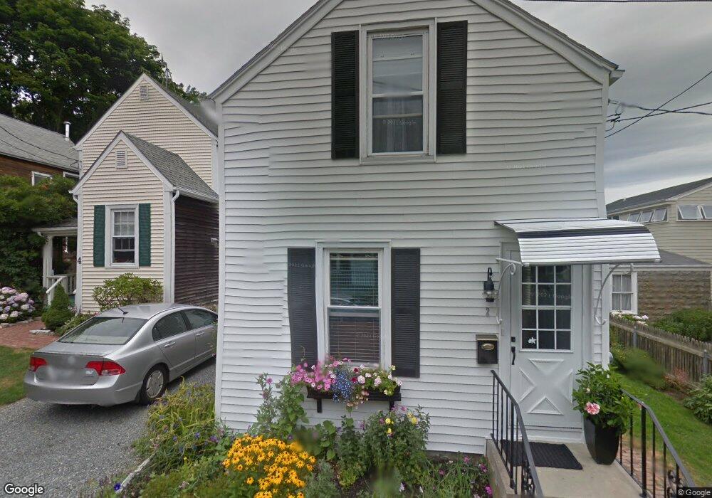
2 Conrad Ct Newport, RI 02840
Fifth Ward NeighborhoodEstimated Value: $611,718 - $749,000
2
Beds
1
Bath
672
Sq Ft
$1,001/Sq Ft
Est. Value
About This Home
This home is located at 2 Conrad Ct, Newport, RI 02840 and is currently estimated at $672,430, approximately $1,000 per square foot. 2 Conrad Ct is a home located in Newport County with nearby schools including Rogers High School, St Michael's Country Day School, and All Saints STEAM Academy.
Ownership History
Date
Name
Owned For
Owner Type
Purchase Details
Closed on
Dec 10, 2024
Sold by
Parsons Jacklyn G
Bought by
Kirwin Kellis S and Parsons Andrew J
Current Estimated Value
Purchase Details
Closed on
Jul 1, 2005
Sold by
Booth David and Booth Joyce M
Bought by
Parsons Ryan J and Parsons Kelli S
Create a Home Valuation Report for This Property
The Home Valuation Report is an in-depth analysis detailing your home's value as well as a comparison with similar homes in the area
Home Values in the Area
Average Home Value in this Area
Purchase History
| Date | Buyer | Sale Price | Title Company |
|---|---|---|---|
| Kirwin Kellis S | -- | None Available | |
| Kirwin Kellis S | -- | None Available | |
| Kirwin Kellis S | -- | None Available | |
| Parsons Ryan J | $286,000 | -- | |
| Parsons Ryan J | $286,000 | -- |
Source: Public Records
Mortgage History
| Date | Status | Borrower | Loan Amount |
|---|---|---|---|
| Previous Owner | Parsons Ryan J | $120,000 | |
| Previous Owner | Parsons Ryan J | $30,000 | |
| Previous Owner | Parsons Ryan J | $89,000 | |
| Previous Owner | Parsons Ryan J | $65,000 |
Source: Public Records
Tax History Compared to Growth
Tax History
| Year | Tax Paid | Tax Assessment Tax Assessment Total Assessment is a certain percentage of the fair market value that is determined by local assessors to be the total taxable value of land and additions on the property. | Land | Improvement |
|---|---|---|---|---|
| 2025 | $3,678 | $512,300 | $319,500 | $192,800 |
| 2024 | $3,571 | $512,300 | $319,500 | $192,800 |
| 2023 | $3,357 | $338,400 | $208,800 | $129,600 |
| 2022 | $3,252 | $338,400 | $208,800 | $129,600 |
| 2021 | $3,157 | $338,400 | $208,800 | $129,600 |
| 2020 | $3,508 | $341,200 | $215,300 | $125,900 |
| 2019 | $3,508 | $341,200 | $215,300 | $125,900 |
| 2018 | $3,409 | $341,200 | $215,300 | $125,900 |
| 2017 | $3,035 | $270,700 | $154,100 | $116,600 |
| 2016 | $2,959 | $270,700 | $154,100 | $116,600 |
| 2015 | $2,888 | $270,700 | $154,100 | $116,600 |
| 2014 | $2,933 | $243,200 | $131,000 | $112,200 |
Source: Public Records
Map
Nearby Homes
- 1 Harbor View Dr
- 99 Roseneath Ave
- 36 Connection St
- 3 Sharon Ct
- 2 Harrison Ave
- 35 Chastellux Ave Unit I
- 13 Vaughan Ave
- 70 Carroll Ave Unit 510
- 29 Bacheller St
- 62 Dixon St
- 13 Dean Ave
- 30 S Baptist St
- 111 Harrison Ave Unit A6
- 24 Brown and Howard Wharf Unit 301
- 112 Harrison Ave
- 112 Harrison Ave Unit B
- 28 Young St
- 9 Anthony St
- 434 Bellevue Ave Unit 2B
- 129 Ruggles Ave
- 4 Conrad Ct
- 75 Roseneath Ave
- 73 Roseneath Ave
- 1 Conrad Ct
- 6 Conrad Ct
- 77 Roseneath Ave
- 3 Conrad Ct
- 71 Roseneath Ave
- 3 Gillies Ct
- 5 Conrad Ct
- 69 Roseneath Ave
- 81 Roseneath Ave
- 5 Gillies Ct
- 83 Roseneath Ave
- 128 Connection St
- 130 Connection St
- 132 Connection St
- 67 1/2 Roseneath Ave
- 2 Gillies Ct
- 4 Gillies Ct