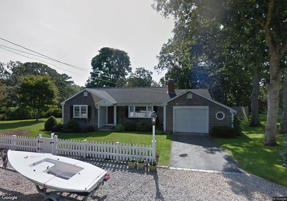
2 Constance Ann Way South Dennis, MA 02660
South Dennis NeighborhoodEstimated Value: $544,057 - $633,000
2
Beds
1
Bath
976
Sq Ft
$606/Sq Ft
Est. Value
About This Home
This home is located at 2 Constance Ann Way, South Dennis, MA 02660 and is currently estimated at $591,514, approximately $606 per square foot. 2 Constance Ann Way is a home located in Barnstable County with nearby schools including Dennis-Yarmouth Regional High School and St. Pius X. School.
Ownership History
Date
Name
Owned For
Owner Type
Purchase Details
Closed on
Feb 26, 1999
Sold by
Martin Dorothy H and Martin Paul E
Bought by
Stanley Linda J and Stanley Lance T
Current Estimated Value
Home Financials for this Owner
Home Financials are based on the most recent Mortgage that was taken out on this home.
Original Mortgage
$114,450
Outstanding Balance
$27,770
Interest Rate
6.78%
Mortgage Type
Purchase Money Mortgage
Estimated Equity
$563,744
Create a Home Valuation Report for This Property
The Home Valuation Report is an in-depth analysis detailing your home's value as well as a comparison with similar homes in the area
Home Values in the Area
Average Home Value in this Area
Purchase History
| Date | Buyer | Sale Price | Title Company |
|---|---|---|---|
| Stanley Linda J | $118,000 | -- |
Source: Public Records
Mortgage History
| Date | Status | Borrower | Loan Amount |
|---|---|---|---|
| Open | Stanley Linda J | $114,450 |
Source: Public Records
Tax History Compared to Growth
Tax History
| Year | Tax Paid | Tax Assessment Tax Assessment Total Assessment is a certain percentage of the fair market value that is determined by local assessors to be the total taxable value of land and additions on the property. | Land | Improvement |
|---|---|---|---|---|
| 2025 | $2,296 | $530,200 | $142,300 | $387,900 |
| 2024 | $2,133 | $485,900 | $136,800 | $349,100 |
| 2023 | $2,063 | $441,700 | $124,400 | $317,300 |
| 2022 | $2,006 | $358,200 | $124,500 | $233,700 |
| 2021 | $1,894 | $314,100 | $122,100 | $192,000 |
| 2020 | $1,808 | $296,400 | $122,100 | $174,300 |
| 2019 | $1,769 | $286,700 | $131,600 | $155,100 |
| 2018 | $1,605 | $253,100 | $113,900 | $139,200 |
| 2017 | $1,530 | $248,700 | $113,900 | $134,800 |
| 2016 | $1,506 | $230,600 | $119,600 | $111,000 |
| 2015 | $1,476 | $230,600 | $119,600 | $111,000 |
| 2014 | $1,358 | $213,800 | $102,500 | $111,300 |
Source: Public Records
Map
Nearby Homes
- 17 Margate Ln
- 17 Fairmount Rd
- 17 Fairmount Rd
- 10 Joanne Dr
- 153 Bayridge Dr
- 7 Vinland Dr
- 25 Skerry Rd
- 11 Uncle Stanleys Way
- 4 Ebb Rd
- 15 Captain Jud Rd
- 1 Norseman Dr
- 118 Driftwood Ln
- 129 Driftwood Ln
- 62 Old Fish House Rd
- 6 Hawthorn St
- 13 Covey Dr
- 111 Merchant Ave
- 4 Old Colony Way
- 85 Keel Cape Dr
- 6 Nimble Hill Dr
- 12 Constance Ann Way
- 150 Mayfair Rd
- 150 Mayfair Rd Unit 2
- 7 Constance Ann Way
- 154 Mayfair Rd
- 147 Mayfair Rd
- 1 Constance Ann Way
- 146 Mayfair Rd
- 143 Mayfair Rd Unit 4
- 143 Mayfair Rd Unit 5
- 143 Mayfair Rd
- 160 Mayfair Rd
- 18 Peter David Way
- 6 Peter David Way
- 21 Constance Ann Way
- 16 Follins Pond Rd
- 168 Mayfair Rd
- 24 Peter David Way
- 22 & 24 Follins Pond Rd
- 18 Follins Pond Rd