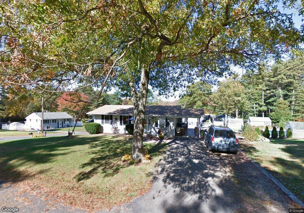
2 Coyle St East Taunton, MA 02718
Elliotts Corner NeighborhoodEstimated Value: $395,000 - $471,000
4
Beds
1
Bath
925
Sq Ft
$464/Sq Ft
Est. Value
About This Home
This home is located at 2 Coyle St, East Taunton, MA 02718 and is currently estimated at $429,268, approximately $464 per square foot. 2 Coyle St is a home located in Bristol County with nearby schools including East Taunton Elementary School, Joseph H. Martin, and Taunton High School.
Ownership History
Date
Name
Owned For
Owner Type
Purchase Details
Closed on
May 25, 2017
Sold by
Almeida Janet
Bought by
Hennings Michael E and Hennings Marcie A
Current Estimated Value
Purchase Details
Closed on
Aug 2, 1983
Bought by
Almeida Kenneth and Almeida Janet
Create a Home Valuation Report for This Property
The Home Valuation Report is an in-depth analysis detailing your home's value as well as a comparison with similar homes in the area
Home Values in the Area
Average Home Value in this Area
Purchase History
| Date | Buyer | Sale Price | Title Company |
|---|---|---|---|
| Hennings Michael E | -- | -- | |
| Almeida Kenneth | -- | -- |
Source: Public Records
Mortgage History
| Date | Status | Borrower | Loan Amount |
|---|---|---|---|
| Previous Owner | Almeida Kenneth | $30,000 | |
| Previous Owner | Almeida Kenneth | $20,000 | |
| Previous Owner | Almeida Kenneth | $75,000 | |
| Previous Owner | Almeida Kenneth | $38,000 |
Source: Public Records
Tax History Compared to Growth
Tax History
| Year | Tax Paid | Tax Assessment Tax Assessment Total Assessment is a certain percentage of the fair market value that is determined by local assessors to be the total taxable value of land and additions on the property. | Land | Improvement |
|---|---|---|---|---|
| 2025 | $3,673 | $335,700 | $131,400 | $204,300 |
| 2024 | $3,548 | $317,100 | $131,400 | $185,700 |
| 2023 | $3,587 | $297,700 | $137,300 | $160,400 |
| 2022 | $3,296 | $250,100 | $106,500 | $143,600 |
| 2021 | $3,140 | $221,100 | $96,800 | $124,300 |
| 2020 | $3,143 | $211,500 | $96,800 | $114,700 |
| 2019 | $3,201 | $203,100 | $96,800 | $106,300 |
| 2018 | $3,006 | $191,200 | $97,800 | $93,400 |
| 2017 | $2,887 | $183,800 | $92,700 | $91,100 |
| 2016 | $2,783 | $177,500 | $90,000 | $87,500 |
| 2015 | $2,673 | $178,100 | $87,700 | $90,400 |
| 2014 | $2,539 | $173,800 | $87,700 | $86,100 |
Source: Public Records
Map
Nearby Homes
- 1091 Middleboro Ave
- 1232 Middleboro Ave
- 111 Park Place
- 125R Middleboro Ave
- 649 Middleboro Ave
- 172 Bumila Dr
- 32 Kendall Ct
- 16 Liberty St
- 3 Anna St
- 79 Liberty St
- 6 Emerald Place
- 2 Emerald Place
- 96 Old Colony Ave Unit 227
- 96 Old Colony Ave Unit 319
- 96 Old Colony Ave Unit 158
- 73 Bally Dr
- 492 Richmond St Unit B
- 96 Old Colony Ave Unit 264
- 34 Oxbow Rd Unit 18-1
- 50 Oxbow Rd Unit 34-1