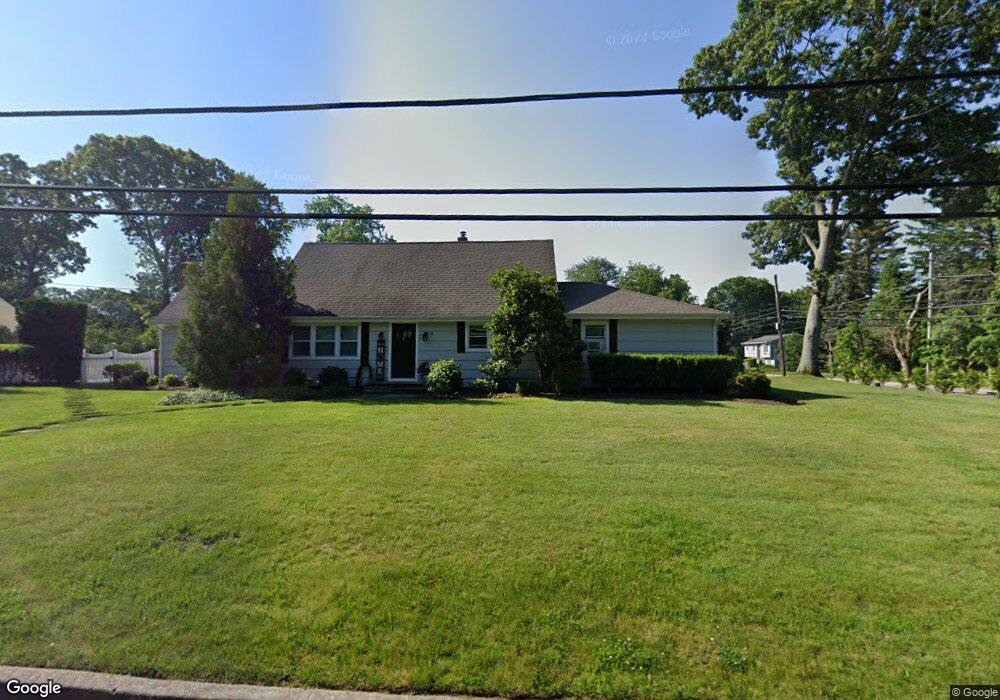
2 Darling Ave Smithtown, NY 11787
Estimated Value: $821,000 - $1,112,000
4
Beds
2
Baths
2,277
Sq Ft
$398/Sq Ft
Est. Value
About This Home
This home is located at 2 Darling Ave, Smithtown, NY 11787 and is currently estimated at $907,259, approximately $398 per square foot. 2 Darling Ave is a home located in Suffolk County with nearby schools including Smithtown Elementary School, Smithtown Christian School, and St Patrick Elementary School.
Ownership History
Date
Name
Owned For
Owner Type
Purchase Details
Closed on
Dec 23, 2011
Sold by
Cardi Louis
Bought by
Cardi Alexander L
Current Estimated Value
Home Financials for this Owner
Home Financials are based on the most recent Mortgage that was taken out on this home.
Original Mortgage
$275,000
Outstanding Balance
$188,028
Interest Rate
4%
Mortgage Type
Purchase Money Mortgage
Estimated Equity
$719,231
Purchase Details
Closed on
Nov 8, 2004
Purchase Details
Closed on
Jun 7, 2001
Sold by
Cardi Realty
Bought by
Cardi Louis T and Cardi Gina M
Create a Home Valuation Report for This Property
The Home Valuation Report is an in-depth analysis detailing your home's value as well as a comparison with similar homes in the area
Home Values in the Area
Average Home Value in this Area
Purchase History
| Date | Buyer | Sale Price | Title Company |
|---|---|---|---|
| Cardi Alexander L | $275,000 | -- | |
| -- | -- | -- | |
| Cardi Louis T | -- | -- |
Source: Public Records
Mortgage History
| Date | Status | Borrower | Loan Amount |
|---|---|---|---|
| Open | Cardi Alexander L | $275,000 |
Source: Public Records
Tax History
| Year | Tax Paid | Tax Assessment Tax Assessment Total Assessment is a certain percentage of the fair market value that is determined by local assessors to be the total taxable value of land and additions on the property. | Land | Improvement |
|---|---|---|---|---|
| 2024 | $16,250 | $6,136 | $545 | $5,591 |
| 2023 | $16,250 | $6,136 | $545 | $5,591 |
| 2022 | $13,484 | $6,136 | $545 | $5,591 |
| 2021 | $13,484 | $6,136 | $545 | $5,591 |
| 2020 | $14,545 | $5,781 | $545 | $5,236 |
| 2019 | $14,545 | $0 | $0 | $0 |
| 2018 | -- | $6,330 | $545 | $5,785 |
| 2017 | $13,782 | $6,330 | $545 | $5,785 |
| 2016 | $13,627 | $6,330 | $545 | $5,785 |
| 2015 | -- | $6,330 | $545 | $5,785 |
| 2014 | -- | $6,720 | $545 | $6,175 |
Source: Public Records
Map
Nearby Homes
- 49 Lexington Ave
- 66 Darling Ave
- 6 Keystone Ct
- 96 Brooksite Dr
- 355 Route 111 Unit 6
- 355 Route 111 Unit 23
- 175 Evergreen Ave
- 365 Route 111 Unit A2
- 65 Birchbrook Dr
- 55 Waverly Ave
- 57 Birchbrook Dr
- 220 Larch Ln
- 31 Brooksite Dr
- 2 W Pond Ct
- 1 Park Ct
- 11 Plantation Dr
- 7 Flamingo Dr
- 639 Townline Rd
- 45 Roundabout Rd
- 10 Smithtown Blvd Unit 7B
Your Personal Tour Guide
Ask me questions while you tour the home.