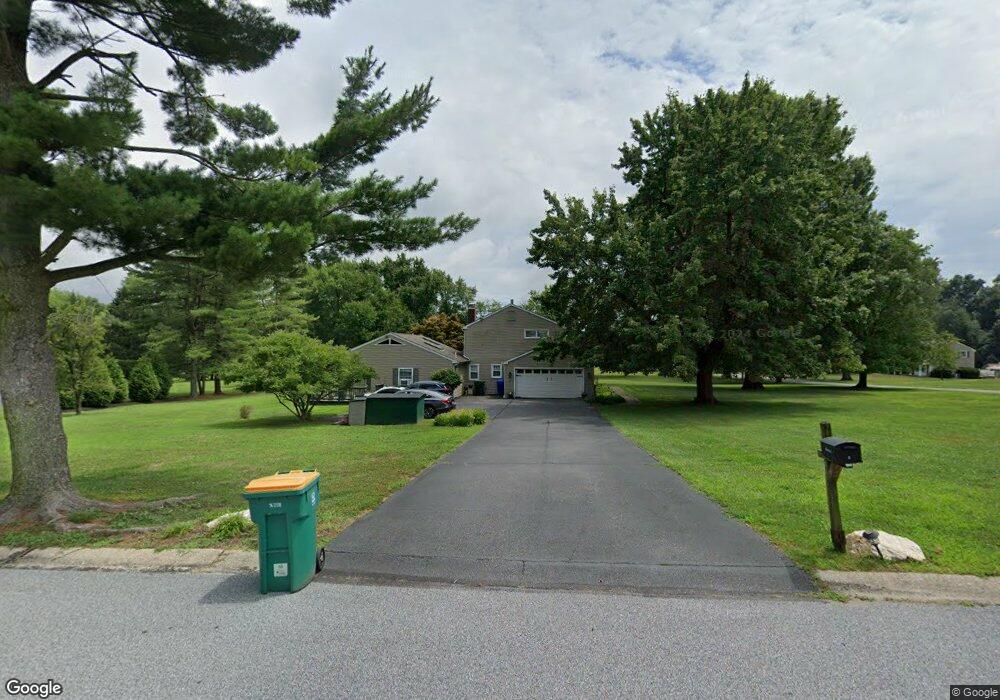
2 David Dr Thornton, PA 19373
Estimated Value: $831,420 - $934,000
5
Beds
4
Baths
2,992
Sq Ft
$290/Sq Ft
Est. Value
About This Home
This home is located at 2 David Dr, Thornton, PA 19373 and is currently estimated at $867,605, approximately $289 per square foot. 2 David Dr is a home located in Delaware County with nearby schools including Sarah W Starkweather Elementary School, Stetson Middle School, and Bayard Rustin High School.
Ownership History
Date
Name
Owned For
Owner Type
Purchase Details
Closed on
Oct 7, 2016
Sold by
Jones Martin C and Jones Sarah L
Bought by
Jones Martin C and Dixon Jones Sarah L
Current Estimated Value
Home Financials for this Owner
Home Financials are based on the most recent Mortgage that was taken out on this home.
Original Mortgage
$290,300
Outstanding Balance
$132,394
Interest Rate
2.77%
Mortgage Type
New Conventional
Estimated Equity
$735,211
Purchase Details
Closed on
Jun 23, 2003
Sold by
Jones Martin C and Jones Sarah L
Bought by
Jones Martin C and Jones Sarah L
Purchase Details
Closed on
Aug 21, 2001
Sold by
Boyle Thomas William and Boyle Barbara Mary
Bought by
Jones Martin C and Jones Sarah L
Home Financials for this Owner
Home Financials are based on the most recent Mortgage that was taken out on this home.
Original Mortgage
$240,000
Interest Rate
7.05%
Create a Home Valuation Report for This Property
The Home Valuation Report is an in-depth analysis detailing your home's value as well as a comparison with similar homes in the area
Home Values in the Area
Average Home Value in this Area
Purchase History
| Date | Buyer | Sale Price | Title Company |
|---|---|---|---|
| Jones Martin C | -- | None Available | |
| Jones Martin C | -- | -- | |
| Jones Martin C | $325,000 | Commonwealth Land Title Ins |
Source: Public Records
Mortgage History
| Date | Status | Borrower | Loan Amount |
|---|---|---|---|
| Open | Jones Martin C | $290,300 | |
| Closed | Jones Martin C | $240,000 |
Source: Public Records
Tax History
| Year | Tax Paid | Tax Assessment Tax Assessment Total Assessment is a certain percentage of the fair market value that is determined by local assessors to be the total taxable value of land and additions on the property. | Land | Improvement |
|---|---|---|---|---|
| 2025 | $6,337 | $484,020 | $128,450 | $355,570 |
| 2024 | $6,337 | $484,020 | $128,450 | $355,570 |
| 2023 | $6,260 | $484,020 | $128,450 | $355,570 |
| 2022 | $6,058 | $484,020 | $128,450 | $355,570 |
| 2021 | $9,517 | $484,020 | $128,450 | $355,570 |
| 2020 | $5,608 | $258,190 | $68,140 | $190,050 |
| 2019 | $5,561 | $258,190 | $68,140 | $190,050 |
| 2018 | $5,373 | $258,190 | $0 | $0 |
| 2017 | $5,244 | $258,190 | $0 | $0 |
| 2016 | $1,417 | $258,190 | $0 | $0 |
| 2015 | $1,446 | $258,190 | $0 | $0 |
| 2014 | $1,417 | $258,190 | $0 | $0 |
Source: Public Records
Map
Nearby Homes
- 186 Dilworthtown Rd
- 16 Creekview Cir
- 236 Greenbriar Dr
- 14 Dever Dr
- 34 Oakland Rd Unit C2
- 411 Webb Rd
- 5 Cedar Grove Dr
- 38 James Cloud
- 307 Thornton Rd
- 9 Heatherstone Way
- 22 Country Run
- 429 Homestead Dr Unit 83B
- 447 Homestead Dr Unit 81-A
- 119 Huntteam Ln
- 825 Bainbridge Dr
- 0 Baltimore Pike
- 1707 Painters Crossing Unit 1707
- 675 LOT 2 Brintons Bridge Rd
- 207 Painters Crossing Unit 207
- 1210 Painters Crossing Unit 1210
Your Personal Tour Guide
Ask me questions while you tour the home.