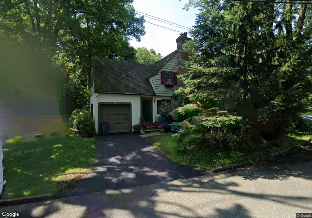
2 Devon Way Hastings On Hudson, NY 10706
Estimated Value: $763,989 - $942,000
--
Bed
--
Bath
838
Sq Ft
$993/Sq Ft
Est. Value
About This Home
This home is located at 2 Devon Way, Hastings On Hudson, NY 10706 and is currently estimated at $832,247, approximately $993 per square foot. 2 Devon Way is a home located in Westchester County with nearby schools including Hastings High School, Hudson Lab School, and The Orchard School.
Ownership History
Date
Name
Owned For
Owner Type
Purchase Details
Closed on
Jun 3, 1999
Sold by
Sieller Frances G
Bought by
Befi Riccardo and Przeklasa Befi Barbara I
Current Estimated Value
Home Financials for this Owner
Home Financials are based on the most recent Mortgage that was taken out on this home.
Original Mortgage
$240,000
Interest Rate
7.73%
Create a Home Valuation Report for This Property
The Home Valuation Report is an in-depth analysis detailing your home's value as well as a comparison with similar homes in the area
Home Values in the Area
Average Home Value in this Area
Purchase History
| Date | Buyer | Sale Price | Title Company |
|---|---|---|---|
| Befi Riccardo | $335,000 | All New York Title Agency In |
Source: Public Records
Mortgage History
| Date | Status | Borrower | Loan Amount |
|---|---|---|---|
| Closed | Befi Riccardo | $53,000 | |
| Previous Owner | Befi Riccardo | $240,000 |
Source: Public Records
Tax History Compared to Growth
Tax History
| Year | Tax Paid | Tax Assessment Tax Assessment Total Assessment is a certain percentage of the fair market value that is determined by local assessors to be the total taxable value of land and additions on the property. | Land | Improvement |
|---|---|---|---|---|
| 2024 | $13,849 | $598,800 | $353,800 | $245,000 |
| 2023 | $15,877 | $637,000 | $337,000 | $300,000 |
| 2022 | $2,311 | $592,300 | $337,000 | $255,300 |
| 2021 | $2,626 | $558,800 | $337,000 | $221,800 |
| 2020 | $17,885 | $617,100 | $374,400 | $242,700 |
| 2019 | $18,964 | $617,100 | $374,400 | $242,700 |
| 2018 | $20,188 | $600,300 | $374,400 | $225,900 |
| 2017 | $3,498 | $583,400 | $374,400 | $209,000 |
| 2016 | $449,534 | $561,000 | $374,400 | $186,600 |
| 2015 | $9,099 | $14,000 | $1,750 | $12,250 |
| 2014 | $9,099 | $13,000 | $1,750 | $11,250 |
| 2013 | $9,099 | $13,000 | $1,750 | $11,250 |
Source: Public Records
Map
Nearby Homes
- 5 Nodine St Unit 5
- 1 Nodine St Unit 1
- 6 Nodine St Unit 6
- 350 Warburton Ave
- 445 Broadway Unit 2-O
- 445 Broadway Unit 2R
- 29 Brandt St
- 90 Rose St
- 51 Branford Rd
- 45 Main St Unit 2A
- 24 School St
- 555 Broadway Unit 1H
- 538 Farragut Pkwy
- 12 Glenn Place
- 22 Lincoln Ave
- 1 Riverpointe Rd
- 1 David Ln Unit 3G
- 1 David Ln Unit 5E
- 1 David Ln Unit 2-G
- 66 Summit Dr