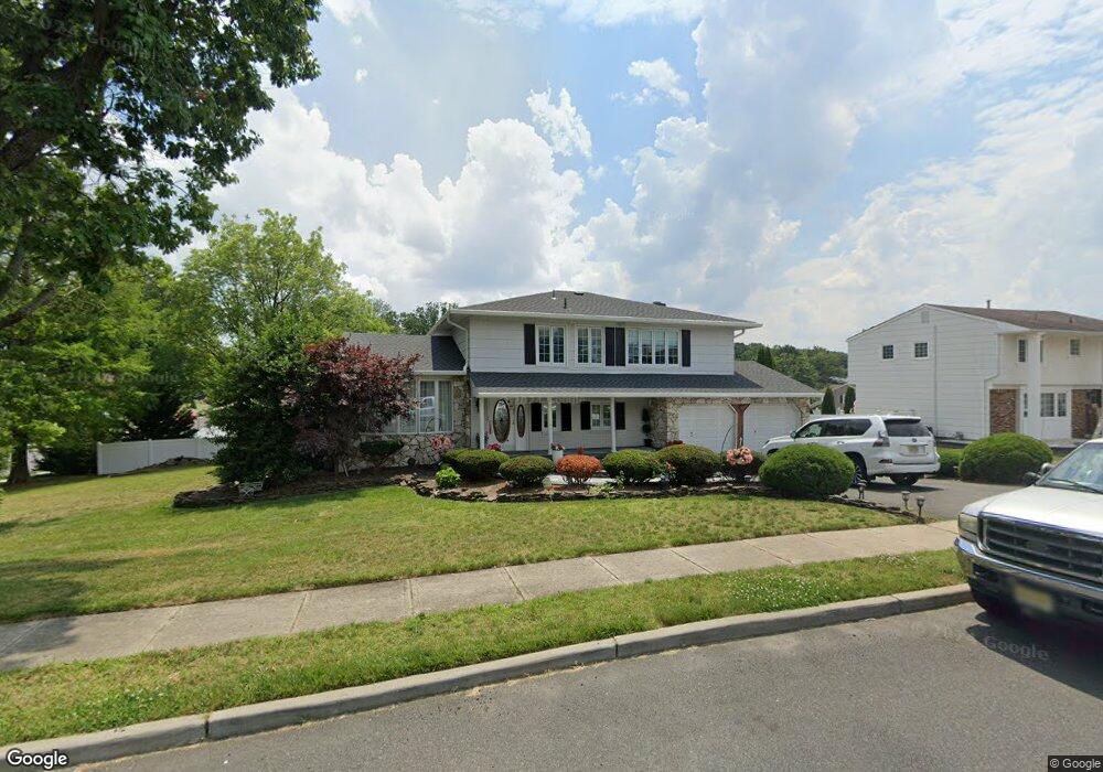
2 Devonshire Rd Parlin, NJ 08859
Estimated Value: $700,613 - $770,000
4
Beds
3
Baths
2,132
Sq Ft
$350/Sq Ft
Est. Value
About This Home
This home is located at 2 Devonshire Rd, Parlin, NJ 08859 and is currently estimated at $745,403, approximately $349 per square foot. 2 Devonshire Rd is a home located in Middlesex County with nearby schools including Sayreville War Memorial High School, St. Mary Elementary School, and Cardinal Mccarrick High School.
Ownership History
Date
Name
Owned For
Owner Type
Purchase Details
Closed on
Aug 29, 2017
Sold by
Marrero Ann
Bought by
Olivero Geovanny F
Current Estimated Value
Home Financials for this Owner
Home Financials are based on the most recent Mortgage that was taken out on this home.
Original Mortgage
$380,625
Interest Rate
3.94%
Mortgage Type
VA
Purchase Details
Closed on
Aug 25, 2001
Sold by
Grzymski Joseph
Bought by
Marrero Ann
Home Financials for this Owner
Home Financials are based on the most recent Mortgage that was taken out on this home.
Original Mortgage
$250,000
Interest Rate
6.92%
Create a Home Valuation Report for This Property
The Home Valuation Report is an in-depth analysis detailing your home's value as well as a comparison with similar homes in the area
Home Values in the Area
Average Home Value in this Area
Purchase History
| Date | Buyer | Sale Price | Title Company |
|---|---|---|---|
| Olivero Geovanny F | $410,000 | First American Title | |
| Marrero Ann | $350,000 | -- |
Source: Public Records
Mortgage History
| Date | Status | Borrower | Loan Amount |
|---|---|---|---|
| Previous Owner | Olivero Geovanny F | $380,625 | |
| Previous Owner | Marrero Ann | $250,000 |
Source: Public Records
Tax History
| Year | Tax Paid | Tax Assessment Tax Assessment Total Assessment is a certain percentage of the fair market value that is determined by local assessors to be the total taxable value of land and additions on the property. | Land | Improvement |
|---|---|---|---|---|
| 2025 | $11,569 | $193,600 | $56,300 | $137,300 |
| 2024 | $11,242 | $193,600 | $56,300 | $137,300 |
Source: Public Records
Map
Nearby Homes
- 23 Sherwood Rd
- 3 Carter Place
- 5 Gardner Place
- 22 Robin Place
- 10 Lily St
- 2950 Washington Rd
- 30 Iroquois Dr
- 655 Washington Ave
- 1 Gorczyca Place
- 23 Borelle Square
- 22 Borelle Square
- 11 Borelle Square
- 441 Wilmont St
- 10 Lapa Ct
- 440 Railroad Ave
- 36 Farnham Square Unit 236
- 395 Raritan St
- 518 Center St
- 498 Alpine St
- 16 Perrine Ave
Your Personal Tour Guide
Ask me questions while you tour the home.