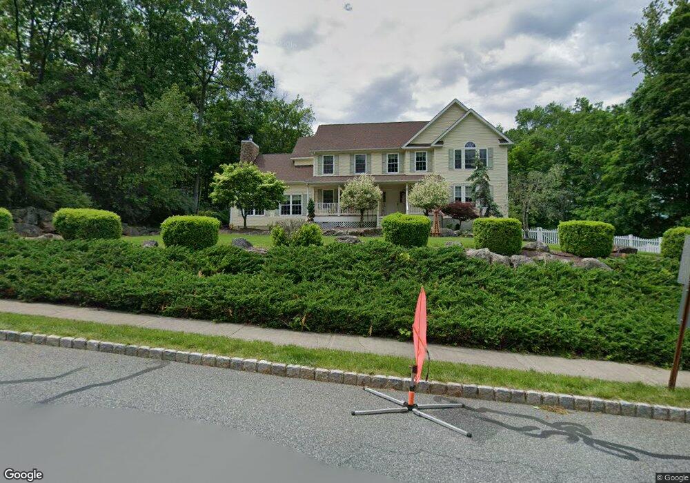
2 Eagles Nest Rd Newton, NJ 07860
Estimated Value: $775,000 - $883,000
Studio
--
Bath
3,384
Sq Ft
$246/Sq Ft
Est. Value
About This Home
This home is located at 2 Eagles Nest Rd, Newton, NJ 07860 and is currently estimated at $831,440, approximately $245 per square foot. 2 Eagles Nest Rd is a home located in Sussex County with nearby schools including Green Hills School.
Ownership History
Date
Name
Owned For
Owner Type
Purchase Details
Closed on
Mar 19, 2021
Sold by
Dougherty Virginia Ann and Dougherty Edward
Bought by
Munk Gregory and Munk Stephanie Y
Current Estimated Value
Home Financials for this Owner
Home Financials are based on the most recent Mortgage that was taken out on this home.
Original Mortgage
$564,585
Interest Rate
2.96%
Mortgage Type
FHA
Purchase Details
Closed on
Dec 5, 2007
Sold by
Forest Knoll Llc
Bought by
Dougherty Virginia Ann
Purchase Details
Closed on
Nov 25, 1998
Sold by
Crow Thomas R
Bought by
Goor Joel S and Roussin Lucille A
Create a Home Valuation Report for This Property
The Home Valuation Report is an in-depth analysis detailing your home's value as well as a comparison with similar homes in the area
Home Values in the Area
Average Home Value in this Area
Purchase History
| Date | Buyer | Sale Price | Title Company |
|---|---|---|---|
| Munk Gregory | $575,000 | Agility Title Llc | |
| Dougherty Virginia Ann | $580,000 | Chicago Title Insurance Co | |
| Goor Joel S | $109,000 | -- |
Source: Public Records
Mortgage History
| Date | Status | Borrower | Loan Amount |
|---|---|---|---|
| Previous Owner | Munk Gregory | $564,585 |
Source: Public Records
Tax History
| Year | Tax Paid | Tax Assessment Tax Assessment Total Assessment is a certain percentage of the fair market value that is determined by local assessors to be the total taxable value of land and additions on the property. | Land | Improvement |
|---|---|---|---|---|
| 2025 | $19,701 | $837,200 | $195,200 | $642,000 |
| 2024 | $19,560 | $506,200 | $132,700 | $373,500 |
Source: Public Records
Map
Nearby Homes
- 30 MacKerley Rd
- 37 Pequest Rd
- 52 Whitehall Rd
- 96 Brighton Rd
- 88 Kennedy Rd
- 10 Sunny Ln
- 4 Spruce Dr
- 0 Decker Pond Airport Rd Unit 3945534
- 33 Hibler Rd
- 488 Ridge Rd
- 30 Scenic Dr
- 95 Forest Rd
- 17 Youngs Rd
- 116 W Sunset Blvd
- 8 Cub Lake Rd
- 1 Brandon Ct
- 7 Martin St
- 6 Jans Way
- 500 New Jersey 94
- 15 Bernard Dr
- 2 Eagles Nest Rd
- 2 Fawn Hollow Dr
- 75 MacKerley Rd
- 80 MacKerley Rd
- 3 Eagle Nest Rd
- 4 Fawn Hollow Dr
- 81 MacKerley Rd
- 26 Green Farms Rd
- 83 MacKerley Rd
- 6 Eagle Nest Rd
- 6 Eagles Nest Rd
- 28 Fawn Hollow Dr
- 30 Fawn Hollow Dr
- 29 Fawn Hollow Dr
- 27 Fawn Hollow Dr
- 31 Fawn Hollow Dr
- 6 Fawn Hollow Dr
- 3 Fawn Hollow Dr
- 70 MacKerley Rd
- 85 MacKerley Rd
Your Personal Tour Guide
Ask me questions while you tour the home.