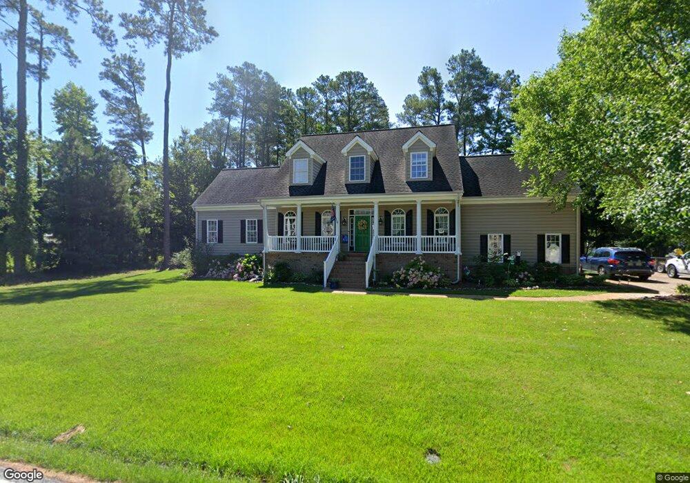
2 Forrest Rd Poquoson, VA 23662
Poquoson West NeighborhoodEstimated Value: $601,505 - $654,000
5
Beds
3
Baths
3,000
Sq Ft
$206/Sq Ft
Est. Value
About This Home
This home is located at 2 Forrest Rd, Poquoson, VA 23662 and is currently estimated at $618,876, approximately $206 per square foot. 2 Forrest Rd is a home located in Poquoson City with nearby schools including Emmanuel Lutheran School and Summit Christian Academy - Upper School.
Ownership History
Date
Name
Owned For
Owner Type
Purchase Details
Closed on
May 2, 2005
Sold by
T R Construction
Bought by
Green Thomas
Current Estimated Value
Home Financials for this Owner
Home Financials are based on the most recent Mortgage that was taken out on this home.
Original Mortgage
$227,950
Outstanding Balance
$120,150
Interest Rate
6.01%
Mortgage Type
New Conventional
Estimated Equity
$498,726
Create a Home Valuation Report for This Property
The Home Valuation Report is an in-depth analysis detailing your home's value as well as a comparison with similar homes in the area
Home Values in the Area
Average Home Value in this Area
Purchase History
| Date | Buyer | Sale Price | Title Company |
|---|---|---|---|
| Green Thomas | $422,613 | -- |
Source: Public Records
Mortgage History
| Date | Status | Borrower | Loan Amount |
|---|---|---|---|
| Open | Green Thomas | $227,950 |
Source: Public Records
Tax History Compared to Growth
Tax History
| Year | Tax Paid | Tax Assessment Tax Assessment Total Assessment is a certain percentage of the fair market value that is determined by local assessors to be the total taxable value of land and additions on the property. | Land | Improvement |
|---|---|---|---|---|
| 2024 | $5,617 | $492,700 | $93,000 | $399,700 |
| 2023 | $5,469 | $492,700 | $93,000 | $399,700 |
| 2022 | $5,033 | $445,400 | $93,000 | $352,400 |
| 2021 | $5,033 | $445,400 | $93,000 | $352,400 |
| 2020 | $0 | $414,600 | $93,000 | $321,600 |
| 2019 | -- | $414,600 | $93,000 | $321,600 |
| 2018 | -- | $390,500 | $93,000 | $297,500 |
| 2017 | -- | $368,500 | $93,000 | $275,500 |
| 2016 | -- | $368,500 | $93,000 | $275,500 |
| 2015 | -- | $353,800 | $93,000 | $260,800 |
| 2013 | -- | $353,800 | $93,000 | $260,800 |
Source: Public Records
Map
Nearby Homes
- 7 Quail Cove
- 1.55ac Holloway Rd
- 1020 Poquoson Ave
- 1020 Poquoson Ave Unit C
- 10 Kathy Dr
- 62 Rens Rd
- 208 Little Florida Rd
- 8.5AC Poquoson Ave
- 21 Rens Rd
- 6 Lessies Dr
- 105 Rens Rd Unit 30
- 105 Rens Rd Unit 2
- 105 Rens Rd Unit 74
- 105 Rens Rd Unit Lot 48
- 15 Robert Bruce Rd
- 718C Poquoson Ave
- 129 Robert Bruce Rd
- 119 Robert Bruce Rd
- 117 Robert Bruce Rd
- 128 Robert Bruce Rd