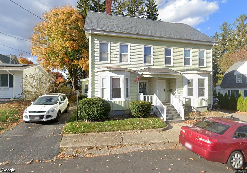
2 Garfield St Amesbury, MA 01913
Estimated Value: $404,000 - $417,006
3
Beds
2
Baths
1,930
Sq Ft
$212/Sq Ft
Est. Value
About This Home
This home is located at 2 Garfield St, Amesbury, MA 01913 and is currently estimated at $409,752, approximately $212 per square foot. 2 Garfield St is a home located in Essex County with nearby schools including Amesbury High School and Amesbury Seventh-Day Adventist School.
Ownership History
Date
Name
Owned For
Owner Type
Purchase Details
Closed on
Mar 21, 2025
Sold by
Provencher Rita E and Provencher William D
Bought by
Bouras Katina
Current Estimated Value
Purchase Details
Closed on
Mar 8, 2004
Sold by
2 Garfield St Rt
Bought by
Provencher William D
Purchase Details
Closed on
Apr 9, 2003
Sold by
2 Garfield St Rt and Provencher
Bought by
Provencher William D
Home Financials for this Owner
Home Financials are based on the most recent Mortgage that was taken out on this home.
Original Mortgage
$130,000
Interest Rate
5.86%
Mortgage Type
Purchase Money Mortgage
Create a Home Valuation Report for This Property
The Home Valuation Report is an in-depth analysis detailing your home's value as well as a comparison with similar homes in the area
Home Values in the Area
Average Home Value in this Area
Purchase History
| Date | Buyer | Sale Price | Title Company |
|---|---|---|---|
| Bouras Katina | $400,000 | None Available | |
| Bouras Katina | $400,000 | None Available | |
| Bouras Katina | $400,000 | None Available | |
| Provencher William D | -- | -- | |
| Provencher William D | -- | -- | |
| Provencher William D | -- | -- | |
| Provencher William D | -- | -- |
Source: Public Records
Mortgage History
| Date | Status | Borrower | Loan Amount |
|---|---|---|---|
| Previous Owner | Provencher William D | $157,500 | |
| Previous Owner | Provencher William D | $150,000 | |
| Previous Owner | Provencher William D | $130,000 |
Source: Public Records
Tax History Compared to Growth
Tax History
| Year | Tax Paid | Tax Assessment Tax Assessment Total Assessment is a certain percentage of the fair market value that is determined by local assessors to be the total taxable value of land and additions on the property. | Land | Improvement |
|---|---|---|---|---|
| 2025 | $5,505 | $359,800 | $91,500 | $268,300 |
| 2024 | $5,546 | $354,600 | $86,300 | $268,300 |
| 2023 | $5,307 | $324,800 | $75,100 | $249,700 |
| 2022 | $5,187 | $293,200 | $65,300 | $227,900 |
| 2021 | $5,718 | $313,300 | $50,400 | $262,900 |
| 2020 | $5,072 | $295,200 | $48,500 | $246,700 |
| 2019 | $5,156 | $280,700 | $48,500 | $232,200 |
| 2018 | $4,673 | $246,100 | $46,200 | $199,900 |
| 2017 | $4,910 | $246,100 | $46,200 | $199,900 |
| 2016 | $4,699 | $231,700 | $46,200 | $185,500 |
| 2015 | $4,685 | $228,100 | $46,200 | $181,900 |
| 2014 | $4,595 | $219,100 | $46,200 | $172,900 |
Source: Public Records
Map
Nearby Homes
- 93 Friend St
- 4 Winter St
- 48 Orchard St
- 37 Millyard Unit 204
- 31 Whitter Meadows Dr Unit 31
- 4 Larnard Ct
- 13 High St Unit 2
- 188 Lions Mouth Rd
- 5 Moncrief St Unit 5
- 43 Aubin St Unit 43
- 49 W Greenwood St
- 3 Arlington St
- 102 Market St
- 101 Market St Unit B
- 101 Market St Unit A
- 105 Market St Unit B
- 25 Cedar St Unit 4
- 25 Cedar St Unit 14
- 25 Cedar St Unit 7
- 4 Greenwood St
- 4 Garfield St
- 49 Whitehall Rd
- 6 Garfield St
- 51 Whitehall Rd Unit A
- 51 Whitehall Rd Unit B
- 51 Whitehall Rd Unit 1
- 51 Whitehall Rd
- 51 Whitehall Rd Unit 2
- 108 High St
- 47 Whitehall Rd
- 53 Whitehall Rd
- 3 Garfield St
- 8 Garfield St
- 45 Whitehall Rd
- 104 High St
- 5 Garfield St
- 1 Ridgemere Way
- 10 Garfield St
- 10 Garfield St Unit 1
- 7 Garfield St